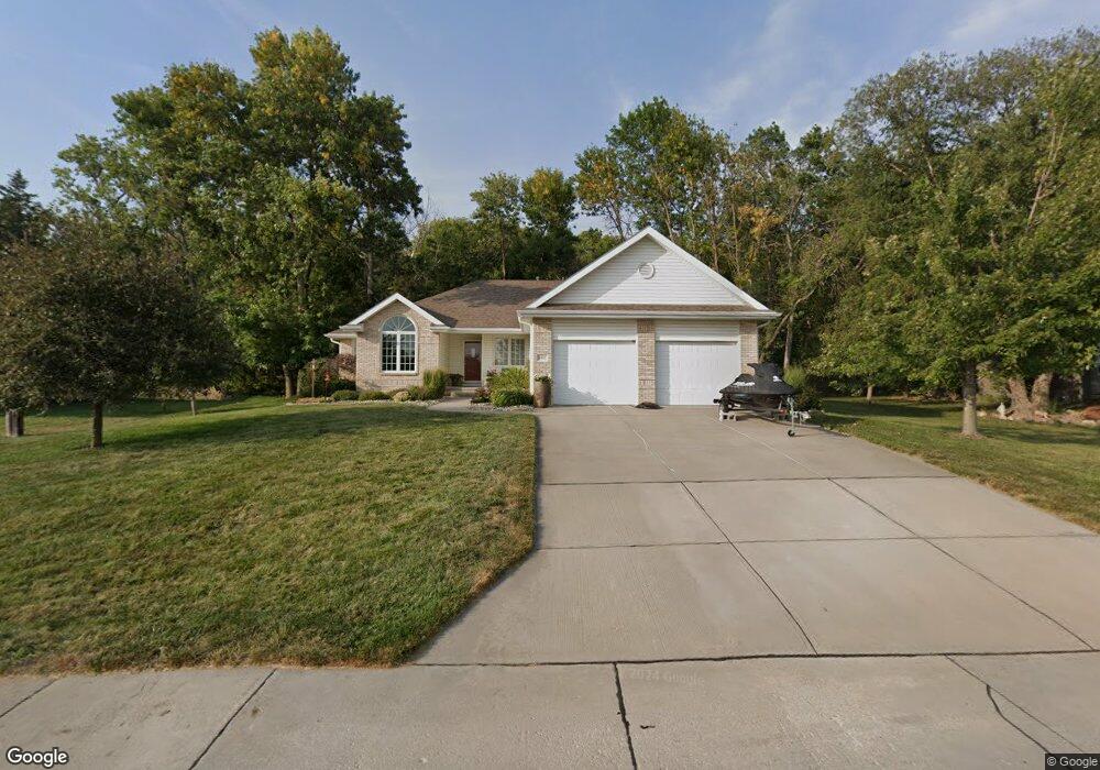
8402 Molokai Dr Papillion, NE 68046
Estimated Value: $492,000 - $580,000
3
Beds
2
Baths
1,943
Sq Ft
$266/Sq Ft
Est. Value
About This Home
This home is located at 8402 Molokai Dr, Papillion, NE 68046 and is currently estimated at $517,076, approximately $266 per square foot. 8402 Molokai Dr is a home located in Sarpy County with nearby schools including Platteview Central Junior High School and Platteview Senior High School.
Ownership History
Date
Name
Owned For
Owner Type
Purchase Details
Closed on
Mar 17, 2020
Sold by
Raszler Russell and Raszler Stefanie
Bought by
Distefano Rhonda S
Current Estimated Value
Home Financials for this Owner
Home Financials are based on the most recent Mortgage that was taken out on this home.
Original Mortgage
$225,400
Outstanding Balance
$154,978
Interest Rate
3.2%
Mortgage Type
New Conventional
Estimated Equity
$362,098
Purchase Details
Closed on
Aug 26, 2011
Sold by
Distefano Rhonda S
Bought by
Distefano Rhonda S and Rhonda S Distefano Living Trust
Purchase Details
Closed on
Jun 23, 2010
Sold by
Armstrong Rick L and Armstrong Deborah J
Bought by
Distefano Rhonda S
Home Financials for this Owner
Home Financials are based on the most recent Mortgage that was taken out on this home.
Original Mortgage
$181,500
Interest Rate
4.81%
Create a Home Valuation Report for This Property
The Home Valuation Report is an in-depth analysis detailing your home's value as well as a comparison with similar homes in the area
Home Values in the Area
Average Home Value in this Area
Purchase History
| Date | Buyer | Sale Price | Title Company |
|---|---|---|---|
| Distefano Rhonda S | $185,000 | Nebraska Title Co Papill | |
| Distefano Rhonda S | -- | None Available | |
| Distefano Rhonda S | $262,000 | Dri Title & Escrow |
Source: Public Records
Mortgage History
| Date | Status | Borrower | Loan Amount |
|---|---|---|---|
| Open | Distefano Rhonda S | $225,400 | |
| Previous Owner | Distefano Rhonda S | $181,500 |
Source: Public Records
Tax History Compared to Growth
Tax History
| Year | Tax Paid | Tax Assessment Tax Assessment Total Assessment is a certain percentage of the fair market value that is determined by local assessors to be the total taxable value of land and additions on the property. | Land | Improvement |
|---|---|---|---|---|
| 2025 | $6,510 | $477,482 | $135,000 | $342,482 |
| 2024 | $7,369 | $454,780 | $132,000 | $322,780 |
| 2023 | $7,369 | $410,466 | $132,000 | $278,466 |
| 2022 | $6,906 | $362,673 | $80,000 | $282,673 |
| 2021 | $7,324 | $354,567 | $80,000 | $274,567 |
| 2020 | $6,477 | $298,949 | $56,000 | $242,949 |
| 2019 | $6,444 | $297,795 | $56,000 | $241,795 |
| 2018 | $6,393 | $290,743 | $56,000 | $234,743 |
| 2017 | $6,006 | $270,507 | $56,000 | $214,507 |
| 2016 | $5,815 | $258,758 | $56,000 | $202,758 |
| 2015 | $5,766 | $255,940 | $50,000 | $205,940 |
| 2014 | $5,715 | $252,614 | $50,000 | $202,614 |
| 2012 | -- | $252,837 | $50,000 | $202,837 |
Source: Public Records
Map
Nearby Homes
- 8609 Molokai Dr
- 8612 Makaha Cir
- 7912 Kona Cir
- 15560 S 79th Cir
- 19980 White Tail Ln
- 19910 White Tail Ln
- 8700 Raven Dr
- 6733 Platteview Rd
- 19577 Pheasant Ln
- TBD - 15600 S 63rd St
- 111 acres Platteview Rd
- 6711 Platteview Rd
- 12715 S 79th St
- 7610 S 66th St
- 12704 S 79th St
- 12620 S 78th Ave
- 12616 S 78th Ave
- 13002 S 66th Ave
- 12926 S 66th Ave
- 12930 S 66th Ave
- 8406 Molokai Dr
- 8316 Molokai Dr
- 8401 Molokai Dr
- 8312 Molokai Dr
- 8317 Molokai Dr
- 8405 Molokai Dr
- 8319 Molokai Dr
- 8409 Molokai Dr
- 8315 Molokai Dr
- 8308 Molokai Dr
- 8418 Molokai Dr
- 8413 Molokai Dr
- 8311 Molokai Dr
- 8417 Molokai Dr
- 8304 Molokai Dr
- 8505 Molokai Dr
- 8303 Molokai Dr
- 8218 Molokai Dr
- 8507 Molokai Dr
- 0 Molokai Dr