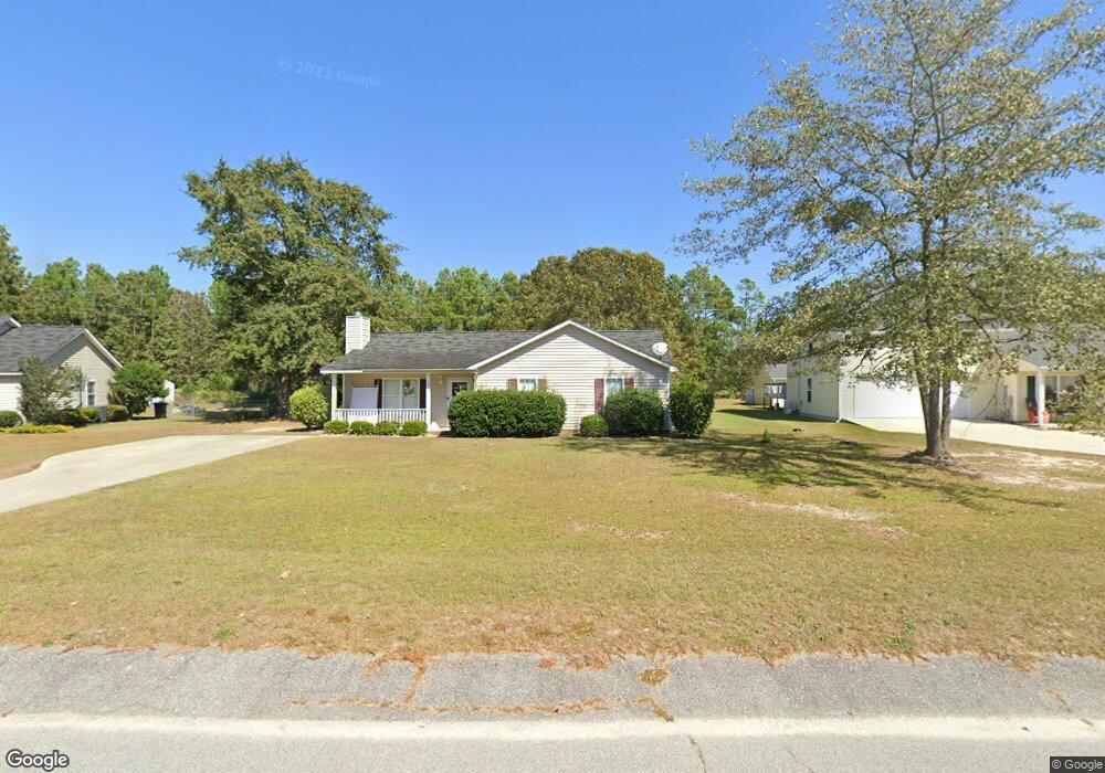
841C Leslie Branham Rd Unit B&C Lugoff, SC 29078
Estimated Value: $298,000 - $417,000
3
Beds
3
Baths
2,051
Sq Ft
$186/Sq Ft
Est. Value
About This Home
This home is located at 841C Leslie Branham Rd Unit B&C, Lugoff, SC 29078 and is currently estimated at $380,471, approximately $185 per square foot. 841C Leslie Branham Rd Unit B&C is a home located in Kershaw County with nearby schools including Doby's Mill Elementary School, Leslie M. Stover Middle School, and Lugoff-Elgin High School.
Ownership History
Date
Name
Owned For
Owner Type
Purchase Details
Closed on
Mar 30, 2022
Sold by
Jeffrey Dials
Bought by
Sanders Ricky Adam
Current Estimated Value
Home Financials for this Owner
Home Financials are based on the most recent Mortgage that was taken out on this home.
Original Mortgage
$404,000
Outstanding Balance
$378,900
Interest Rate
4.42%
Mortgage Type
VA
Estimated Equity
$1,571
Purchase Details
Closed on
Oct 19, 2007
Sold by
Smith Lauren W
Bought by
Dials Jeffrey S and Dials Julie G
Purchase Details
Closed on
Jun 17, 2004
Sold by
Smith Jason P and Smith Lauren W
Bought by
Smith Lauren W
Create a Home Valuation Report for This Property
The Home Valuation Report is an in-depth analysis detailing your home's value as well as a comparison with similar homes in the area
Home Values in the Area
Average Home Value in this Area
Purchase History
| Date | Buyer | Sale Price | Title Company |
|---|---|---|---|
| Sanders Ricky Adam | $404,000 | Southeastern Title | |
| Dials Jeffrey S | $225,000 | -- | |
| Smith Lauren W | -- | -- |
Source: Public Records
Mortgage History
| Date | Status | Borrower | Loan Amount |
|---|---|---|---|
| Open | Sanders Ricky Adam | $404,000 |
Source: Public Records
Tax History Compared to Growth
Tax History
| Year | Tax Paid | Tax Assessment Tax Assessment Total Assessment is a certain percentage of the fair market value that is determined by local assessors to be the total taxable value of land and additions on the property. | Land | Improvement |
|---|---|---|---|---|
| 2025 | -- | $389,000 | $25,000 | $364,000 |
| 2024 | $0 | $389,000 | $25,000 | $364,000 |
| 2023 | $2,074 | $389,000 | $25,000 | $364,000 |
| 2022 | $1,336 | $389,000 | $25,000 | $364,000 |
| 2021 | $1,303 | $227,200 | $19,900 | $207,300 |
| 2020 | $1,137 | $192,700 | $8,100 | $184,600 |
| 2019 | $1,172 | $191,700 | $8,100 | $183,600 |
| 2018 | $1,100 | $191,700 | $8,100 | $183,600 |
| 2017 | $1,058 | $191,700 | $8,100 | $183,600 |
| 2016 | $1,040 | $191,300 | $8,100 | $183,200 |
| 2015 | $949 | $191,300 | $8,100 | $183,200 |
| 2014 | $949 | $7,652 | $0 | $0 |
Source: Public Records
Map
Nearby Homes
- 67 Smokewood Dr
- 21 Smokewood Dr
- 2011 Highway 1 S
- 27 Driftwood Ave
- 61 Aberdeen Way
- 149 Rippling Way
- 28 Briar Forest Dr
- 210 Carrington Dr
- 125 Rippling Way
- 166 Rippling Way
- 1035 Donna Dr
- 2140 Highway 1 S
- 2174 Highway 1 S
- 1015 B Elgin Estates Dr
- 2206 Route 1
- 2206 Highway 1 S
- 7 Harvest Ct
- 44 Harvest Wheat Ct
- 10 Harvest Wheat Ct
- 60 Harvest Wheat Ct
- 841C Leslie Branham Rd
- 1910 Bunker Hill Rd
- 1919 Bunker Hill Rd
- 837B Leslie Branham Rd
- 1923 Bunker Hill Rd
- 570 Railgate Loop
- 566 Railgate Loop
- 1925 Bunker Hill Rd
- 572 Railgate Loop
- 867 Leslie Branham Rd
- 857 Leslie Branham Rd
- 576 Railgate Loop
- 845 Leslie Branham Rd
- 578 Railgate Loop
- 1920 Bunker Hill Rd
- 1929 Bunker Hill Rd
- 562 Railgate Loop
- 844 Leslie Branham Rd
- 569 Railgate Loop
- 575 Railgate Loop