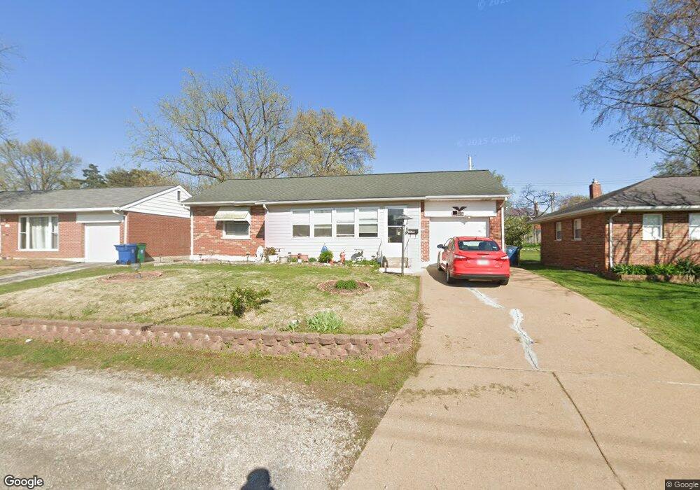
8420 New Hampshire Ave Saint Louis, MO 63123
Estimated Value: $216,788 - $252,000
2
Beds
1
Bath
938
Sq Ft
$249/Sq Ft
Est. Value
About This Home
This home is located at 8420 New Hampshire Ave, Saint Louis, MO 63123 and is currently estimated at $233,197, approximately $248 per square foot. 8420 New Hampshire Ave is a home located in St. Louis County with nearby schools including Mesnier Primary School, Gotsch Intermediate School, and Rogers Middle School.
Ownership History
Date
Name
Owned For
Owner Type
Purchase Details
Closed on
Nov 15, 2000
Sold by
Torrence Agnes B
Bought by
Kitanovic Ivo and Kitanovic Ana
Current Estimated Value
Home Financials for this Owner
Home Financials are based on the most recent Mortgage that was taken out on this home.
Original Mortgage
$79,959
Outstanding Balance
$29,337
Interest Rate
7.82%
Mortgage Type
FHA
Estimated Equity
$203,860
Create a Home Valuation Report for This Property
The Home Valuation Report is an in-depth analysis detailing your home's value as well as a comparison with similar homes in the area
Home Values in the Area
Average Home Value in this Area
Purchase History
| Date | Buyer | Sale Price | Title Company |
|---|---|---|---|
| Kitanovic Ivo | $80,000 | -- | |
| Kitanovic Ivo | $80,000 | -- |
Source: Public Records
Mortgage History
| Date | Status | Borrower | Loan Amount |
|---|---|---|---|
| Open | Kitanovic Ivo | $79,959 | |
| Closed | Kitanovic Ivo | $79,959 |
Source: Public Records
Tax History Compared to Growth
Tax History
| Year | Tax Paid | Tax Assessment Tax Assessment Total Assessment is a certain percentage of the fair market value that is determined by local assessors to be the total taxable value of land and additions on the property. | Land | Improvement |
|---|---|---|---|---|
| 2025 | $2,651 | $32,950 | $13,400 | $19,550 |
| 2024 | $2,651 | $32,600 | $8,930 | $23,670 |
| 2023 | $2,564 | $32,600 | $8,930 | $23,670 |
| 2022 | $2,589 | $28,220 | $8,930 | $19,290 |
| 2021 | $2,364 | $28,220 | $8,930 | $19,290 |
| 2020 | $2,166 | $24,110 | $8,740 | $15,370 |
| 2019 | $2,162 | $24,110 | $8,740 | $15,370 |
| 2018 | $2,062 | $20,310 | $6,100 | $14,210 |
| 2017 | $2,049 | $20,310 | $6,100 | $14,210 |
| 2016 | $1,730 | $18,200 | $5,240 | $12,960 |
| 2015 | $1,738 | $18,200 | $5,240 | $12,960 |
| 2014 | $1,685 | $17,560 | $5,950 | $11,610 |
Source: Public Records
Map
Nearby Homes
- 6540 Lawnside Dr
- 8510 Valdes Dr
- 8505 Ava Dr
- 8509 Mackenzie Rd
- 8554 Palmetto Dr
- 6236 Bixby Ave
- 8736 New Hampshire Ave
- 8405 Rockhaven Ln
- 8415 Rockhaven Ln
- 6426 Judson Ave
- 8027 McGee St
- 7101 Fernbrook Dr
- 9701 Sterling Place
- 8942 Eden Ave
- 8305 Vasel Dr
- 8348 Vasel Dr
- 6843 Preservation Pkwy
- 6819 Preservation Pkwy
- 7243 General Sherman Ln
- 7917 Menola St
- 8416 New Hampshire Ave
- 8424 New Hampshire Ave
- 8428 New Hampshire Ave
- 8435 Hampstead Dr
- 8403 Hampstead Dr
- 8439 Hampstead Dr
- 8431 Hampstead Dr
- 8443 Hampstead Dr
- 8421 New Hampshire Ave
- 8432 New Hampshire Ave
- 8427 New Hampshire Ave
- 8413 Hampstead Dr
- 8447 Hampstead Dr
- 6706 Colony Acres 6710 Dr
- 6706 Colony Acres Dr
- 6706 Colony Acres Dr Unit C
- 8436 New Hampshire Ave
- 6709 Colony Acres Dr
- 8451 Hampstead Dr
- 6710 Colony Acres Dr