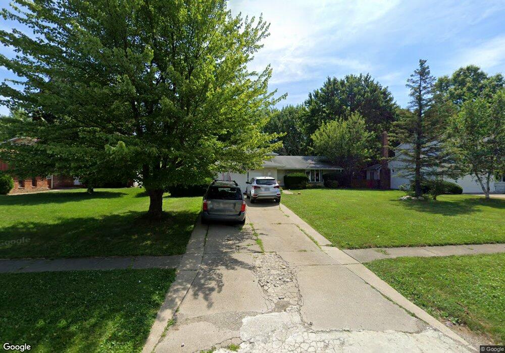
8421 Lorraine Dr Strongsville, OH 44149
Estimated Value: $357,896 - $399,000
4
Beds
3
Baths
2,652
Sq Ft
$142/Sq Ft
Est. Value
About This Home
This home is located at 8421 Lorraine Dr, Strongsville, OH 44149 and is currently estimated at $375,974, approximately $141 per square foot. 8421 Lorraine Dr is a home located in Cuyahoga County with nearby schools including Strongsville High School, St Mary School, and Sts Joseph & John Interparochial School.
Ownership History
Date
Name
Owned For
Owner Type
Purchase Details
Closed on
Mar 4, 2022
Sold by
Jones Ervin B and Jones Deborah A
Bought by
Jones Ervin B and Jones Deborah A
Current Estimated Value
Purchase Details
Closed on
Sep 26, 1986
Sold by
Lopeman Edward E
Bought by
Jones Ervin B and Jones Deborah A
Purchase Details
Closed on
Oct 21, 1977
Bought by
Lopeman Edward E
Purchase Details
Closed on
Jul 16, 1976
Sold by
Boyas Peter
Bought by
Ventura Company
Purchase Details
Closed on
Jan 1, 1975
Bought by
Broad Breck Dev Corp
Create a Home Valuation Report for This Property
The Home Valuation Report is an in-depth analysis detailing your home's value as well as a comparison with similar homes in the area
Home Values in the Area
Average Home Value in this Area
Purchase History
| Date | Buyer | Sale Price | Title Company |
|---|---|---|---|
| Jones Ervin B | -- | J W Krueger Law Llc | |
| Jones Ervin B | $100,000 | -- | |
| Lopeman Edward E | $82,500 | -- | |
| Ventura Company | $10,000 | -- | |
| Boyas Peter | $30,000 | -- | |
| Broad Breck Dev Corp | -- | -- |
Source: Public Records
Tax History Compared to Growth
Tax History
| Year | Tax Paid | Tax Assessment Tax Assessment Total Assessment is a certain percentage of the fair market value that is determined by local assessors to be the total taxable value of land and additions on the property. | Land | Improvement |
|---|---|---|---|---|
| 2024 | $3,992 | $94,815 | $19,845 | $74,970 |
| 2023 | $4,861 | $77,640 | $16,770 | $60,870 |
| 2022 | $4,826 | $77,630 | $16,770 | $60,870 |
| 2021 | $4,788 | $77,630 | $16,770 | $60,870 |
| 2020 | $4,436 | $63,630 | $13,760 | $49,880 |
| 2019 | $4,306 | $181,800 | $39,300 | $142,500 |
| 2018 | $3,908 | $63,630 | $13,760 | $49,880 |
| 2017 | $3,931 | $59,260 | $11,480 | $47,780 |
| 2016 | $3,899 | $59,260 | $11,480 | $47,780 |
| 2015 | $3,840 | $59,260 | $11,480 | $47,780 |
| 2014 | $3,840 | $57,540 | $11,130 | $46,410 |
Source: Public Records
Map
Nearby Homes
- 8746 Barton Dr
- 9384 N Marks Rd
- 8902 Lincolnshire Blvd
- 9598 Pebble Brook Ln
- 8896 Firethorne Dr
- 10001 N Marks Rd
- 458 Sprague Rd
- 9829 Plum Brook Ln
- 8981 Leatherleaf Dr
- 8809 Leatherleaf Dr
- 8839 Leatherleaf Dr
- 22300 Rock Creek Cir
- 8960 Leatherleaf Dr
- 8036 Fair Rd
- 8924 Leatherleaf Dr
- 8627 Courtland Dr
- 23004 Chandlers Ln Unit 109
- 9797 Sugarbush Cir
- 0 Priem Rd
- 23003 Chandlers Ln Unit 230
- 8415 Lorraine Dr
- 8439 Lorraine Dr
- 8401 Lorraine Dr
- 8458 Barton Dr
- 8448 Barton Dr
- 22340 Jonathan Dr
- 22318 Jonathan Dr
- 8464 Barton Dr
- 8438 Barton Dr
- 8395 Lorraine Dr
- 22306 Jonathan Dr
- 8422 Lorraine Dr
- 22400 Jonathan Dr
- 8426 Barton Dr
- 8402 Lorraine Dr
- 8389 Lorraine Dr
- 22418 Jonathan Dr
- 22302 Jonathan Dr
- 8396 Lorraine Dr
- 8412 Barton Dr