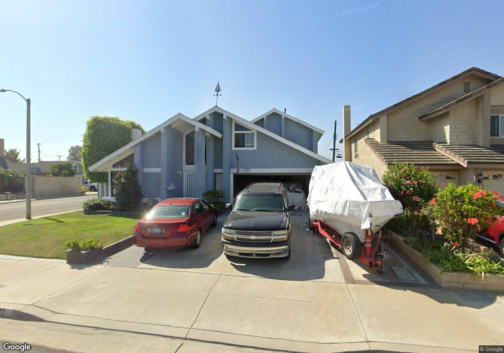
8422 Seaport Dr Huntington Beach, CA 92646
Southeast NeighborhoodEstimated Value: $1,471,000 - $1,793,000
3
Beds
2
Baths
1,886
Sq Ft
$843/Sq Ft
Est. Value
About This Home
This home is located at 8422 Seaport Dr, Huntington Beach, CA 92646 and is currently estimated at $1,589,611, approximately $842 per square foot. 8422 Seaport Dr is a home located in Orange County with nearby schools including S.A. Moffett Elementary School, Isaac L. Sowers Middle School, and Edison High School.
Ownership History
Date
Name
Owned For
Owner Type
Purchase Details
Closed on
Jun 18, 2024
Sold by
Hammerton George Henry
Bought by
Hammerton Family Trust and Hammerton
Current Estimated Value
Purchase Details
Closed on
Apr 18, 2006
Sold by
Hammerton George Henry
Bought by
Hammerton Ii George Henry
Home Financials for this Owner
Home Financials are based on the most recent Mortgage that was taken out on this home.
Original Mortgage
$250,000
Interest Rate
5.87%
Mortgage Type
Purchase Money Mortgage
Purchase Details
Closed on
Jun 21, 2002
Sold by
Hammerton Cynthia Lynn
Bought by
Hammerton Ii George Henry
Home Financials for this Owner
Home Financials are based on the most recent Mortgage that was taken out on this home.
Original Mortgage
$230,000
Interest Rate
5.62%
Create a Home Valuation Report for This Property
The Home Valuation Report is an in-depth analysis detailing your home's value as well as a comparison with similar homes in the area
Home Values in the Area
Average Home Value in this Area
Purchase History
| Date | Buyer | Sale Price | Title Company |
|---|---|---|---|
| Hammerton Family Trust | -- | None Listed On Document | |
| Hammerton Ii George Henry | -- | First American Title Ins Co | |
| Hammerton Ii George Henry | -- | Commerce Title |
Source: Public Records
Mortgage History
| Date | Status | Borrower | Loan Amount |
|---|---|---|---|
| Previous Owner | Hammerton Ii George Henry | $250,000 | |
| Previous Owner | Hammerton Ii George Henry | $230,000 |
Source: Public Records
Tax History Compared to Growth
Tax History
| Year | Tax Paid | Tax Assessment Tax Assessment Total Assessment is a certain percentage of the fair market value that is determined by local assessors to be the total taxable value of land and additions on the property. | Land | Improvement |
|---|---|---|---|---|
| 2025 | $4,153 | $355,097 | $152,324 | $202,773 |
| 2024 | $4,153 | $348,135 | $149,337 | $198,798 |
| 2023 | $4,056 | $341,309 | $146,409 | $194,900 |
| 2022 | $3,948 | $334,617 | $143,538 | $191,079 |
| 2021 | $3,875 | $328,056 | $140,723 | $187,333 |
| 2020 | $3,848 | $324,693 | $139,280 | $185,413 |
| 2019 | $3,803 | $318,327 | $136,549 | $181,778 |
| 2018 | $3,744 | $312,086 | $133,872 | $178,214 |
| 2017 | $3,693 | $305,967 | $131,247 | $174,720 |
| 2016 | $3,534 | $299,968 | $128,673 | $171,295 |
| 2015 | $3,498 | $295,463 | $126,741 | $168,722 |
| 2014 | $3,423 | $289,676 | $124,259 | $165,417 |
Source: Public Records
Map
Nearby Homes
- 8342 Seaport Dr
- 20251 Lighthouse Ln
- 8472 Norfolk Dr
- 8565 Colusa Cir Unit 906C
- 20302 Tidepool Cir Unit 204
- 20191 Imperial Cove Ln
- 20162 S New Britain Ln
- 8565 Trinity Cir Unit 824D
- 20131 Crown Reef Ln
- 20401 Somerville Ln
- 8565 Larkhall Cir Unit 802C
- 8565 Larkhall Cir Unit 804A
- 8122 Seawater Dr
- 8646 Butte Cir Unit 607E
- 20371 Bluffside Cir Unit B214
- 8566 Larkhall Cir Unit 808A
- 8566 Larkhall Cir Unit 809D
- 20251 Cape Coral Ln Unit 315
- 20301 Bluffside Cir Unit D312
- 20301 Bluffside Cir Unit D401
- 8402 Seaport Dr
- 8421 Munster Dr
- 8442 Seaport Dr
- 8401 Munster Dr
- 8392 Seaport Dr
- 8421 Seaport Dr
- 8391 Munster Dr
- 20362 Dublin Ln
- 8431 Seaport Dr
- 8401 Seaport Dr
- 8472 Seaport Dr
- 8382 Seaport Dr
- 8441 Seaport Dr
- 8391 Seaport Dr
- 20372 Dublin Ln
- 8381 Munster Dr
- 8422 Sealrock Dr
- 8381 Seaport Dr
- 20382 Dublin Ln
- 8402 Sealrock Dr