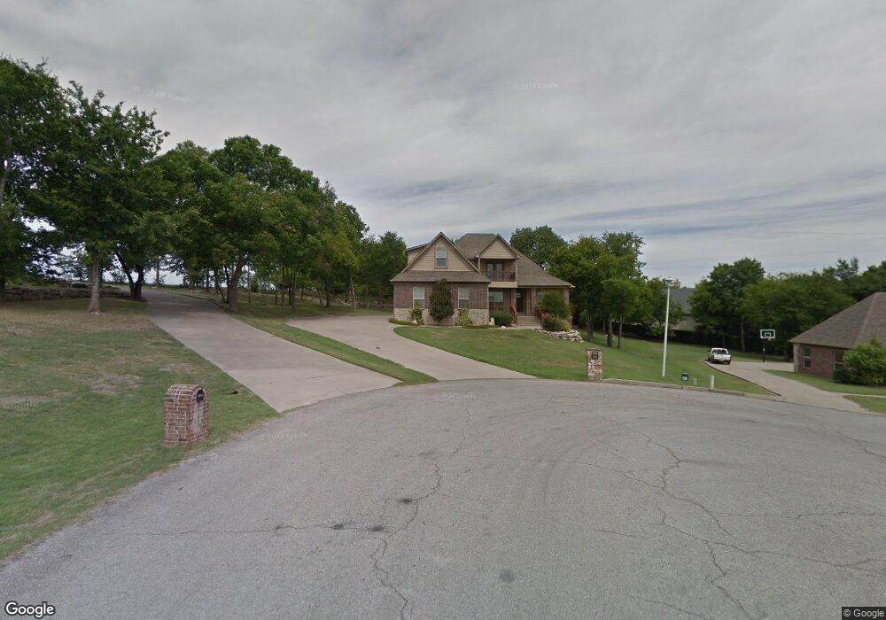
8426 N 191st East Ave Owasso, OK 74055
Estimated Value: $530,000 - $655,000
4
Beds
4
Baths
3,630
Sq Ft
$162/Sq Ft
Est. Value
About This Home
This home is located at 8426 N 191st East Ave, Owasso, OK 74055 and is currently estimated at $589,437, approximately $162 per square foot. 8426 N 191st East Ave is a home located in Rogers County with nearby schools including Stone Canyon Elementary School, Owasso 6th Grade Center, and Owasso 8th Grade Center.
Ownership History
Date
Name
Owned For
Owner Type
Purchase Details
Closed on
Jan 11, 2008
Sold by
Stokes Construction Llc
Bought by
Haffner James P and Haffner Denise M
Current Estimated Value
Home Financials for this Owner
Home Financials are based on the most recent Mortgage that was taken out on this home.
Original Mortgage
$352,346
Interest Rate
6.07%
Mortgage Type
Purchase Money Mortgage
Create a Home Valuation Report for This Property
The Home Valuation Report is an in-depth analysis detailing your home's value as well as a comparison with similar homes in the area
Home Values in the Area
Average Home Value in this Area
Purchase History
| Date | Buyer | Sale Price | Title Company |
|---|---|---|---|
| Haffner James P | $74,500 | None Available |
Source: Public Records
Mortgage History
| Date | Status | Borrower | Loan Amount |
|---|---|---|---|
| Closed | Haffner James P | $352,346 |
Source: Public Records
Tax History Compared to Growth
Tax History
| Year | Tax Paid | Tax Assessment Tax Assessment Total Assessment is a certain percentage of the fair market value that is determined by local assessors to be the total taxable value of land and additions on the property. | Land | Improvement |
|---|---|---|---|---|
| 2025 | $6,638 | $57,886 | $8,810 | $49,076 |
| 2024 | $6,638 | $60,150 | $8,139 | $52,011 |
| 2023 | $6,638 | $57,285 | $10,165 | $47,120 |
| 2022 | $6,124 | $54,558 | $9,399 | $45,159 |
| 2021 | $5,769 | $51,960 | $9,399 | $42,561 |
| 2020 | $5,673 | $51,157 | $9,399 | $41,758 |
| 2019 | $5,453 | $49,150 | $9,399 | $39,751 |
| 2018 | $5,400 | $50,296 | $9,399 | $40,897 |
| 2017 | $5,408 | $49,911 | $9,399 | $40,512 |
| 2016 | $5,176 | $47,729 | $9,355 | $38,374 |
| 2015 | $5,000 | $45,457 | $9,249 | $36,208 |
| 2014 | $4,762 | $43,291 | $9,071 | $34,220 |
Source: Public Records
Map
Nearby Homes
- 18894 E 80th St N
- 17798 E Anthem Ridge Rd
- 8219 N 175th East Ave
- 17834 E 93rd St N
- 19433 E 73rd Place N
- 19433 E Clear Brook Rd
- 7397 N 201st East Ave
- 19837 E Woodhaven Rd
- 17401 E 78th St N
- 7221 N 200th East Ave
- 7311 N 202nd East Ave
- 18934 Chickadee Ct
- 19715 E Clear Brook Rd
- 19425 E 69th St N
- 18509 E 100th St N
- 10016 N Glen Ellen
- 6940 N Garden Stone Ln
- 19460 E Boulder Dr
- 9101 N 165th East Ave
- 18533 E Crooked Oak Dr
- 8418 N 191st East Ave
- 8425 N 191st East Ave
- 8419 N 191st East Ave
- 8413 N 191st East Ave
- 0 N 191st Ave Unit 1623551
- 0 N 191st Ave Unit 1742840
- 19109 E 84th St N
- 19110 E 84th St N
- 19290 E 86th St N
- 19131 E 84th St N
- 19134 E 84th St N
- 4097 E 484 Rd
- 4194 E 488 Rd
- 19150 E 84th St N
- 19153 E 84th St N
- 8271 N 191st East Ave
- 11617 N 191st Ave E
- 8207 N 191st East Ave
- 19014 E 82nd St N
- 18951 E 86th St N