Estimated Value: $308,000 - $369,000
4
Beds
3
Baths
2,400
Sq Ft
$141/Sq Ft
Est. Value
About This Home
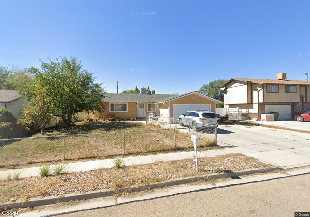
This home is located at 845 Castle Heights Dr, Price, UT 84501 and is currently estimated at $337,851, approximately $140 per square foot. 845 Castle Heights Dr is a home located in Carbon County with nearby schools including Castle Heights School, Mont Harmon Junior High School, and Carbon High School.
Ownership History
Date
Name
Owned For
Owner Type
Purchase Details
Closed on
Nov 27, 2018
Sold by
Sherman Raymond P and Sherman Mary
Bought by
Hill Kenneth W and Hill Mary Elizabeth
Current Estimated Value
Purchase Details
Closed on
Jun 8, 2016
Sold by
Boylen Rhonda D
Bought by
Sherman Raymond P and Sherman Mary
Home Financials for this Owner
Home Financials are based on the most recent Mortgage that was taken out on this home.
Original Mortgage
$172,900
Interest Rate
3.66%
Mortgage Type
New Conventional
Purchase Details
Closed on
Oct 9, 2008
Sold by
Ashley Karl E and Ashley Toinette
Bought by
Boylen Rhonda D
Home Financials for this Owner
Home Financials are based on the most recent Mortgage that was taken out on this home.
Original Mortgage
$149,748
Interest Rate
6.39%
Mortgage Type
FHA
Create a Home Valuation Report for This Property
The Home Valuation Report is an in-depth analysis detailing your home's value as well as a comparison with similar homes in the area
Home Values in the Area
Average Home Value in this Area
Purchase History
| Date | Buyer | Sale Price | Title Company |
|---|---|---|---|
| Hill Kenneth W | -- | Title Guarantee Layton | |
| Sherman Raymond P | -- | South Eastern Utah Title Co | |
| Boylen Rhonda D | -- | South Eastern Utah Title Co |
Source: Public Records
Mortgage History
| Date | Status | Borrower | Loan Amount |
|---|---|---|---|
| Previous Owner | Sherman Raymond P | $172,900 | |
| Previous Owner | Boylen Rhonda D | $149,748 |
Source: Public Records
Tax History Compared to Growth
Tax History
| Year | Tax Paid | Tax Assessment Tax Assessment Total Assessment is a certain percentage of the fair market value that is determined by local assessors to be the total taxable value of land and additions on the property. | Land | Improvement |
|---|---|---|---|---|
| 2025 | $2,114 | $174,032 | $12,953 | $161,079 |
| 2024 | $2,126 | $177,017 | $12,375 | $164,642 |
| 2023 | $1,889 | $167,717 | $11,888 | $155,829 |
| 2022 | $1,890 | $150,549 | $9,884 | $140,665 |
| 2021 | $1,621 | $200,431 | $15,101 | $185,330 |
| 2020 | $1,589 | $98,603 | $0 | $0 |
| 2019 | $1,412 | $91,874 | $0 | $0 |
| 2018 | $1,484 | $98,503 | $0 | $0 |
| 2017 | $1,466 | $98,503 | $0 | $0 |
| 2016 | $1,322 | $98,503 | $0 | $0 |
| 2015 | $1,322 | $98,503 | $0 | $0 |
| 2014 | $1,313 | $98,503 | $0 | $0 |
| 2013 | $1,246 | $92,579 | $0 | $0 |
Source: Public Records
Map
Nearby Homes
- 831 N 1820 E Unit 66
- 879 N 1820 E Unit 69
- 1830 E 840 N Unit 80
- 1829 E 840 N Unit 87
- 1827 E 8th N Unit 79
- 1840 E 840 N Unit 81
- 1843 E 840 N Unit 86
- 1841 E 8th N Unit 78
- 1858 E 840 N Unit 82
- 1857 E 840 N Unit 85
- 1855 E 8th N Unit 77
- 1860 E 880 N
- 1871 E 840 N Unit 84
- 838 N 1880 E Unit 73
- 824 N 1880 E Unit 74
- 854 N 1880 E Unit 72
- 868 N 1880 E Unit 71
- 703 N Windsor Cir
- 639 N 1550 E
- 546 Windsor Rd
- 855 Castle Heights Dr
- 835 Castle Heights Dr
- 838 Blarney Cir
- 828 Blarney Cir
- 1785 E 800 N
- 1785 E 800 N
- 1785 E 800 N
- 865 Castle Heights Dr
- 848 Blarney Cir
- 832 Castle Heights Dr
- 844 Castle Heights Dr
- 854 Castle Heights Dr
- 1777 E 800 N
- 864 Castle Heights Dr
- 1784 E Castle Ave
- 1784 Castle Ave
- 816 Castle Heights Dr
- 835 Blarney Cir
- 1776 Castle Ave
- 1776 Castle Ave