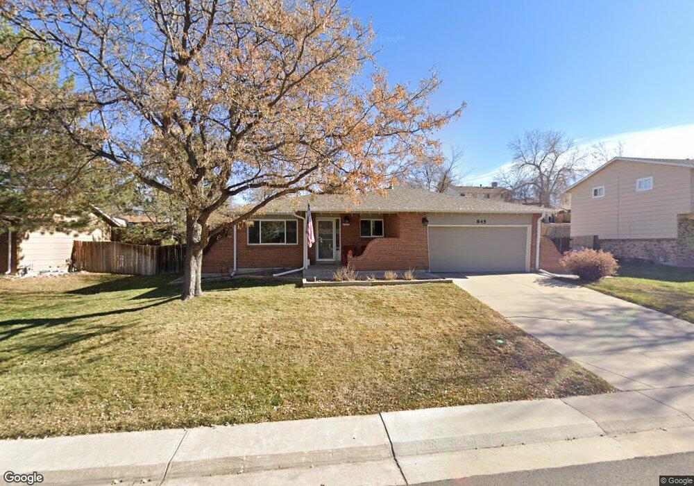
845 Mercury Cir Lone Tree, CO 80124
Estimated Value: $636,131 - $661,000
4
Beds
3
Baths
2,737
Sq Ft
$237/Sq Ft
Est. Value
About This Home
This home is located at 845 Mercury Cir, Lone Tree, CO 80124 and is currently estimated at $648,566, approximately $236 per square foot. 845 Mercury Cir is a home located in Douglas County with nearby schools including Acres Green Elementary School, Cresthill Middle School, and Highlands Ranch High School.
Ownership History
Date
Name
Owned For
Owner Type
Purchase Details
Closed on
May 30, 2019
Sold by
Hayes Timothy L and Hayes Terri L
Bought by
Moynahan Chad E and Moynahan Susan E
Current Estimated Value
Home Financials for this Owner
Home Financials are based on the most recent Mortgage that was taken out on this home.
Original Mortgage
$340,800
Outstanding Balance
$299,647
Interest Rate
4.1%
Mortgage Type
New Conventional
Estimated Equity
$348,919
Purchase Details
Closed on
Apr 30, 1993
Sold by
Troute Daryl Allen and Troute Gail
Bought by
Hayes Timothy L and Hayes Terri L
Purchase Details
Closed on
May 1, 1986
Sold by
Davis Jimmy F and Davis Sheryl L
Bought by
Troute Daryl Allen and Troute Gail
Purchase Details
Closed on
Oct 5, 1979
Sold by
Unavailable
Bought by
Unavailable
Create a Home Valuation Report for This Property
The Home Valuation Report is an in-depth analysis detailing your home's value as well as a comparison with similar homes in the area
Home Values in the Area
Average Home Value in this Area
Purchase History
| Date | Buyer | Sale Price | Title Company |
|---|---|---|---|
| Moynahan Chad E | $426,000 | Colorado Escrow & Title | |
| Hayes Timothy L | $96,000 | -- | |
| Troute Daryl Allen | $88,900 | -- | |
| Unavailable | $66,500 | -- |
Source: Public Records
Mortgage History
| Date | Status | Borrower | Loan Amount |
|---|---|---|---|
| Open | Moynahan Chad E | $340,800 |
Source: Public Records
Tax History Compared to Growth
Tax History
| Year | Tax Paid | Tax Assessment Tax Assessment Total Assessment is a certain percentage of the fair market value that is determined by local assessors to be the total taxable value of land and additions on the property. | Land | Improvement |
|---|---|---|---|---|
| 2024 | $3,730 | $44,330 | $8,120 | $36,210 |
| 2023 | $3,768 | $44,330 | $8,120 | $36,210 |
| 2022 | $2,777 | $31,180 | $6,890 | $24,290 |
| 2021 | $2,888 | $31,180 | $6,890 | $24,290 |
| 2020 | $2,407 | $26,630 | $6,520 | $20,110 |
| 2019 | $2,415 | $26,630 | $6,520 | $20,110 |
| 2018 | $1,937 | $22,880 | $5,670 | $17,210 |
| 2017 | $1,969 | $22,880 | $5,670 | $17,210 |
| 2016 | $1,736 | $19,750 | $4,080 | $15,670 |
| 2015 | $1,775 | $19,750 | $4,080 | $15,670 |
| 2014 | $1,634 | $17,030 | $3,980 | $13,050 |
Source: Public Records
Map
Nearby Homes
- 789 Hamal Dr
- 802 Altair Dr
- 7057 Chestnut Hill St
- 7041 Chestnut Hill Trail
- 6887 Chestnut Hill St
- 9275 Erminedale Dr
- 13117 Deneb Dr
- 13134 Deneb Dr
- 9412 La Quinta Way
- 8159 Lodgepole Trail
- 6426 Nassau Ct
- 6482 Silver Mesa Dr Unit B
- 9390 Yale Ln
- 9368 Harvard Dr
- 9308 Miles Dr Unit 5
- 6266 Nassau Ct
- 7469 La Quinta Place
- 8638 Gold Peak Dr Unit D
- 13483 Achilles Dr
- 8626 Gold Peak Dr Unit B
- 839 Mercury Cir
- 849 Mercury Cir
- 13173 Hadar Dr
- 13163 Hadar Dr
- 835 Mercury Cir
- 855 Mercury Cir
- 13193 Canopus Dr
- 13153 Hadar Dr
- 13183 Canopus Dr
- 848 Mercury Cir
- 856 Mercury Cir
- 13245 Canopus Dr
- 844 Mercury Cir
- 854 Mercury Cir
- 829 Mercury Cir
- 859 Mercury Cir
- 832 Mercury Cir
- 13143 Hadar Dr
- 13173 Canopus Dr
- 13154 Hadar Dr