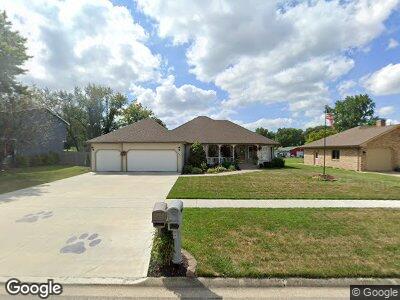
845 Phyllis Dr Wilmington, IL 60481
Wilmington NeighborhoodEstimated Value: $302,245 - $375,000
--
Bed
--
Bath
--
Sq Ft
0.25
Acres
About This Home
This home is located at 845 Phyllis Dr, Wilmington, IL 60481 and is currently estimated at $333,811. 845 Phyllis Dr is a home located in Will County with nearby schools including Bruning Elementary School, L.J. Stevens Intermediate School, and Wilmington Middle School.
Ownership History
Date
Name
Owned For
Owner Type
Purchase Details
Closed on
Jul 14, 2006
Sold by
Frank Robert G and Frank Gerald A
Bought by
Norman James S and Norman Beth
Current Estimated Value
Home Financials for this Owner
Home Financials are based on the most recent Mortgage that was taken out on this home.
Original Mortgage
$194,000
Interest Rate
6.73%
Mortgage Type
Purchase Money Mortgage
Create a Home Valuation Report for This Property
The Home Valuation Report is an in-depth analysis detailing your home's value as well as a comparison with similar homes in the area
Home Values in the Area
Average Home Value in this Area
Purchase History
| Date | Buyer | Sale Price | Title Company |
|---|---|---|---|
| Norman James S | $242,500 | Chicago Title Insurance Co |
Source: Public Records
Mortgage History
| Date | Status | Borrower | Loan Amount |
|---|---|---|---|
| Open | Norma James S | $201,200 | |
| Closed | Norman James S | $201,200 | |
| Closed | Norman James S | $200,000 | |
| Closed | Norman James S | $193,000 | |
| Closed | Norman James S | $212,784 | |
| Closed | Norman James S | $194,000 |
Source: Public Records
Tax History Compared to Growth
Tax History
| Year | Tax Paid | Tax Assessment Tax Assessment Total Assessment is a certain percentage of the fair market value that is determined by local assessors to be the total taxable value of land and additions on the property. | Land | Improvement |
|---|---|---|---|---|
| 2023 | $6,979 | $98,137 | $17,878 | $80,259 |
| 2022 | $6,979 | $88,868 | $16,189 | $72,679 |
| 2021 | $6,065 | $82,938 | $15,109 | $67,829 |
| 2020 | $5,971 | $80,758 | $14,712 | $66,046 |
| 2019 | $5,898 | $79,167 | $14,422 | $64,745 |
| 2018 | $5,785 | $77,365 | $14,094 | $63,271 |
| 2017 | $5,423 | $72,270 | $13,166 | $59,104 |
| 2016 | $4,920 | $66,395 | $12,096 | $54,299 |
| 2015 | $5,005 | $64,807 | $11,807 | $53,000 |
| 2014 | $5,005 | $65,461 | $11,926 | $53,535 |
| 2013 | $5,005 | $69,758 | $12,709 | $57,049 |
Source: Public Records
Map
Nearby Homes
- 940 Maple St
- 301 Ridge St
- 910 Williams St
- 1807 Roberts St
- 0000 Ryan St
- 311 Bass St
- 1820 Roberts St
- 127 Laurel St
- 1915 Lakewood Dr
- 406 Trout St
- 309 S Joliet St
- 302 S Kankakee St
- 710 Bremer St
- 0000 Route 53
- 614 E Baltimore St
- 741 Koala Ct
- Rt 53 S 216th Ave
- 202 N Mitchell St
- 221 N Main St
- LOT 1 Kristin Ln