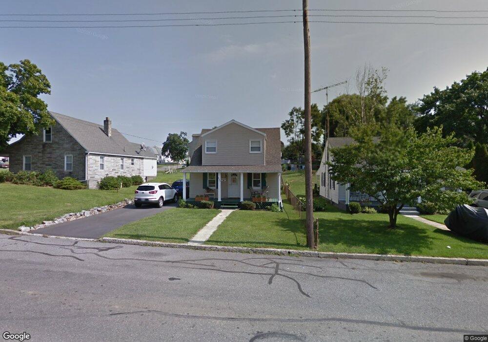
845 Security Rd Hagerstown, MD 21740
East End NeighborhoodEstimated Value: $197,290 - $279,000
--
Bed
1
Bath
1,224
Sq Ft
$200/Sq Ft
Est. Value
About This Home
This home is located at 845 Security Rd, Hagerstown, MD 21740 and is currently estimated at $244,323, approximately $199 per square foot. 845 Security Rd is a home located in Washington County with nearby schools including Pangborn Elementary School, Otsego West Campus High School, and Northern Middle School.
Ownership History
Date
Name
Owned For
Owner Type
Purchase Details
Closed on
Aug 13, 1987
Sold by
Powers Roger L and Powers Virginia L
Bought by
Smith Alan M and Smith Joni L
Current Estimated Value
Home Financials for this Owner
Home Financials are based on the most recent Mortgage that was taken out on this home.
Original Mortgage
$45,315
Interest Rate
10.35%
Purchase Details
Closed on
Apr 30, 1985
Sold by
Sweitzer George L
Bought by
Powers Roger L
Create a Home Valuation Report for This Property
The Home Valuation Report is an in-depth analysis detailing your home's value as well as a comparison with similar homes in the area
Home Values in the Area
Average Home Value in this Area
Purchase History
| Date | Buyer | Sale Price | Title Company |
|---|---|---|---|
| Smith Alan M | $49,500 | -- | |
| Powers Roger L | $42,000 | -- |
Source: Public Records
Mortgage History
| Date | Status | Borrower | Loan Amount |
|---|---|---|---|
| Closed | Smith Alan M | $45,315 |
Source: Public Records
Tax History Compared to Growth
Tax History
| Year | Tax Paid | Tax Assessment Tax Assessment Total Assessment is a certain percentage of the fair market value that is determined by local assessors to be the total taxable value of land and additions on the property. | Land | Improvement |
|---|---|---|---|---|
| 2025 | $1,304 | $175,300 | $40,500 | $134,800 |
| 2024 | $1,304 | $155,400 | $0 | $0 |
| 2023 | $1,234 | $135,500 | $0 | $0 |
| 2022 | $1,053 | $115,600 | $40,500 | $75,100 |
| 2021 | $964 | $109,567 | $0 | $0 |
| 2020 | $964 | $103,533 | $0 | $0 |
| 2019 | $912 | $97,500 | $40,500 | $57,000 |
| 2018 | $912 | $97,500 | $40,500 | $57,000 |
| 2017 | $912 | $97,500 | $0 | $0 |
| 2016 | -- | $98,700 | $0 | $0 |
| 2015 | -- | $98,700 | $0 | $0 |
| 2014 | $1,769 | $98,700 | $0 | $0 |
Source: Public Records
Map
Nearby Homes
- 80 Sunbrook Ln Unit 170
- 23 Atlantic Dr
- 723 Medway Rd
- 713 Medway Rd
- 221 Sunbrook Ln Unit 73
- 732 Jefferson Blvd
- 761 Jefferson Blvd
- 1001 Jefferson Blvd
- 939 View St
- 206 Division Ave
- 226 Brynwood St
- 351 Vale St
- 830 Westwood St
- 212 Brynwood St
- 528 Jefferson St
- 808 Mulberry Ave
- 190 Brynwood St
- 823 Mulberry Ave
- 805 Mulberry Ave
- 144 Fairground Ave
- 841 Security Rd
- 475 Pangborn Blvd
- 801 Security Rd
- 839 Security Rd
- 471 Pangborn & 473 Blvd
- 504 Papa Ct
- 465 Pangborn Blvd
- 833 Security Rd
- 506 Papa Ct
- 478 Pangborn Blvd
- 459 Pangborn Blvd
- 508 Papa Ct
- 512 Papa Ct
- 474 Pangborn Blvd
- 829 Security Rd
- 472 Pangborn Blvd
- 501 Papa Ct
- 514 Papa Ct
- 503 Papa Ct
- 470 Pangborn Blvd