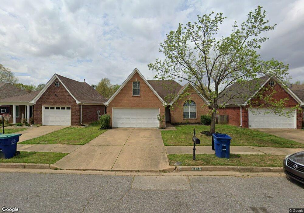
8459 Cross Point Dr Olive Branch, MS 38654
Estimated Value: $241,587 - $275,000
3
Beds
2
Baths
1,778
Sq Ft
$142/Sq Ft
Est. Value
About This Home
This home is located at 8459 Cross Point Dr, Olive Branch, MS 38654 and is currently estimated at $251,897, approximately $141 per square foot. 8459 Cross Point Dr is a home located in DeSoto County with nearby schools including Overpark Elementary School, Center Hill High School, and Desoto Christian Academy.
Ownership History
Date
Name
Owned For
Owner Type
Purchase Details
Closed on
Sep 25, 2014
Sold by
Cameron Serdana A
Bought by
Freo Mississippi Llc
Current Estimated Value
Purchase Details
Closed on
Mar 26, 2010
Sold by
Clarkson Andrew J
Bought by
Cameron Serdena A
Home Financials for this Owner
Home Financials are based on the most recent Mortgage that was taken out on this home.
Original Mortgage
$67,500
Interest Rate
4.91%
Mortgage Type
New Conventional
Create a Home Valuation Report for This Property
The Home Valuation Report is an in-depth analysis detailing your home's value as well as a comparison with similar homes in the area
Home Values in the Area
Average Home Value in this Area
Purchase History
| Date | Buyer | Sale Price | Title Company |
|---|---|---|---|
| Freo Mississippi Llc | -- | Reality Title | |
| Cameron Serdena A | -- | Realty Title |
Source: Public Records
Mortgage History
| Date | Status | Borrower | Loan Amount |
|---|---|---|---|
| Previous Owner | Cameron Serdena A | $67,500 |
Source: Public Records
Tax History Compared to Growth
Tax History
| Year | Tax Paid | Tax Assessment Tax Assessment Total Assessment is a certain percentage of the fair market value that is determined by local assessors to be the total taxable value of land and additions on the property. | Land | Improvement |
|---|---|---|---|---|
| 2024 | $2,144 | $15,710 | $3,750 | $11,960 |
| 2023 | $2,144 | $15,710 | $0 | $0 |
| 2022 | $2,144 | $15,710 | $3,750 | $11,960 |
| 2021 | $2,144 | $15,710 | $3,750 | $11,960 |
| 2020 | $2,012 | $14,745 | $3,750 | $10,995 |
| 2019 | $2,012 | $14,745 | $3,750 | $10,995 |
| 2017 | $1,980 | $25,106 | $14,428 | $10,678 |
| 2016 | $1,980 | $14,428 | $3,750 | $10,678 |
| 2015 | $1,980 | $25,106 | $14,428 | $10,678 |
| 2014 | $345 | $10,014 | $0 | $0 |
| 2013 | $366 | $10,014 | $0 | $0 |
Source: Public Records
Map
Nearby Homes
- 8382 Regal Bend Dr
- 9857 Tremont Dr
- 9899 Wynngate Dr
- 8300 Waverly Cove
- 8992 Gavin Dr
- 8247 Montrose Dr
- 8939 Travis Dr
- 9097 Gavin Dr
- 9178 William Paul Dr
- 8971 Tahoe Cove
- 9387 Joe Lyon Blvd
- 7741 Meadow Ridge Ln
- 9195 Lakeside Dr
- 9158 Lakeside Dr
- 9037 Plantation Rd
- 7669 Meadow Ridge Ln
- 9444 Geneva Loop E
- 9081 Lakeside Dr
- 9164 Superior Cove
- 9861 Alexanders Ridge Dr
- 8459 Cross Point Dr
- 8447 Cross Point Dr
- 8471 Cross Point Dr
- 8435 Cross Point Dr
- 8483 Cross Point Dr
- 8454 Regal Bend Dr
- 8423 Cross Point Dr
- 8442 Regal Bend Dr
- 8466 Regal Bend Dr
- 8519 Cross Point Dr
- 8430 Regal Bend Dr
- 8495 Cross Point Dr
- 8456 Cross Point Dr
- 8456 Cross Point Dr
- 8478 Regal Bend Dr
- 8444 Cross Point Dr
- 8468 Cross Point Dr
- 8411 Cross Point Dr
- 8432 Cross Point Dr
- 8418 Regal Bend Dr