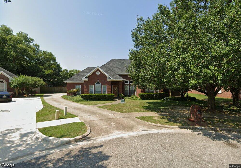
8465 Kyle Ct Mobile, AL 36695
Yorkwood NeighborhoodEstimated Value: $328,000 - $368,000
4
Beds
4
Baths
2,953
Sq Ft
$118/Sq Ft
Est. Value
About This Home
This home is located at 8465 Kyle Ct, Mobile, AL 36695 and is currently estimated at $347,662, approximately $117 per square foot. 8465 Kyle Ct is a home located in Mobile County with nearby schools including O'rourke Elementary School, Bernice J Causey Middle School, and Baker High School.
Ownership History
Date
Name
Owned For
Owner Type
Purchase Details
Closed on
Oct 1, 2025
Sold by
Cunningham Samuel Lamar and Cunningham Davida Norrice
Bought by
Sdc Living Trust and Cunningham
Current Estimated Value
Purchase Details
Closed on
Apr 22, 2002
Sold by
Kenney R Steven and Kenney Julie M
Bought by
Cunningham Samuel L and Cunningham Davida N
Home Financials for this Owner
Home Financials are based on the most recent Mortgage that was taken out on this home.
Original Mortgage
$203,417
Interest Rate
7.07%
Create a Home Valuation Report for This Property
The Home Valuation Report is an in-depth analysis detailing your home's value as well as a comparison with similar homes in the area
Home Values in the Area
Average Home Value in this Area
Purchase History
| Date | Buyer | Sale Price | Title Company |
|---|---|---|---|
| Sdc Living Trust | $335,200 | None Listed On Document | |
| Cunningham Samuel L | -- | -- |
Source: Public Records
Mortgage History
| Date | Status | Borrower | Loan Amount |
|---|---|---|---|
| Previous Owner | Cunningham Samuel L | $203,417 |
Source: Public Records
Tax History
| Year | Tax Paid | Tax Assessment Tax Assessment Total Assessment is a certain percentage of the fair market value that is determined by local assessors to be the total taxable value of land and additions on the property. | Land | Improvement |
|---|---|---|---|---|
| 2025 | $1,569 | $33,520 | $4,000 | $29,520 |
| 2024 | $1,569 | $32,760 | $3,900 | $28,860 |
| 2023 | $1,532 | $28,570 | $3,750 | $24,820 |
| 2022 | $1,229 | $26,710 | $3,750 | $22,960 |
| 2021 | $1,199 | $26,100 | $3,960 | $22,140 |
| 2020 | $1,195 | $26,020 | $3,600 | $22,420 |
| 2019 | $1,213 | $26,400 | $0 | $0 |
| 2018 | $1,221 | $26,560 | $0 | $0 |
| 2017 | $1,221 | $26,560 | $0 | $0 |
| 2016 | $1,235 | $26,840 | $0 | $0 |
| 2013 | $962 | $21,060 | $0 | $0 |
Source: Public Records
Map
Nearby Homes
- 2155 Brittany Dr
- 2261 Vulcan Ct
- 2200 O'Rourke Dr
- 8690 W Anvil Ct
- 8700 Irongate Way
- 1897 Burnham Ct
- 2316 Leroy Stevens Rd
- 8601 Cottage Hill Rd
- 8451 Placid Dr
- 0 Walter Ct Unit 7008922
- 0 Walter Ct Unit 7008907
- 0 Walter Ct Unit 7008918
- 8400 Kendall Ct N
- 2575 Rosebud Dr
- 8100 Danielle Dr
- 1720 Leroy Stevens Rd
- 8367 Calgary Dr S
- 8080 Danielle Dr
- 8945 Spring Grove S
- 7611 Anglebrook Rd S
- 8475 Kyle Ct
- 8455 Kyle Ct
- 2205 Sterling Ct
- 2200 Sterling Ct
- 8485 Kyle Ct
- 8450 Kyle Ct
- 2074 Orourke Dr
- 8449 Brittany Dr
- 8470 Kyle Ct
- 8460 Kyle Ct
- 8435 Brittany Ct
- 2210 Sterling Ct
- 2215 Sterling Ct
- 8480 Kyle Ct
- 2160 Brittany Dr
- 2150 Brittany Dr
- 2075 Orourke Dr
- 8595 Sterling Dr
- 2065 Orourke Dr
- 2220 Sterling Ct
Your Personal Tour Guide
Ask me questions while you tour the home.