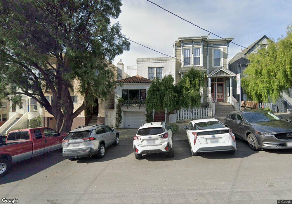
847 Baker St San Francisco, CA 94115
North of the Panhandle NeighborhoodEstimated Value: $1,478,000 - $2,228,000
--
Bed
2
Baths
1,425
Sq Ft
$1,307/Sq Ft
Est. Value
About This Home
This home is located at 847 Baker St, San Francisco, CA 94115 and is currently estimated at $1,862,581, approximately $1,307 per square foot. 847 Baker St is a home located in San Francisco County with nearby schools including New Traditions Elementary School, Roosevelt Middle School, and Creative Arts Charter School.
Ownership History
Date
Name
Owned For
Owner Type
Purchase Details
Closed on
Jul 18, 2002
Sold by
Brown Gordon R
Bought by
Cohn Russell S
Current Estimated Value
Home Financials for this Owner
Home Financials are based on the most recent Mortgage that was taken out on this home.
Original Mortgage
$400,000
Outstanding Balance
$156,401
Interest Rate
5.62%
Estimated Equity
$1,706,180
Create a Home Valuation Report for This Property
The Home Valuation Report is an in-depth analysis detailing your home's value as well as a comparison with similar homes in the area
Home Values in the Area
Average Home Value in this Area
Purchase History
| Date | Buyer | Sale Price | Title Company |
|---|---|---|---|
| Cohn Russell S | $775,000 | Fidelity National Title Co |
Source: Public Records
Mortgage History
| Date | Status | Borrower | Loan Amount |
|---|---|---|---|
| Open | Cohn Russell S | $400,000 |
Source: Public Records
Tax History Compared to Growth
Tax History
| Year | Tax Paid | Tax Assessment Tax Assessment Total Assessment is a certain percentage of the fair market value that is determined by local assessors to be the total taxable value of land and additions on the property. | Land | Improvement |
|---|---|---|---|---|
| 2025 | $14,636 | $1,212,770 | $673,466 | $539,304 |
| 2024 | $14,636 | $1,188,991 | $660,261 | $528,730 |
| 2023 | $14,412 | $1,165,679 | $647,315 | $518,364 |
| 2022 | $14,132 | $1,142,824 | $634,623 | $508,201 |
| 2021 | $13,880 | $1,120,417 | $622,180 | $498,237 |
| 2020 | $13,946 | $1,108,930 | $615,801 | $493,129 |
| 2019 | $13,468 | $1,087,188 | $603,727 | $483,461 |
| 2018 | $13,013 | $1,065,873 | $591,890 | $473,983 |
| 2017 | $12,560 | $1,044,975 | $580,285 | $464,690 |
| 2016 | $12,350 | $1,024,486 | $568,907 | $455,579 |
| 2015 | $11,307 | $933,935 | $560,362 | $373,573 |
| 2014 | $11,008 | $915,642 | $549,386 | $366,256 |
Source: Public Records
Map
Nearby Homes
- 856 Baker St
- 815 Lyon St Unit A
- 726 Lyon St
- 560 Lyon St
- 1909 Eddy St Unit 3
- 48 Terra Vista Ave Unit B
- 525 Baker St Unit 525
- 617 Broderick St Unit B
- 613 Broderick St
- 2000 Ellis St Unit 201
- 2001 Mcallister St Unit 120
- 535 Broderick St
- 558 Central Ave
- 1451-1453 Hayes St
- 1365 Scott St Unit 2
- 1365 Scott St Unit 1
- 1858 Grove St Unit 1860
- 1450 Lyon St
- 1947 Fulton St
- 350 Broderick St Unit 214
- 855 Baker St
- 851-855 Baker St
- 841 Baker St Unit 843
- 851 Baker St
- 859 Baker St Unit 861
- 833 Baker St Unit 835
- 2029 Turk Blvd Unit 2033
- 2037 Turk Blvd
- 1904 Golden Gate Ave
- 1906 Golden Gate Ave
- 801 Baker St Unit 17
- 1912 Golden Gate Ave
- 1906A Golden Gate Ave
- 1910 Golden Gate Ave
- 2055 Turk Blvd
- 2047 Turk Blvd
- 2061 Turk Blvd
- 1916 Golden Gate Ave
- 848 Baker St Unit 850
- 1995 Turk St Unit 2