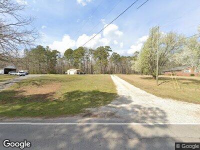
847 Coan Dr Locust Grove, GA 30248
Estimated Value: $323,544 - $362,000
3
Beds
2
Baths
1,814
Sq Ft
$187/Sq Ft
Est. Value
About This Home
This home is located at 847 Coan Dr, Locust Grove, GA 30248 and is currently estimated at $339,636, approximately $187 per square foot. 847 Coan Dr is a home located in Henry County with nearby schools including Tussahaw Elementary School, Locust Grove Middle School, and Locust Grove High School.
Ownership History
Date
Name
Owned For
Owner Type
Purchase Details
Closed on
Sep 11, 2020
Sold by
Jenkins Matthew
Bought by
Jenkins Matthew H and Jenkins Mary Kathryn
Current Estimated Value
Home Financials for this Owner
Home Financials are based on the most recent Mortgage that was taken out on this home.
Original Mortgage
$224,095
Outstanding Balance
$199,191
Interest Rate
2.9%
Mortgage Type
VA
Estimated Equity
$140,445
Purchase Details
Closed on
Dec 28, 2018
Sold by
Hardin Michael
Bought by
Jenkins Matthew
Home Financials for this Owner
Home Financials are based on the most recent Mortgage that was taken out on this home.
Original Mortgage
$216,930
Interest Rate
4.8%
Create a Home Valuation Report for This Property
The Home Valuation Report is an in-depth analysis detailing your home's value as well as a comparison with similar homes in the area
Home Values in the Area
Average Home Value in this Area
Purchase History
| Date | Buyer | Sale Price | Title Company |
|---|---|---|---|
| Jenkins Matthew H | -- | -- | |
| Jenkins Matthew | $210,000 | -- |
Source: Public Records
Mortgage History
| Date | Status | Borrower | Loan Amount |
|---|---|---|---|
| Open | Jenkins Matthew H | $224,095 | |
| Previous Owner | Jenkins Matthew | $216,930 | |
| Previous Owner | Hardin Michael | $149,000 | |
| Previous Owner | Hardin Michael | $150,500 | |
| Previous Owner | Hardin Michael | $134,300 |
Source: Public Records
Tax History Compared to Growth
Tax History
| Year | Tax Paid | Tax Assessment Tax Assessment Total Assessment is a certain percentage of the fair market value that is determined by local assessors to be the total taxable value of land and additions on the property. | Land | Improvement |
|---|---|---|---|---|
| 2024 | $5,628 | $140,640 | $14,920 | $125,720 |
| 2023 | $5,314 | $137,480 | $14,360 | $123,120 |
| 2022 | $4,468 | $115,440 | $13,240 | $102,200 |
| 2021 | $3,706 | $95,560 | $11,360 | $84,200 |
| 2020 | $3,377 | $87,000 | $10,720 | $76,280 |
| 2019 | $3,195 | $82,240 | $10,160 | $72,080 |
| 2018 | $2,214 | $64,000 | $9,400 | $54,600 |
| 2016 | $1,916 | $55,960 | $7,560 | $48,400 |
| 2015 | $1,878 | $53,760 | $8,480 | $45,280 |
| 2014 | $1,729 | $49,560 | $8,480 | $41,080 |
Source: Public Records
Map
Nearby Homes
- 850 Coan Dr
- 950 Besse Way
- 201 Nina Cir
- 563 Deadwood Trail
- 785 Seabolt Rd
- 556 Deadwood Trail
- 705 Seabolt Rd
- 596 Deadwood Trail
- 678 Seabolt Rd
- 560 Coan Dr
- 229 Prescott St
- 206 Prescott St
- 1202 Coan Dr
- 135 Kimbell Farm Dr
- 1555 S Bethany Rd
- 308 Tussahaw Trail
- 460 Rabbit Run
- 1547 S Bethany Rd
- 565 Miles Ct
- 30 Apache Ct
- 847 Coan Dr
- 70 Seabolt Dr
- 851 Coan Dr
- 843 Coan Dr
- 65 Seabolt Dr
- 835 Coan Dr
- 0 Coan Dr Unit 7233369
- 0 Coan Dr Unit 3192244
- 0 Coan Dr Unit 8678334
- 0 Coan Dr Unit 8633343
- 0 Coan Dr Unit 8567449
- 0 Coan Dr Unit 8490772
- 0 Coan Dr Unit 8483798
- 0 Coan Dr Unit 8421227
- 0 Coan Dr Unit 8284217
- 0 Coan Dr Unit 8258889
- 0 Coan Dr Unit 8250616
- 0 Coan Dr Unit 8243014
- 0 Coan Dr Unit 8246277
- 0 Coan Dr Unit 3252780