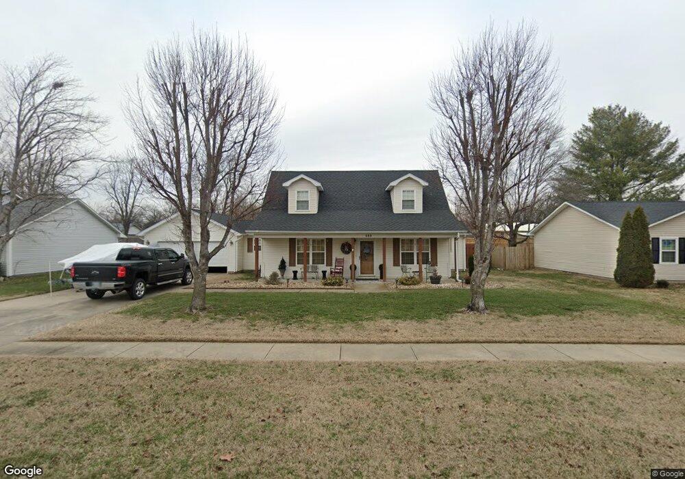
848 Auburn Dr Sikeston, MO 63801
Estimated Value: $212,898 - $231,000
3
Beds
--
Bath
1,540
Sq Ft
$145/Sq Ft
Est. Value
About This Home
This home is located at 848 Auburn Dr, Sikeston, MO 63801 and is currently estimated at $222,966, approximately $144 per square foot. 848 Auburn Dr is a home with nearby schools including Sikeston Senior High School, Southeast Missouri Christian Academy, and The Christian Academy.
Ownership History
Date
Name
Owned For
Owner Type
Purchase Details
Closed on
Oct 13, 2011
Sold by
Fletcher Patricia and Fletcher Robert Dale
Bought by
Cheatham Ronnie W and Cheatham Deborah A
Current Estimated Value
Home Financials for this Owner
Home Financials are based on the most recent Mortgage that was taken out on this home.
Original Mortgage
$149,850
Outstanding Balance
$103,086
Interest Rate
4.28%
Mortgage Type
New Conventional
Estimated Equity
$119,880
Purchase Details
Closed on
Jul 9, 2009
Sold by
Mclane Barbar Brent and Mclane Barbar
Bought by
Holmes Joshua D and Holmes Sarah J
Home Financials for this Owner
Home Financials are based on the most recent Mortgage that was taken out on this home.
Original Mortgage
$120,300
Interest Rate
4.97%
Mortgage Type
New Conventional
Create a Home Valuation Report for This Property
The Home Valuation Report is an in-depth analysis detailing your home's value as well as a comparison with similar homes in the area
Home Values in the Area
Average Home Value in this Area
Purchase History
| Date | Buyer | Sale Price | Title Company |
|---|---|---|---|
| Cheatham Ronnie W | -- | -- | |
| Holmes Joshua D | -- | -- |
Source: Public Records
Mortgage History
| Date | Status | Borrower | Loan Amount |
|---|---|---|---|
| Open | Cheatham Ronnie W | $149,850 | |
| Previous Owner | Holmes Joshua D | $120,300 |
Source: Public Records
Tax History Compared to Growth
Tax History
| Year | Tax Paid | Tax Assessment Tax Assessment Total Assessment is a certain percentage of the fair market value that is determined by local assessors to be the total taxable value of land and additions on the property. | Land | Improvement |
|---|---|---|---|---|
| 2024 | $1,429 | $28,800 | $3,300 | $25,500 |
| 2023 | $1,435 | $28,800 | $0 | $0 |
| 2022 | $1,340 | $27,100 | $3,300 | $23,800 |
| 2021 | $1,338 | $27,100 | $0 | $0 |
| 2020 | $1,174 | $27,100 | $0 | $0 |
| 2019 | $1,173 | $25,800 | $3,300 | $22,500 |
| 2017 | $1,099 | $24,400 | $0 | $0 |
| 2016 | -- | $24,400 | $0 | $0 |
| 2015 | -- | $24,400 | $0 | $0 |
| 2014 | -- | $24,400 | $0 | $0 |
| 2011 | -- | $0 | $0 | $0 |
Source: Public Records
Map
Nearby Homes
- 850 Cambridge Dr
- 840 Delta Pine Ln
- 866 Auburn Dr
- 821 Plantation Blvd
- 907 Stanford Dr
- 913 Cambridge Dr
- 804 Harvard St
- 1003 Red Arrow
- 907 Plantation Blvd
- 801 Cambridge Dr
- 941 Cambridge Dr
- 608 Holly Hill Dr
- 1135 Daffodil St
- 322 Helen St
- 804 S Prairie St
- 713 E Gladys St
- 709 E Gladys St
- 711 E Gladys St
- 316 Edmondson St
- 321 Benton St
- 850 Auburn Dr
- 846 Auburn Dr
- 851 Cambridge Dr
- 852 Auburn Dr
- 843 Auburn Dr
- 844 Auburn Dr
- 841 Auburn Dr
- 849 Cambridge Dr
- 845 Auburn Dr
- 855 Cambridge Dr
- 839 Auburn Dr
- 847 Cambridge Dr
- 842 Auburn Dr
- 854 Auburn Dr
- 851 Auburn Dr
- 837 Auburn Dr
- 852 Cambridge Dr
- 845 Cambridge Dr
- 838 Delta Pine Ln
- 836 Delta Pine Ln