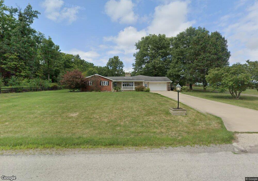
848 County Road 1600 Ashland, OH 44805
Estimated Value: $545,912 - $626,000
3
Beds
2
Baths
2,550
Sq Ft
$227/Sq Ft
Est. Value
About This Home
This home is located at 848 County Road 1600, Ashland, OH 44805 and is currently estimated at $578,228, approximately $226 per square foot. 848 County Road 1600 is a home located in Ashland County with nearby schools including Ashland High School, Ashland County Community Academy, and St. Edward Elementary School.
Ownership History
Date
Name
Owned For
Owner Type
Purchase Details
Closed on
Jun 11, 2025
Sold by
Ashbaugh Matthew W and Ashbaugh Hannah H
Bought by
Mitchell Noel and Rose Noel Brianna
Current Estimated Value
Home Financials for this Owner
Home Financials are based on the most recent Mortgage that was taken out on this home.
Original Mortgage
$484,000
Outstanding Balance
$482,745
Interest Rate
6.76%
Mortgage Type
New Conventional
Estimated Equity
$95,483
Purchase Details
Closed on
Oct 18, 2017
Sold by
Howell Living Trust
Bought by
Ashbaugh Matthew W
Home Financials for this Owner
Home Financials are based on the most recent Mortgage that was taken out on this home.
Original Mortgage
$274,725
Interest Rate
3.25%
Mortgage Type
FHA
Purchase Details
Closed on
Feb 24, 2006
Sold by
Howell Lawrence D
Bought by
Howell Lawrence D
Purchase Details
Closed on
Jan 1, 1990
Bought by
Howell Lawrence D
Create a Home Valuation Report for This Property
The Home Valuation Report is an in-depth analysis detailing your home's value as well as a comparison with similar homes in the area
Home Values in the Area
Average Home Value in this Area
Purchase History
| Date | Buyer | Sale Price | Title Company |
|---|---|---|---|
| Mitchell Noel | $605,000 | Castle Real Estate Title | |
| Ashbaugh Matthew W | $305,000 | Ashland Title Agcy | |
| Howell Lawrence D | -- | -- | |
| Howell Lawrence D | -- | -- |
Source: Public Records
Mortgage History
| Date | Status | Borrower | Loan Amount |
|---|---|---|---|
| Open | Mitchell Noel | $484,000 | |
| Previous Owner | Ashbaugh Matthew W | $274,725 |
Source: Public Records
Tax History Compared to Growth
Tax History
| Year | Tax Paid | Tax Assessment Tax Assessment Total Assessment is a certain percentage of the fair market value that is determined by local assessors to be the total taxable value of land and additions on the property. | Land | Improvement |
|---|---|---|---|---|
| 2024 | $4,655 | $136,340 | $17,550 | $118,790 |
| 2023 | $4,655 | $136,340 | $17,550 | $118,790 |
| 2022 | $4,217 | $97,390 | $12,540 | $84,850 |
| 2021 | $4,234 | $97,390 | $12,540 | $84,850 |
| 2020 | $4,018 | $97,390 | $12,540 | $84,850 |
| 2019 | $3,776 | $83,800 | $12,590 | $71,210 |
| 2018 | $3,789 | $83,800 | $12,590 | $71,210 |
| 2017 | $3,046 | $83,800 | $12,590 | $71,210 |
| 2016 | $3,046 | $74,160 | $11,140 | $63,020 |
| 2015 | $3,019 | $74,160 | $11,140 | $63,020 |
| 2013 | $3,143 | $77,460 | $10,870 | $66,590 |
Source: Public Records
Map
Nearby Homes
- 1653 Ohio 60
- 1653 State Route 60
- 1457 Township Road 853
- 1435 Township Road 853
- 1581 County Road 995
- 1446 Township Road 805
- 1690 County Road 995
- 1015 Township Road 1696
- 0 Eagle Way
- 0 Twp Rd 1806 Unit 11591470
- 1331 Eastern Ave
- 453 Hillcrest Dr
- 1109 Eastern Ave
- 1011 Eastern Ave
- 31 Morgan Ave
- 1706 Kingwood Ct
- 531 Keen Ave
- 914 Chestnut St
- 416 Diamond St
- 834 County Road 1600
- 841 County Road 1600
- 839 Cr 1600
- 839 County Road 1600
- 860 County Road 1600
- 0 Co Road 1600 Unit 3479665
- 829 County Road 1600
- 868 County Road 1600
- 828 County Road 1600
- 827 County Road 1600
- 826 County Road 1600
- 1610 County Road 1610
- 873 County Road 1600
- 1602 State Route 60
- 1594 State Route 60
- 820 Cr 1600
- 820 County Road 1600
- 1606 State Route 60
- 876 County Road 1600
- 1590 Ohio 60