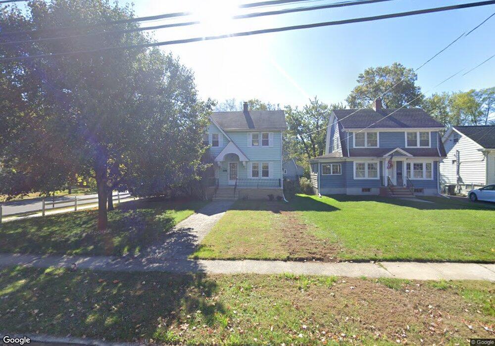
848 Leland Ave Unit 50 Plainfield, NJ 07062
Estimated Value: $480,566 - $589,000
--
Bed
--
Bath
1,420
Sq Ft
$387/Sq Ft
Est. Value
About This Home
This home is located at 848 Leland Ave Unit 50, Plainfield, NJ 07062 and is currently estimated at $549,142, approximately $386 per square foot. 848 Leland Ave Unit 50 is a home located in Union County with nearby schools including Frederic W. Cook School, Emerson Community School, and Maxson Middle School.
Ownership History
Date
Name
Owned For
Owner Type
Purchase Details
Closed on
Sep 27, 2004
Sold by
Bailey Jeffrey
Bought by
Roesler Elizabeth
Current Estimated Value
Home Financials for this Owner
Home Financials are based on the most recent Mortgage that was taken out on this home.
Original Mortgage
$283,200
Interest Rate
5.71%
Purchase Details
Closed on
Oct 15, 1999
Sold by
Maletz Joseph M and Maletz Dawn M
Bought by
Bailey Jeffrey and Baca Carlos
Home Financials for this Owner
Home Financials are based on the most recent Mortgage that was taken out on this home.
Original Mortgage
$166,250
Interest Rate
7.83%
Create a Home Valuation Report for This Property
The Home Valuation Report is an in-depth analysis detailing your home's value as well as a comparison with similar homes in the area
Home Values in the Area
Average Home Value in this Area
Purchase History
| Date | Buyer | Sale Price | Title Company |
|---|---|---|---|
| Roesler Elizabeth | $354,000 | -- | |
| Bailey Jeffrey | $175,000 | -- |
Source: Public Records
Mortgage History
| Date | Status | Borrower | Loan Amount |
|---|---|---|---|
| Previous Owner | Roesler Elizabeth | $283,200 | |
| Previous Owner | Bailey Jeffrey | $166,250 |
Source: Public Records
Tax History Compared to Growth
Tax History
| Year | Tax Paid | Tax Assessment Tax Assessment Total Assessment is a certain percentage of the fair market value that is determined by local assessors to be the total taxable value of land and additions on the property. | Land | Improvement |
|---|---|---|---|---|
| 2025 | $9,396 | $107,600 | $46,800 | $60,800 |
| 2024 | $9,303 | $107,600 | $46,800 | $60,800 |
| 2023 | $9,303 | $107,600 | $46,800 | $60,800 |
| 2022 | $9,102 | $107,600 | $46,800 | $60,800 |
| 2021 | $9,022 | $107,600 | $46,800 | $60,800 |
| 2020 | $8,996 | $107,600 | $46,800 | $60,800 |
| 2019 | $8,996 | $107,600 | $46,800 | $60,800 |
| 2018 | $8,808 | $107,600 | $46,800 | $60,800 |
| 2017 | $8,593 | $107,600 | $46,800 | $60,800 |
| 2016 | $8,418 | $107,600 | $46,800 | $60,800 |
| 2015 | $8,169 | $107,600 | $46,800 | $60,800 |
| 2014 | $7,947 | $107,600 | $46,800 | $60,800 |
Source: Public Records
Map
Nearby Homes
- 810 Leland Ave Unit 14
- 1158 Woodmere Place
- 842 Berkeley Ave
- 848 Adam Cir
- 1138-40 Gresham Rd
- 714 Dixie Ln
- 771 Ravine Rd
- 767 Ravine Rd Unit 73
- 939-45 Post Dr
- 633 Woodland Ave Unit 37
- 1224 Sunnyfield Ln
- 1232 Sunnyfield Ln
- 1009 Mayfair Way
- 1505 Charlotte Rd
- 724 Central St
- 1107-11 North Ave
- 1107 North Ave Unit 11
- 343 Netherwood Ave Unit 45
- 1343 Putnam Ave Unit 45
- 812 E 6th St
- 844 Leland Ave Unit 46
- 840 Leland Ave Unit 42
- 1175 Loraine Ave Unit 79
- 1179 Loraine Ave
- 856 Leland Ave Unit 62
- 834 Leland Ave Unit 38
- 1176 Loraine Ave Unit 78
- 1169 Loraine Ave Unit 73
- 864 Leland Ave Unit 66
- 1172 Loraine Ave Unit 74
- 828 Leland Ave Unit 32
- 1122 Helene Ave Unit 24
- 1124 Helene Ave
- 1166 Loraine Ave Unit 70
- 1165 Loraine Ave Unit 67
- 868 Leland Ave Unit 72
- 861 Leland Ave Unit 65
- 1118 Helene Ave Unit 20
- 1162 Loraine Ave Unit 64
- 1114 Helene Ave Unit 16