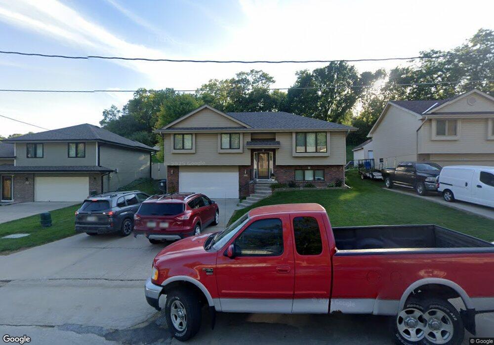
848 Mckenzie Ave Council Bluffs, IA 51503
McKenzie Avenue NeighborhoodEstimated Value: $297,037 - $307,000
3
Beds
3
Baths
1,246
Sq Ft
$243/Sq Ft
Est. Value
About This Home
This home is located at 848 Mckenzie Ave, Council Bluffs, IA 51503 and is currently estimated at $302,509, approximately $242 per square foot. 848 Mckenzie Ave is a home located in Pottawattamie County with nearby schools including College View Elementary School, Gerald W. Kirn Middle School, and Abraham Lincoln High School.
Ownership History
Date
Name
Owned For
Owner Type
Purchase Details
Closed on
Dec 29, 2006
Sold by
Roth Beverly A and Roth John M
Bought by
Steinmetz Justin T and Steinmetz Sarah A
Current Estimated Value
Home Financials for this Owner
Home Financials are based on the most recent Mortgage that was taken out on this home.
Original Mortgage
$167,000
Outstanding Balance
$99,965
Interest Rate
6.24%
Mortgage Type
New Conventional
Estimated Equity
$202,544
Create a Home Valuation Report for This Property
The Home Valuation Report is an in-depth analysis detailing your home's value as well as a comparison with similar homes in the area
Home Values in the Area
Average Home Value in this Area
Purchase History
| Date | Buyer | Sale Price | Title Company |
|---|---|---|---|
| Steinmetz Justin T | $167,000 | None Available |
Source: Public Records
Mortgage History
| Date | Status | Borrower | Loan Amount |
|---|---|---|---|
| Open | Steinmetz Justin T | $167,000 |
Source: Public Records
Tax History Compared to Growth
Tax History
| Year | Tax Paid | Tax Assessment Tax Assessment Total Assessment is a certain percentage of the fair market value that is determined by local assessors to be the total taxable value of land and additions on the property. | Land | Improvement |
|---|---|---|---|---|
| 2025 | $4,538 | $282,000 | $45,000 | $237,000 |
| 2024 | $4,538 | $235,500 | $39,200 | $196,300 |
| 2023 | $4,486 | $235,500 | $39,200 | $196,300 |
| 2022 | $4,532 | $202,100 | $40,100 | $162,000 |
| 2021 | $6,948 | $202,100 | $40,100 | $162,000 |
| 2020 | $4,342 | $202,100 | $40,100 | $162,000 |
| 2019 | $4,500 | $183,600 | $21,600 | $162,000 |
| 2018 | $4,412 | $183,600 | $21,600 | $162,000 |
| 2017 | $3,994 | $165,186 | $21,546 | $143,640 |
| 2015 | $3,902 | $165,186 | $21,546 | $143,640 |
| 2014 | $3,908 | $165,186 | $21,546 | $143,640 |
Source: Public Records
Map
Nearby Homes
- 944 Mckenzie Ave
- 1011 Simms Ave
- 627 Spencer Ave
- 500 Spencer Ave
- 638 Simms Ave
- 407 Spencer Ave
- 401 Spencer Ave
- 162 N Linden Ave
- 155 S Linden Ave
- 415 Midland Dr
- 440 Simms Ave
- 116 Spencer Ave
- 212 Highland Dr
- 605 Ridge Rd N
- 242 Elmwood Dr
- 2231 N Broadway
- 118 Euclid Ave
- 18267 Northline Dr
- 1553 N Broadway
- 222 Locust Lodge Ave
- 844 Mckenzie Ave
- 852 Mckenzie Ave
- 840 Mckenzie Ave
- 856 Mckenzie Ave
- 142 E View Dr
- 138 E View Dr
- 202 E View Dr
- 819 Mckenzie Ave
- 836 Mckenzie Ave
- 821 Mckenzie Ave
- 860 Mckenzie Ave
- 823 Mckenzie Ave
- 832 Mckenzie Ave
- 825 Mckenzie Ave
- 825 Mckenzie Ave
- 130 E View Dr
- 815 Mckenzie Ave
- 210 E View Dr
- 133 E View Dr
- 206 E View Dr