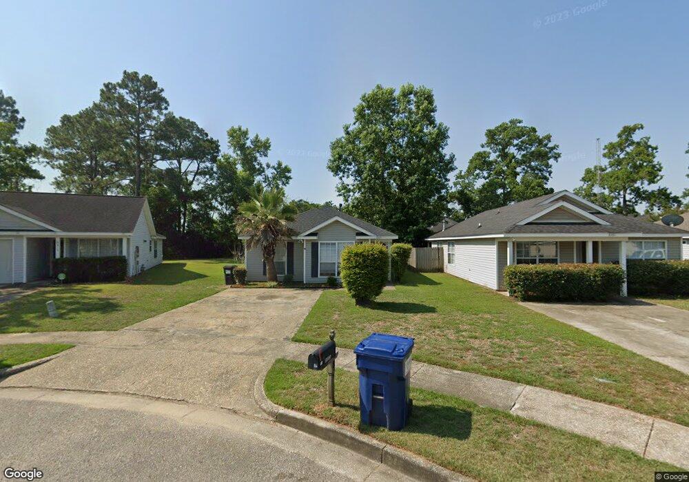
8485 Desert Oak Ct Mobile, AL 36695
Yorkwood NeighborhoodEstimated Value: $125,000 - $209,000
3
Beds
2
Baths
1,261
Sq Ft
$138/Sq Ft
Est. Value
About This Home
This home is located at 8485 Desert Oak Ct, Mobile, AL 36695 and is currently estimated at $174,515, approximately $138 per square foot. 8485 Desert Oak Ct is a home located in Mobile County with nearby schools including O'rourke Elementary School, Bernice J Causey Middle School, and Baker High School.
Ownership History
Date
Name
Owned For
Owner Type
Purchase Details
Closed on
Jun 24, 2005
Sold by
Wilks Kevin H and Wilks Leigh A
Bought by
Goldsmith Kim
Current Estimated Value
Home Financials for this Owner
Home Financials are based on the most recent Mortgage that was taken out on this home.
Original Mortgage
$91,700
Outstanding Balance
$47,688
Interest Rate
5.7%
Mortgage Type
Fannie Mae Freddie Mac
Estimated Equity
$126,827
Purchase Details
Closed on
Jun 10, 1999
Sold by
The Mitchell Company Inc
Bought by
Wilks Kevin H and Wilks Leigh A
Create a Home Valuation Report for This Property
The Home Valuation Report is an in-depth analysis detailing your home's value as well as a comparison with similar homes in the area
Home Values in the Area
Average Home Value in this Area
Purchase History
| Date | Buyer | Sale Price | Title Company |
|---|---|---|---|
| Goldsmith Kim | -- | Surety Land Title Inc | |
| Wilks Kevin H | -- | -- |
Source: Public Records
Mortgage History
| Date | Status | Borrower | Loan Amount |
|---|---|---|---|
| Open | Goldsmith Kim | $91,700 |
Source: Public Records
Tax History Compared to Growth
Tax History
| Year | Tax Paid | Tax Assessment Tax Assessment Total Assessment is a certain percentage of the fair market value that is determined by local assessors to be the total taxable value of land and additions on the property. | Land | Improvement |
|---|---|---|---|---|
| 2024 | $655 | $13,720 | $2,800 | $10,920 |
| 2023 | $499 | $11,660 | $2,820 | $8,840 |
| 2022 | $465 | $10,960 | $2,560 | $8,400 |
| 2021 | $428 | $10,190 | $2,560 | $7,630 |
| 2020 | $436 | $10,380 | $2,560 | $7,820 |
| 2019 | $408 | $9,800 | $0 | $0 |
| 2018 | $410 | $9,840 | $0 | $0 |
| 2017 | $451 | $10,680 | $0 | $0 |
| 2016 | $456 | $10,780 | $0 | $0 |
| 2013 | $429 | $10,140 | $0 | $0 |
Source: Public Records
Map
Nearby Homes
- 2006 E Clarke Rd
- 8545 Brandy Oak Ct
- 8391 Jeptha Ct
- 8525 Gayla Ct
- 2155 Brittany Dr
- 8569 E Anvil Ct
- 1839 Kendall Ct
- 2200 O'Rourke Dr
- 8700 Irongate Way
- 2271 Carrington Dr
- 1763 Harrington Way
- 8240 Taddish Dr N
- 1720 Leroy Stevens Rd
- 2364 Randlett Trace
- 0 Chapel Hill Ct Unit 7671872
- 2316 Leroy Stevens Rd
- 1645 Dawes Rd
- 0 Walter Ct Unit 7008907
- 0 Walter Ct Unit 7008922
- 0 Walter Ct Unit 7008918
- 8481 Desert Oak Ct
- 8495 Desert Oak Ct
- 8516 Southern Oak Ct
- 8501 Desert Oak Ct
- 8475 Desert Oak Ct
- 8505 Desert Oak Ct
- 8522 Southern Oak Ct
- 8482 Southern Oak Ct
- 8511 Desert Oak Ct
- 8490 Desert Oak Ct
- 8484 Desert Oak Ct
- 8494 Desert Oak Ct
- 8480 Desert Oak Ct
- 2026 E Clarke Rd
- 8526 Southern Oak Ct
- 8500 Desert Oak Ct
- 8515 Desert Oak Ct
- 8474 Desert Oak Ct
- 2016 E Clarke Rd
- 8504 Desert Oak Ct