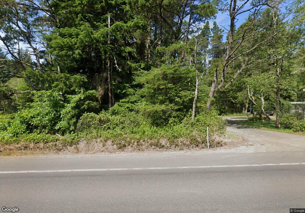
84884 Highway 101 Florence, OR 97439
Oregon Dunes NeighborhoodEstimated Value: $341,000 - $418,115
4
Beds
2
Baths
1,536
Sq Ft
$240/Sq Ft
Est. Value
About This Home
This home is located at 84884 Highway 101, Florence, OR 97439 and is currently estimated at $369,029, approximately $240 per square foot. 84884 Highway 101 is a home located in Lane County with nearby schools including Siuslaw Elementary School, Siuslaw Middle School, and Siuslaw High School.
Ownership History
Date
Name
Owned For
Owner Type
Purchase Details
Closed on
Sep 21, 2004
Sold by
Haddock Paul and Haddock Sheryl M
Bought by
Hamb Noah
Current Estimated Value
Home Financials for this Owner
Home Financials are based on the most recent Mortgage that was taken out on this home.
Original Mortgage
$110,400
Outstanding Balance
$56,546
Interest Rate
6.39%
Mortgage Type
Purchase Money Mortgage
Estimated Equity
$312,483
Create a Home Valuation Report for This Property
The Home Valuation Report is an in-depth analysis detailing your home's value as well as a comparison with similar homes in the area
Home Values in the Area
Average Home Value in this Area
Purchase History
| Date | Buyer | Sale Price | Title Company |
|---|---|---|---|
| Hamb Noah | $138,000 | Multiple |
Source: Public Records
Mortgage History
| Date | Status | Borrower | Loan Amount |
|---|---|---|---|
| Open | Hamb Noah | $110,400 | |
| Closed | Hamb Noah | $27,600 |
Source: Public Records
Tax History Compared to Growth
Tax History
| Year | Tax Paid | Tax Assessment Tax Assessment Total Assessment is a certain percentage of the fair market value that is determined by local assessors to be the total taxable value of land and additions on the property. | Land | Improvement |
|---|---|---|---|---|
| 2024 | $1,834 | $163,905 | -- | -- |
| 2023 | $1,834 | $159,132 | $0 | $0 |
| 2022 | $1,711 | $154,498 | $0 | $0 |
| 2021 | $1,664 | $149,999 | $0 | $0 |
| 2020 | $1,617 | $145,631 | $0 | $0 |
| 2019 | $1,555 | $141,390 | $0 | $0 |
| 2018 | $1,571 | $133,274 | $0 | $0 |
| 2017 | $1,514 | $133,274 | $0 | $0 |
| 2016 | $1,472 | $129,392 | $0 | $0 |
| 2015 | $1,445 | $125,623 | $0 | $0 |
| 2014 | $1,423 | $121,964 | $0 | $0 |
Source: Public Records
Map
Nearby Homes
- 84875 Highway 101
- 84755 U S 101
- 4990 Mitchell Loop Rd
- 0 Alder Dr Tl 03300 Dr
- 4640 Mitchell Loop Rd
- 5170 Grand Ave Unit 19
- 4898 S Loftus Rd
- 4884 N Loftus Rd
- 5004 N Loftus Rd
- 0 Little Woahink Dr Unit 2 22424530
- 01113 N Loftus Rd
- 4990 N Loftus Rd
- 0 Hwy 101 Unit 659685850
- 5700 Little Woahink Dr
- 5700 Little Woahink Dr Unit 1
- 6008 Little Woahink Dr
- 6018 Little Woahink Dr
- 6010 Little Woahink Dr
- 0 Tl5500 Cedar Ridge Unit 23011790
- 85287 Hemlock St
- 84880 U S 101
- 84875 U S 101
- 5047 Alder Dr
- 84855 Highway 101
- 84839 Highway 101
- 5070 Mitchell Loop Rd
- 5090 Mitchell Loop Rd
- 84831 U S 101
- 84831 Highway 101
- 84966 Highway 101
- 84933 Branch Rd
- 5060 Mitchell Loop Rd
- 84945 Branch Rd
- 5025 Alder Dr
- 4616 Mitchell Loop Rd
- 84810 U S 101
- 84959 Branch Rd
- 84800 U S 101
- 5013 Alder Dr
