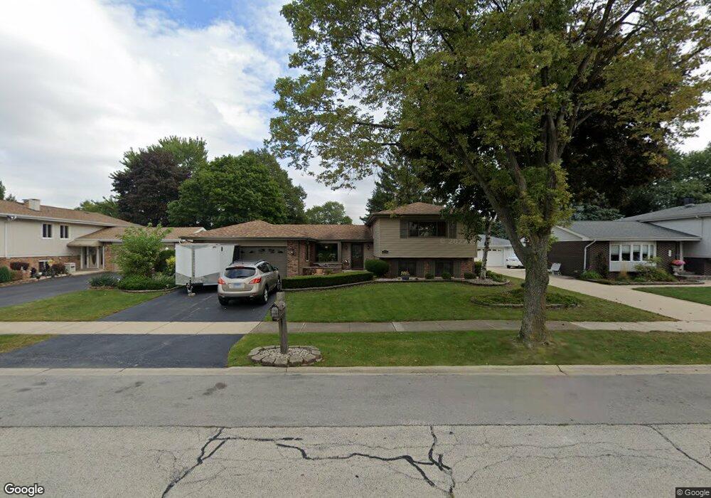
849 Kings Point Dr W Addison, IL 60101
Estimated Value: $440,643 - $489,000
4
Beds
3
Baths
2,409
Sq Ft
$194/Sq Ft
Est. Value
About This Home
This home is located at 849 Kings Point Dr W, Addison, IL 60101 and is currently estimated at $467,911, approximately $194 per square foot. 849 Kings Point Dr W is a home located in DuPage County with nearby schools including Stone Elementary School, Indian Trail Jr High School, and Addison Trail High School.
Ownership History
Date
Name
Owned For
Owner Type
Purchase Details
Closed on
Nov 8, 2018
Sold by
Ricker Christopher Michael and Ricker Daniel Robert
Bought by
Wetherbe David A
Current Estimated Value
Purchase Details
Closed on
Jun 11, 2018
Sold by
Wetherbe David A and Estate Of Johanna Wisner
Bought by
Wetherbe David A
Create a Home Valuation Report for This Property
The Home Valuation Report is an in-depth analysis detailing your home's value as well as a comparison with similar homes in the area
Home Values in the Area
Average Home Value in this Area
Purchase History
| Date | Buyer | Sale Price | Title Company |
|---|---|---|---|
| Wetherbe David A | $25,000 | Attorney | |
| Wetherbe David A | -- | Attorney |
Source: Public Records
Tax History Compared to Growth
Tax History
| Year | Tax Paid | Tax Assessment Tax Assessment Total Assessment is a certain percentage of the fair market value that is determined by local assessors to be the total taxable value of land and additions on the property. | Land | Improvement |
|---|---|---|---|---|
| 2024 | $8,763 | $132,980 | $38,491 | $94,489 |
| 2023 | $8,319 | $121,610 | $35,200 | $86,410 |
| 2022 | $8,142 | $116,450 | $34,980 | $81,470 |
| 2021 | $7,737 | $110,640 | $33,230 | $77,410 |
| 2020 | $7,667 | $107,940 | $32,420 | $75,520 |
| 2019 | $7,635 | $103,720 | $31,150 | $72,570 |
| 2018 | $7,276 | $95,310 | $28,620 | $66,690 |
| 2017 | $6,870 | $88,340 | $26,530 | $61,810 |
| 2016 | $6,686 | $81,750 | $24,550 | $57,200 |
| 2015 | $6,592 | $76,290 | $22,910 | $53,380 |
| 2014 | $6,173 | $71,310 | $22,070 | $49,240 |
| 2013 | $6,138 | $73,740 | $22,820 | $50,920 |
Source: Public Records
Map
Nearby Homes
- 823 N Cambridge Row
- 953 N Rohlwing Rd Unit GB
- 953 N Rohlwing Rd Unit 201A
- 943 N Rohlwing Rd Unit 101H
- 802 N Tamarac Blvd Unit Z5
- 865 N Tamarac Blvd
- 881 N Swift Rd Unit 306
- 881 N Swift Rd Unit 106
- 941 N Swift Rd Unit 301
- 1741 W Goldengate Dr Unit 2
- 1795 W Jo Ann Ln
- 1701 W Goldengate Dr
- 1750 W Woodland Ave
- 1711 W Woodland Ave
- 1560 W Goldengate Dr
- 522 N Castle Rd
- 1660 W Prescott Place
- 1205 Scarlet Dr
- 5N210 Central Rd
- 5N260 Eagle Terrace
- 853 Kings Point Dr W
- 845 Kings Point Dr W
- 840 N Wyncroft Place
- 841 Kings Point Dr W
- 836 N Wyncroft Place
- 857 Kings Point Dr W
- 844 N Wyncroft Place
- 848 Kings Point Dr W
- 852 Kings Point Dr W
- 844 Kings Point Dr W
- 837 Kings Point Dr W
- 1851 Kings Point Dr N
- 856 Kings Point Dr W
- 840 Kings Point Dr W
- 824 N Harrow Ct
- 1843 Kings Point Dr N
- 831 N Wyncroft Place
- 828 N Harrow Ct
- 833 Kings Point Dr W
- 836 Kings Point Dr W