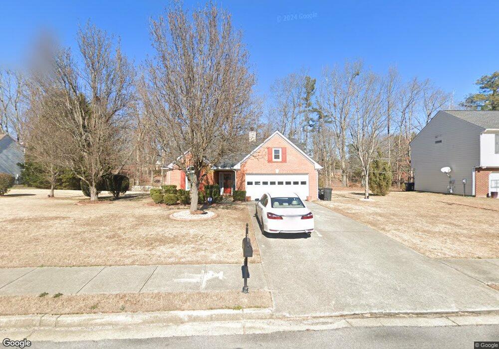
849 Longbranch Ln Unit 2 Douglasville, GA 30134
Lithia Springs NeighborhoodEstimated Value: $254,000 - $298,000
3
Beds
2
Baths
1,791
Sq Ft
$155/Sq Ft
Est. Value
About This Home
This home is located at 849 Longbranch Ln Unit 2, Douglasville, GA 30134 and is currently estimated at $277,081, approximately $154 per square foot. 849 Longbranch Ln Unit 2 is a home located in Douglas County with nearby schools including Beulah Elementary School, Turner Middle School, and Lithia Springs Comprehensive High School.
Ownership History
Date
Name
Owned For
Owner Type
Purchase Details
Closed on
Jul 27, 2001
Sold by
Mccoy Kimberly R A
Bought by
Mccoy Kimberly R A
Current Estimated Value
Home Financials for this Owner
Home Financials are based on the most recent Mortgage that was taken out on this home.
Original Mortgage
$116,950
Interest Rate
6.74%
Mortgage Type
New Conventional
Create a Home Valuation Report for This Property
The Home Valuation Report is an in-depth analysis detailing your home's value as well as a comparison with similar homes in the area
Home Values in the Area
Average Home Value in this Area
Purchase History
| Date | Buyer | Sale Price | Title Company |
|---|---|---|---|
| Mccoy Kimberly R A | -- | -- | |
| Mccoy Kimberly R A | $130,000 | -- |
Source: Public Records
Mortgage History
| Date | Status | Borrower | Loan Amount |
|---|---|---|---|
| Previous Owner | Mccoy Kimberly R A | $116,950 |
Source: Public Records
Tax History Compared to Growth
Tax History
| Year | Tax Paid | Tax Assessment Tax Assessment Total Assessment is a certain percentage of the fair market value that is determined by local assessors to be the total taxable value of land and additions on the property. | Land | Improvement |
|---|---|---|---|---|
| 2024 | $2,111 | $75,400 | $18,000 | $57,400 |
| 2023 | $2,111 | $75,400 | $18,000 | $57,400 |
| 2022 | $2,065 | $81,920 | $18,000 | $63,920 |
| 2021 | $1,908 | $61,600 | $13,440 | $48,160 |
| 2020 | $1,612 | $60,680 | $9,040 | $51,640 |
| 2019 | $1,908 | $58,680 | $9,040 | $49,640 |
| 2018 | -- | $57,280 | $9,040 | $48,240 |
| 2017 | $1,586 | $51,520 | $9,040 | $42,480 |
| 2016 | $1,483 | $47,560 | $8,680 | $38,880 |
Source: Public Records
Map
Nearby Homes
- 11411 Veterans Memorial Hwy
- 1065 Walker Place Dr
- 7144 Carolyn Cir
- 4113 Maroney Mill Rd
- 1134 Wagon Trace
- 4485 Canary Ct
- 6776 Tralee Dr Unit 1
- 4365 Clare Ln
- 4336 Parkview Dr
- 1131 Bingham Rd
- 00 Boyd Rd
- 7146 Old Beulah Rd
- 352 Greystone Ln
- 0 Mckown Rd Unit 10583796
- 0 Mckown Rd Unit 7632191
- 540 Boulder Park Dr
- 3934 Birdie Dr
- 716 W Spring Dr
- 771 N Burnt Hickory Rd
- 839 Longbranch Ln Unit 2
- 859 Longbranch Ln
- 884 Longbranch Ln Unit 2
- 869 Longbranch Ln
- 3861 Rogers Dr
- 834 Longbranch Ln
- 829 Longbranch Ln
- 879 Longbranch Ln
- 814 Longbranch Ln Unit 11
- 814 Longbranch Ln
- 3791 Wexford Dr
- 808 Oldham Ct
- 819 Longbranch Ln Unit 2
- 807 Oldham Ct
- 3806 Wexford Dr
- 3681 Rogers Dr
- 3669 Rogers Dr Unit 2
- 894 Longbranch Ln
- 3642 Onley Ln
- 3693 Rogers Dr