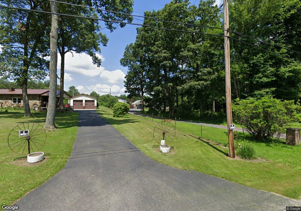
849 Maple Summit Rd Mill Run, PA 15464
Estimated Value: $182,000 - $254,000
3
Beds
2
Baths
1,248
Sq Ft
$163/Sq Ft
Est. Value
About This Home
This home is located at 849 Maple Summit Rd, Mill Run, PA 15464 and is currently estimated at $203,427, approximately $163 per square foot. 849 Maple Summit Rd is a home located in Fayette County with nearby schools including Uniontown Area Senior High School.
Ownership History
Date
Name
Owned For
Owner Type
Purchase Details
Closed on
Mar 2, 2022
Sold by
Nicholson Manuel E
Bought by
Nicholson Family Revocable Living Trust
Current Estimated Value
Purchase Details
Closed on
Jan 1, 1968
Bought by
Nicholson Manuel E
Create a Home Valuation Report for This Property
The Home Valuation Report is an in-depth analysis detailing your home's value as well as a comparison with similar homes in the area
Home Values in the Area
Average Home Value in this Area
Purchase History
| Date | Buyer | Sale Price | Title Company |
|---|---|---|---|
| Nicholson Family Revocable Living Trust | -- | Bankers Settlement Services | |
| Nicholson Manuel E | -- | -- |
Source: Public Records
Tax History
| Year | Tax Paid | Tax Assessment Tax Assessment Total Assessment is a certain percentage of the fair market value that is determined by local assessors to be the total taxable value of land and additions on the property. | Land | Improvement |
|---|---|---|---|---|
| 2025 | $1,021 | $39,895 | $14,400 | $25,495 |
| 2024 | $974 | $39,895 | $14,400 | $25,495 |
| 2023 | $1,947 | $39,895 | $14,400 | $25,495 |
| 2022 | $1,947 | $39,895 | $14,400 | $25,495 |
| 2021 | $1,947 | $39,895 | $14,400 | $25,495 |
| 2020 | $1,903 | $39,895 | $14,400 | $25,495 |
| 2019 | $1,765 | $39,895 | $14,400 | $25,495 |
| 2018 | $1,671 | $39,895 | $14,400 | $25,495 |
| 2017 | $1,671 | $39,895 | $14,400 | $25,495 |
| 2016 | -- | $39,895 | $14,400 | $25,495 |
| 2015 | -- | $39,895 | $14,400 | $25,495 |
| 2014 | -- | $79,790 | $28,800 | $50,990 |
Source: Public Records
Map
Nearby Homes
- 0 Stewarton Rd Unit 1737788
- Lot 4 Cranberry Rd
- 0 Odonnal Rd Unit 1737793
- 100 Jersey Hollow Rd
- 109 Blaine St
- 12 Logan St
- SR 653 Scullton Rd
- 17 Farm Ln
- 0 Earl Ansell Rd Lot Unit WP001
- 0 Earl Ansell Rd
- 0 Greenbriar Rd
- 0 Rogers Mill Rd
- 626 Sterner St
- 631 Meyers St
- 505 Greenbriar Rd
- 0 Roger Mill Rd Lot Unit WP001
- 829 Oden St
- 833 Oden St
- 192 Hawkins Hollow Rd
- 108 Foster Ln - Mobile Home Park
- 854 Maple Summit Rd
- 814 Maple Summit Rd
- 780 Maple Summit Rd
- 883 Maple Summit Rd
- 879 Maple Summit Rd
- 889 Maple Summit Rd
- 121 Augustine Rd
- 108 Augustine Rd
- 0 Maple Summit Rd
- 917 Maple Summit Rd
- 1000 Maple Summit Rd
- 126 Schroyer Rd
- 121 Jersey Hollow Rd
- 175 Jersey Hollow Rd
- 676 Maple Summit Rd
- 120 Schroyer Rd
- 635 Maple Summit Rd
- 112 Steyer Rd
- 179 Schroyer Rd
Your Personal Tour Guide
Ask me questions while you tour the home.