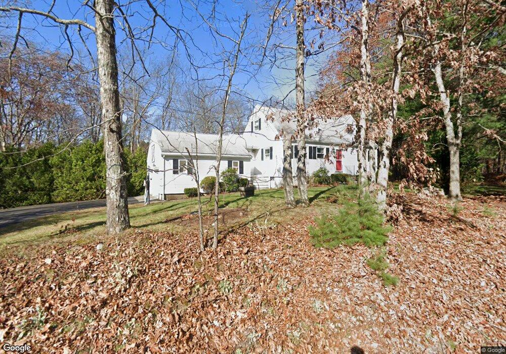
85 Colburn Rd Charlton, MA 01507
Estimated Value: $431,826 - $642,000
4
Beds
2
Baths
1,398
Sq Ft
$369/Sq Ft
Est. Value
About This Home
This home is located at 85 Colburn Rd, Charlton, MA 01507 and is currently estimated at $515,957, approximately $369 per square foot. 85 Colburn Rd is a home located in Worcester County with nearby schools including Shepherd Hill Regional High School and ViewPoint Christian Academy.
Ownership History
Date
Name
Owned For
Owner Type
Purchase Details
Closed on
May 25, 2001
Sold by
Farrugia Frans and Dowell Alfred L
Bought by
Merolli Jerelyn G and Merolli Renato E
Current Estimated Value
Home Financials for this Owner
Home Financials are based on the most recent Mortgage that was taken out on this home.
Original Mortgage
$171,500
Outstanding Balance
$64,133
Interest Rate
7.05%
Mortgage Type
Purchase Money Mortgage
Estimated Equity
$451,824
Create a Home Valuation Report for This Property
The Home Valuation Report is an in-depth analysis detailing your home's value as well as a comparison with similar homes in the area
Home Values in the Area
Average Home Value in this Area
Purchase History
| Date | Buyer | Sale Price | Title Company |
|---|---|---|---|
| Merolli Jerelyn G | $248,434 | -- | |
| Merolli Jerelyn G | $248,434 | -- |
Source: Public Records
Mortgage History
| Date | Status | Borrower | Loan Amount |
|---|---|---|---|
| Open | Merolli Jerelyn G | $171,500 | |
| Closed | Merolli Jerelyn G | $171,500 |
Source: Public Records
Tax History Compared to Growth
Tax History
| Year | Tax Paid | Tax Assessment Tax Assessment Total Assessment is a certain percentage of the fair market value that is determined by local assessors to be the total taxable value of land and additions on the property. | Land | Improvement |
|---|---|---|---|---|
| 2025 | $3,847 | $345,600 | $85,500 | $260,100 |
| 2024 | $3,756 | $331,200 | $85,500 | $245,700 |
| 2023 | $3,661 | $300,800 | $82,600 | $218,200 |
| 2022 | $3,467 | $260,900 | $75,200 | $185,700 |
| 2021 | $3,442 | $229,300 | $71,200 | $158,100 |
| 2020 | $3,384 | $226,500 | $68,400 | $158,100 |
| 2019 | $3,345 | $226,500 | $68,400 | $158,100 |
| 2018 | $3,058 | $226,500 | $68,400 | $158,100 |
| 2017 | $2,844 | $201,700 | $62,700 | $139,000 |
| 2016 | $2,779 | $201,700 | $62,700 | $139,000 |
| 2015 | $2,707 | $201,700 | $62,700 | $139,000 |
| 2014 | $2,608 | $206,000 | $67,800 | $138,200 |
Source: Public Records
Map
Nearby Homes
- 58 Colburn Rd
- 0 Partridge Hill Rd
- 0 Freeman Rd Unit 73369281
- 2 Lelandville Rd
- 3 Lelandville Rd
- 65 Haggerty Rd
- 76 Number 6 Schoolhouse Rd
- 2 Potter Village Rd
- 18 Mckinstry Dr
- 91 Burlingame Rd
- 20 Drury Ln
- 13 Boucher Dr
- 16 Sandersdale Rd
- 7 L Stevens Rd Unit A
- 7 L Stevens Rd Unit B
- 18 Old Worcester Rd
- 44 Buffum Rd
- 0 Blood Rd
- 8 Northside Rd
- 25 N Main St Unit A