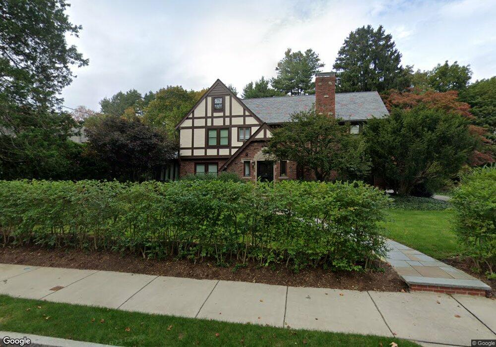
85 Dartmouth St West Newton, MA 02465
West Newton NeighborhoodEstimated Value: $3,122,609 - $3,681,000
6
Beds
7
Baths
3,817
Sq Ft
$916/Sq Ft
Est. Value
About This Home
This home is located at 85 Dartmouth St, West Newton, MA 02465 and is currently estimated at $3,495,652, approximately $915 per square foot. 85 Dartmouth St is a home located in Middlesex County with nearby schools including Peirce Elementary School, F.A. Day Middle School, and Newton North High School.
Ownership History
Date
Name
Owned For
Owner Type
Purchase Details
Closed on
Nov 19, 1993
Sold by
Allstate Life Ins Co
Bought by
Crystal 117 Lp and Marc Non Vista
Current Estimated Value
Purchase Details
Closed on
Aug 2, 1993
Sold by
K&C Rt
Bought by
Allstate Life Ins Co
Purchase Details
Closed on
Jun 30, 1992
Sold by
Mccarthy John D and Mccarthy Linda J
Bought by
Tong Arthur and Tong Angela
Create a Home Valuation Report for This Property
The Home Valuation Report is an in-depth analysis detailing your home's value as well as a comparison with similar homes in the area
Home Values in the Area
Average Home Value in this Area
Purchase History
| Date | Buyer | Sale Price | Title Company |
|---|---|---|---|
| Crystal 117 Lp | $850,000 | -- | |
| Allstate Life Ins Co | $695,000 | -- | |
| Tong Arthur | $570,000 | -- |
Source: Public Records
Mortgage History
| Date | Status | Borrower | Loan Amount |
|---|---|---|---|
| Open | Tong Arthur | $820,000 | |
| Previous Owner | Tong Arthur | $350,000 | |
| Previous Owner | Tong Arthur | $220,000 |
Source: Public Records
Tax History Compared to Growth
Tax History
| Year | Tax Paid | Tax Assessment Tax Assessment Total Assessment is a certain percentage of the fair market value that is determined by local assessors to be the total taxable value of land and additions on the property. | Land | Improvement |
|---|---|---|---|---|
| 2025 | $31,384 | $3,202,400 | $1,298,600 | $1,903,800 |
| 2024 | $30,345 | $3,109,100 | $1,260,800 | $1,848,300 |
| 2023 | $29,496 | $2,897,400 | $982,500 | $1,914,900 |
| 2022 | $28,223 | $2,682,800 | $909,700 | $1,773,100 |
| 2021 | $27,232 | $2,530,900 | $858,200 | $1,672,700 |
| 2020 | $26,423 | $2,530,900 | $858,200 | $1,672,700 |
| 2019 | $25,678 | $2,457,200 | $833,200 | $1,624,000 |
| 2018 | $25,017 | $2,312,100 | $753,800 | $1,558,300 |
| 2017 | $24,255 | $2,181,200 | $711,100 | $1,470,100 |
| 2016 | $23,198 | $2,038,500 | $664,600 | $1,373,900 |
| 2015 | $22,118 | $1,905,100 | $621,100 | $1,284,000 |
Source: Public Records
Map
Nearby Homes
- 75 Dartmouth St
- 93 Dartmouth St
- 193 Fuller St
- 197 Fuller St
- 69 Dartmouth St
- 169 Fuller St
- 80 Dartmouth St
- 201 Fuller St
- 107 Dartmouth St
- 1438 Commonwealth Ave
- 63 Dartmouth St
- 170 Fuller St
- 1466 Commonwealth Ave
- 192 Fuller St
- 29 Elizabeth Cir
- 92 Dartmouth St
- 32 Elizabeth Cir
- 209 Fuller St
- 157 Fuller St
- 1428 Commonwealth Ave