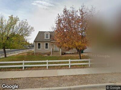
85 N 1200 W Clearfield, UT 84015
Estimated Value: $466,000 - $532,000
6
Beds
3
Baths
3,200
Sq Ft
$155/Sq Ft
Est. Value
About This Home
This home is located at 85 N 1200 W, Clearfield, UT 84015 and is currently estimated at $495,921, approximately $154 per square foot. 85 N 1200 W is a home located in Davis County with nearby schools including Holt Elementary School, North Davis Junior High School, and Syracuse High School.
Ownership History
Date
Name
Owned For
Owner Type
Purchase Details
Closed on
Sep 26, 2000
Sold by
Starks William J and Starks Ronda R
Bought by
Price William H
Current Estimated Value
Home Financials for this Owner
Home Financials are based on the most recent Mortgage that was taken out on this home.
Original Mortgage
$128,900
Outstanding Balance
$51,505
Interest Rate
7.98%
Mortgage Type
Stand Alone First
Estimated Equity
$439,875
Purchase Details
Closed on
Nov 4, 1997
Sold by
Whetton Carolyn S
Bought by
Starks William J and Starks Ronda R
Home Financials for this Owner
Home Financials are based on the most recent Mortgage that was taken out on this home.
Original Mortgage
$133,600
Interest Rate
10.5%
Purchase Details
Closed on
Sep 15, 1997
Sold by
Wehus Robert G
Bought by
Whetton Carolyn S
Home Financials for this Owner
Home Financials are based on the most recent Mortgage that was taken out on this home.
Original Mortgage
$133,600
Interest Rate
10.5%
Create a Home Valuation Report for This Property
The Home Valuation Report is an in-depth analysis detailing your home's value as well as a comparison with similar homes in the area
Home Values in the Area
Average Home Value in this Area
Purchase History
| Date | Buyer | Sale Price | Title Company |
|---|---|---|---|
| Price William H | -- | Backman Stewart Title Servic | |
| Starks William J | -- | Avis Archibald Title Insur | |
| Whetton Carolyn S | -- | Mountain View Title & Escrow |
Source: Public Records
Mortgage History
| Date | Status | Borrower | Loan Amount |
|---|---|---|---|
| Open | Price William H | $128,900 | |
| Previous Owner | Starks William J | $133,600 | |
| Previous Owner | Whetton Carolyn S | $133,600 |
Source: Public Records
Tax History Compared to Growth
Tax History
| Year | Tax Paid | Tax Assessment Tax Assessment Total Assessment is a certain percentage of the fair market value that is determined by local assessors to be the total taxable value of land and additions on the property. | Land | Improvement |
|---|---|---|---|---|
| 2024 | $2,687 | $242,550 | $67,174 | $175,376 |
| 2023 | $2,487 | $412,000 | $107,340 | $304,660 |
| 2022 | $2,572 | $230,450 | $61,325 | $169,125 |
| 2021 | $2,231 | $302,000 | $65,980 | $236,020 |
| 2020 | $1,949 | $262,000 | $55,634 | $206,366 |
| 2019 | $1,891 | $251,000 | $57,769 | $193,231 |
| 2018 | $1,701 | $220,000 | $51,276 | $168,724 |
| 2016 | $1,473 | $99,605 | $20,534 | $79,071 |
| 2015 | $1,373 | $88,495 | $20,534 | $67,961 |
| 2014 | $1,256 | $82,050 | $20,534 | $61,516 |
| 2013 | -- | $88,932 | $30,096 | $58,836 |
Source: Public Records
Map
Nearby Homes
- 1112 W 250 N
- 81 S 1300 W
- 60 N 1000 W
- 81 N 950 W
- 1212 W 400 N Unit 92
- 92 1219 W 450 N
- 1350 W 300 N Unit 9
- 1350 W 300 N Unit 38
- 1350 W 300 N Unit 49
- 1124 W 450 N Unit 18
- 1304 W 500 N Unit 166
- 1337 W 550 N Unit 195
- 168 N 825 W Unit 8
- 194 N 825 W Unit 7
- 208 N 825 W Unit 6
- 570 N 1100 W
- 652 N 1250 W
- 1421 W 400 S
- 3943 W 1800 N
- 1720 W 475 N