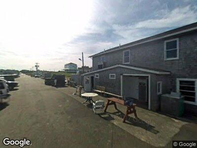
85 Ocean Ave Block Island, RI 02807
Estimated Value: $1,873,401
--
Bed
3
Baths
2,992
Sq Ft
$626/Sq Ft
Est. Value
About This Home
This home is located at 85 Ocean Ave, Block Island, RI 02807 and is currently priced at $1,873,401, approximately $626 per square foot. 85 Ocean Ave is a home located in Washington County with nearby schools including Block Island School.
Ownership History
Date
Name
Owned For
Owner Type
Purchase Details
Closed on
Mar 13, 2025
Sold by
Gaffett Lewis N
Bought by
Tmg Whitestone Realty Llc
Current Estimated Value
Purchase Details
Closed on
Jul 20, 2017
Sold by
Gaffett Lewis H
Bought by
Gaffett Lewis H
Create a Home Valuation Report for This Property
The Home Valuation Report is an in-depth analysis detailing your home's value as well as a comparison with similar homes in the area
Home Values in the Area
Average Home Value in this Area
Purchase History
| Date | Buyer | Sale Price | Title Company |
|---|---|---|---|
| Tmg Whitestone Realty Llc | -- | None Available | |
| Tmg Whitestone Realty Llc | -- | None Available | |
| Tmg Whitestone Realty Llc | $1,865,000 | None Available | |
| Tmg Whitestone Realty Llc | $1,865,000 | None Available | |
| Gaffett Lewis H | -- | -- | |
| Gaffett Lewis H | -- | -- |
Source: Public Records
Mortgage History
| Date | Status | Borrower | Loan Amount |
|---|---|---|---|
| Previous Owner | Gaffett Lewis H | $600,000 |
Source: Public Records
Tax History Compared to Growth
Tax History
| Year | Tax Paid | Tax Assessment Tax Assessment Total Assessment is a certain percentage of the fair market value that is determined by local assessors to be the total taxable value of land and additions on the property. | Land | Improvement |
|---|---|---|---|---|
| 2024 | $5,206 | $943,200 | $430,400 | $512,800 |
| 2023 | $5,678 | $943,200 | $430,400 | $512,800 |
| 2022 | $5,239 | $739,920 | $338,160 | $401,760 |
| 2021 | $4,957 | $739,920 | $338,160 | $401,760 |
| 2020 | $4,706 | $739,920 | $338,160 | $401,760 |
| 2019 | $4,233 | $687,200 | $338,160 | $349,040 |
| 2018 | $1,947 | $327,280 | $321,280 | $6,000 |
| 2017 | $1,427 | $243,440 | $243,440 | $0 |
| 2016 | $1,392 | $243,440 | $243,440 | $0 |
| 2015 | $1,677 | $304,300 | $304,300 | $0 |
| 2014 | $1,625 | $304,300 | $304,300 | $0 |
| 2013 | $1,585 | $304,300 | $304,300 | $0 |
Source: Public Records
Map
Nearby Homes
- 387 High St
- 244 Spring St
- 0 W Side Rd Unit 1376234
- 1194 Center Rd
- 0 Southeast Rd Unit 1381406
- 0 Old Center Rd
- 1455 Payne Rd
- 72 W Side Rd Unit 6
- 1501 Beacon Hill Rd
- 0 Pilot Hill Rd
- 1661 Sand Pond Rd
- 1632 Lakeside Dr
- 1627 Old Mill Rd
- 0 Mohegan Trail
- 0 Off West Side Rd Unit 1366047
- 10 Dunn Town Rd
- 1557 W Side Rd
- 681 Corn Neck Rd
- 959 Dories Cove Rd
- 721 Corn Neck Rd
- 222 Old Town Rd
- 33 Ocean Ave Unit 2
- 33 Ocean Ave Unit 5
- 33 Ocean Ave Unit 1
- 33 Ocean Ave Unit 4
- 469 Old Town Rd
- 0 Ocean Ave
- 66 Ocean Ave
- 471 Old Town Rd
- 0 Old Town Rd Unit 980510
- 123 Ocean Ave
- 445 Ocean Ave
- 165 Ocean Ave
- 0 Corn Neck Rd Unit 212944
- 0 Corn Neck Rd Unit 970135
- 0 Corn Neck Rd Unit 1040557
- 0 Corn Neck Road Off Rd Unit 1104969
- 0 Corn Neck Rd Unit 1105246
- 0 Corn Neck Rd Unit 1117960
- 0 Corn Neck Road Off Rd Unit 1157610