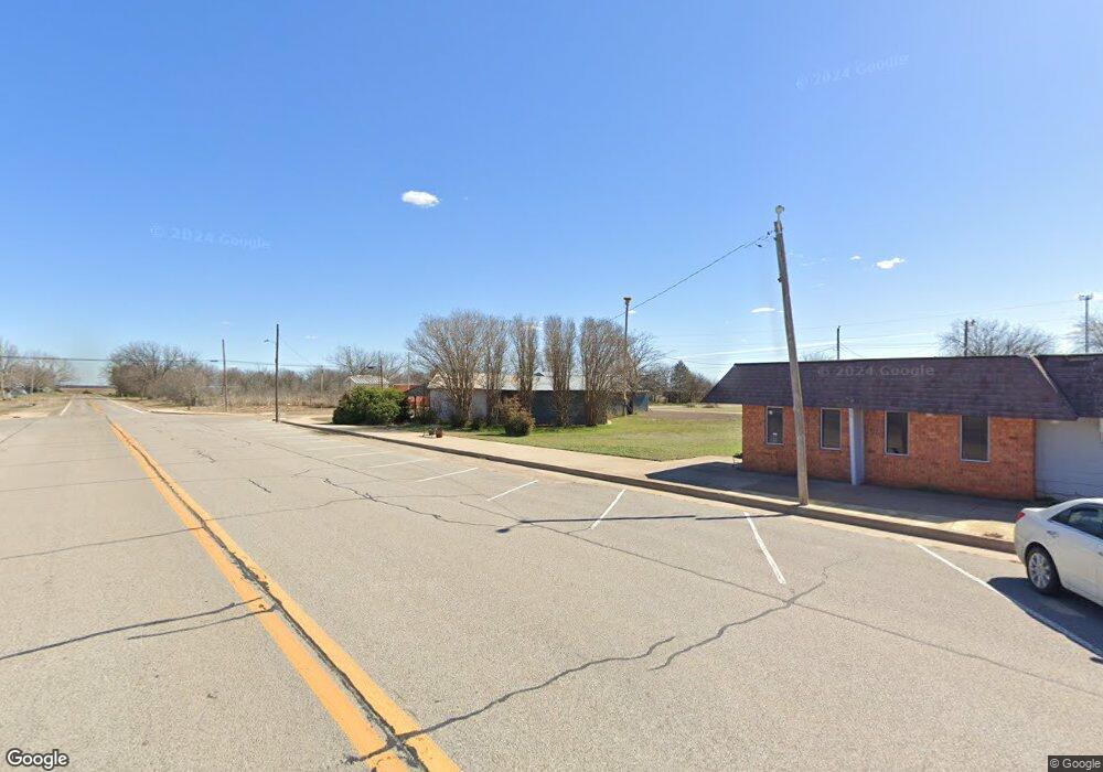
85 Rr 1 Hastings, OK 73548
Estimated Value: $76,000 - $122,000
3
Beds
1
Bath
1,564
Sq Ft
$59/Sq Ft
Est. Value
About This Home
This home is located at 85 Rr 1, Hastings, OK 73548 and is currently estimated at $93,000, approximately $59 per square foot. 85 Rr 1 is a home located in Jefferson County with nearby schools including Waurika Elementary School, Waurika Middle School, and Waurika High School.
Ownership History
Date
Name
Owned For
Owner Type
Purchase Details
Closed on
Mar 13, 2025
Sold by
Burton Michael L
Bought by
Griffith Orin
Current Estimated Value
Purchase Details
Closed on
Jul 29, 2014
Sold by
Burton Michael
Bought by
Burton Michael
Purchase Details
Closed on
Mar 28, 2012
Sold by
Federal National Mrtg Asc
Bought by
Burton Michael
Purchase Details
Closed on
Dec 28, 2011
Sold by
Black Ricky L
Bought by
Federal National Mort Asc
Purchase Details
Closed on
Feb 28, 2007
Sold by
Elkins Douglas L
Bought by
Black Ricky L
Purchase Details
Closed on
Mar 20, 2000
Sold by
Countiss Glenda Etvir
Bought by
Elkins Douglas L
Purchase Details
Closed on
Feb 3, 1993
Sold by
Kendrick Reeble R
Bought by
Countiss Glenda
Purchase Details
Closed on
Jan 20, 1993
Sold by
Kendrick G L
Bought by
Kendrick Reeble R
Create a Home Valuation Report for This Property
The Home Valuation Report is an in-depth analysis detailing your home's value as well as a comparison with similar homes in the area
Home Values in the Area
Average Home Value in this Area
Purchase History
| Date | Buyer | Sale Price | Title Company |
|---|---|---|---|
| Griffith Orin | $70,000 | -- | |
| Burton Michael | -- | -- | |
| Burton Michael | $34,500 | -- | |
| Federal National Mort Asc | -- | -- | |
| Black Ricky L | $58,300 | -- | |
| Elkins Douglas L | $34,000 | -- | |
| Countiss Glenda | -- | -- | |
| Kendrick Reeble R | -- | -- |
Source: Public Records
Tax History Compared to Growth
Tax History
| Year | Tax Paid | Tax Assessment Tax Assessment Total Assessment is a certain percentage of the fair market value that is determined by local assessors to be the total taxable value of land and additions on the property. | Land | Improvement |
|---|---|---|---|---|
| 2025 | $490 | $5,784 | $1,541 | $4,243 |
| 2024 | $490 | $5,509 | $1,541 | $3,968 |
| 2023 | $491 | $5,509 | $1,541 | $3,968 |
| 2022 | $491 | $5,509 | $1,541 | $3,968 |
| 2021 | $490 | $5,374 | $1,506 | $3,868 |
| 2020 | $456 | $5,118 | $1,439 | $3,679 |
| 2019 | $332 | $4,875 | $1,218 | $3,657 |
| 2018 | $321 | $4,733 | $1,352 | $3,381 |
| 2017 | $315 | $4,596 | $1,299 | $3,297 |
| 2016 | $295 | $4,461 | $253 | $4,208 |
| 2015 | $286 | $4,332 | $247 | $4,085 |
| 2014 | $274 | $4,206 | $246 | $3,960 |
Source: Public Records
Map
Nearby Homes
- 110 4th St
- 186233 N 2740 Rd
- Rr N2730 E1910
- N2740 Road
- 7920 N 2760 Rd
- 7920 N2760 Rd
- 5435
- 000 N 2710 Rd
- 1 12 Oaks Rd
- 6659 6659 E 1940 Rd
- 0 Oklahoma 5
- 000 N 2700 and E 1880 Rd
- 7071 7071 State Hwy 5
- 0 Oak Dr Unit 2516340
- 9494 N 2780 Rd
- 6752 Highway 81
- 127 127 E Missouri
- 1005 N Meridian St
- 1030 1030 N Ash
- 112 E Iowa Ave
