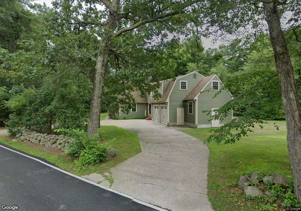
85 Vine St Wrentham, MA 02093
Estimated Value: $714,486 - $954,000
3
Beds
3
Baths
2,016
Sq Ft
$414/Sq Ft
Est. Value
About This Home
This home is located at 85 Vine St, Wrentham, MA 02093 and is currently estimated at $835,622, approximately $414 per square foot. 85 Vine St is a home located in Norfolk County with nearby schools including Delaney Elementary School, Charles E Roderick, and Foxborough Regional Charter School.
Ownership History
Date
Name
Owned For
Owner Type
Purchase Details
Closed on
Nov 6, 2012
Sold by
Jones Jonathan H and Renz-Jones Christine
Bought by
Jones Jonathan H
Current Estimated Value
Purchase Details
Closed on
Jun 20, 2003
Sold by
Reidel Peter G and Reidel Cheryle B
Bought by
Jones Jonathan H and Renz-Jones Christine
Home Financials for this Owner
Home Financials are based on the most recent Mortgage that was taken out on this home.
Original Mortgage
$285,000
Interest Rate
5.71%
Mortgage Type
Purchase Money Mortgage
Create a Home Valuation Report for This Property
The Home Valuation Report is an in-depth analysis detailing your home's value as well as a comparison with similar homes in the area
Purchase History
| Date | Buyer | Sale Price | Title Company |
|---|---|---|---|
| Jones Jonathan H | -- | -- | |
| Jones Jonathan H | $386,000 | -- |
Source: Public Records
Mortgage History
| Date | Status | Borrower | Loan Amount |
|---|---|---|---|
| Previous Owner | Jones Jonathan H | $285,000 |
Source: Public Records
Tax History
| Year | Tax Paid | Tax Assessment Tax Assessment Total Assessment is a certain percentage of the fair market value that is determined by local assessors to be the total taxable value of land and additions on the property. | Land | Improvement |
|---|---|---|---|---|
| 2025 | $7,527 | $649,400 | $262,700 | $386,700 |
| 2024 | $7,214 | $601,200 | $262,700 | $338,500 |
| 2023 | $7,438 | $589,400 | $238,700 | $350,700 |
| 2022 | $7,277 | $532,300 | $232,100 | $300,200 |
| 2021 | $7,205 | $512,100 | $216,900 | $295,200 |
| 2020 | $6,837 | $479,800 | $165,500 | $314,300 |
| 2019 | $6,775 | $479,800 | $165,500 | $314,300 |
| 2018 | $6,708 | $471,100 | $165,700 | $305,400 |
| 2017 | $6,525 | $457,900 | $162,500 | $295,400 |
| 2016 | $6,226 | $436,000 | $157,800 | $278,200 |
| 2015 | $6,239 | $416,500 | $151,700 | $264,800 |
| 2014 | $6,139 | $401,000 | $145,900 | $255,100 |
Source: Public Records
Map
Nearby Homes
- 25 Foxboro Rd
- 75 Foxboro Rd
- 65 Foxboro Rd
- 131 Washington St Unit 42
- 131 Washington St Unit 50
- 7 Hill St Unit 12
- 7 Hill St Unit 16
- 9 Sharon Ave
- 11 Sharon Ave
- 30 Weber Farm Rd Unit 30
- 8 Weber Farm Rd Unit 8
- 11 Weber Farm Rd Unit 11
- 11 Goodwin Dr
- 0 W Birch Rd
- 155 Clark Rd Unit 155
- 260 Summer St
- 375 Winter St
- 246 Forest Grove Ave
- 483 Thurston St
- 10 Nature View Dr
Your Personal Tour Guide
Ask me questions while you tour the home.