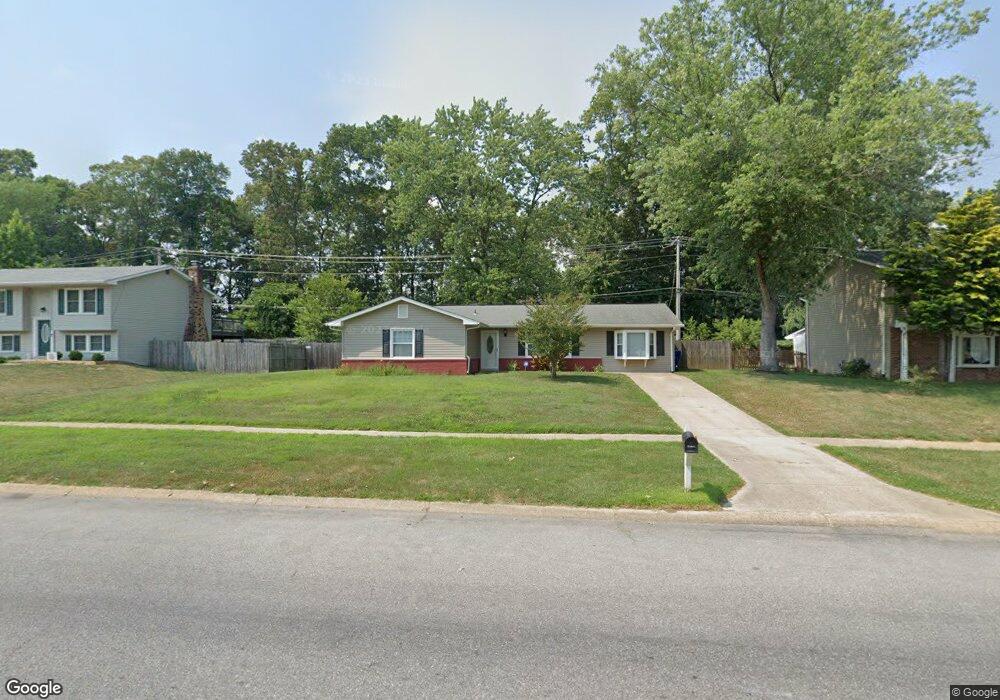
850 Copley Ave Waldorf, MD 20602
Estimated Value: $332,000 - $388,000
--
Bed
2
Baths
1,536
Sq Ft
$234/Sq Ft
Est. Value
About This Home
This home is located at 850 Copley Ave, Waldorf, MD 20602 and is currently estimated at $359,655, approximately $234 per square foot. 850 Copley Ave is a home located in Charles County with nearby schools including Dr. Samuel A. Mudd Elementary School, John Hanson Middle School, and Thomas Stone High School.
Ownership History
Date
Name
Owned For
Owner Type
Purchase Details
Closed on
Feb 22, 2002
Sold by
Secretary Of Housing & Urban Dev
Bought by
Shirriel Brenda
Current Estimated Value
Purchase Details
Closed on
Sep 27, 2001
Sold by
Smith Pamela D
Bought by
Secretary Of Housing & Urban Dev
Purchase Details
Closed on
Jun 30, 1998
Sold by
Secretary Of Housing & Urban Devel
Bought by
Smith Pamela D
Purchase Details
Closed on
Apr 29, 1998
Sold by
Oldland John R and Oldland Jhonni M
Bought by
Secretary Of Housing & Urban Devel
Purchase Details
Closed on
Jan 6, 1994
Sold by
Robertson Ll
Bought by
Oldland John R
Home Financials for this Owner
Home Financials are based on the most recent Mortgage that was taken out on this home.
Original Mortgage
$110,210
Interest Rate
7.23%
Create a Home Valuation Report for This Property
The Home Valuation Report is an in-depth analysis detailing your home's value as well as a comparison with similar homes in the area
Home Values in the Area
Average Home Value in this Area
Purchase History
| Date | Buyer | Sale Price | Title Company |
|---|---|---|---|
| Shirriel Brenda | $115,500 | -- | |
| Secretary Of Housing & Urban Dev | $130,800 | -- | |
| Smith Pamela D | $111,500 | -- | |
| Secretary Of Housing & Urban Devel | $119,000 | -- | |
| Oldland John R | $109,500 | -- |
Source: Public Records
Mortgage History
| Date | Status | Borrower | Loan Amount |
|---|---|---|---|
| Previous Owner | Oldland John R | $110,210 | |
| Closed | Smith Pamela D | -- |
Source: Public Records
Tax History Compared to Growth
Tax History
| Year | Tax Paid | Tax Assessment Tax Assessment Total Assessment is a certain percentage of the fair market value that is determined by local assessors to be the total taxable value of land and additions on the property. | Land | Improvement |
|---|---|---|---|---|
| 2025 | $8,818 | $280,867 | -- | -- |
| 2024 | $3,883 | $270,400 | $125,000 | $145,400 |
| 2023 | $3,539 | $247,633 | $0 | $0 |
| 2022 | $3,229 | $224,867 | $0 | $0 |
| 2021 | $2,800 | $202,100 | $95,000 | $107,100 |
| 2020 | $2,800 | $195,733 | $0 | $0 |
| 2019 | $2,796 | $189,367 | $0 | $0 |
| 2018 | $2,673 | $183,000 | $90,000 | $93,000 |
| 2017 | $2,559 | $174,867 | $0 | $0 |
| 2016 | -- | $166,733 | $0 | $0 |
| 2015 | $2,342 | $158,600 | $0 | $0 |
| 2014 | $2,342 | $158,600 | $0 | $0 |
Source: Public Records
Map
Nearby Homes
- 801 Roxbury Ct
- 314 Rivermont Dr
- 717 Barrington Dr
- 302 Barksdale Ave
- 0 Smallwood Dr Unit MDCH2031694
- 3864 Kelly Green Place
- 3071 Donegal Ct
- 3893 Light Arms Place
- 3809 Light Arms Place
- 221 Brent Rd
- 1016 Stone Ave
- 3081 Dorsey Ct
- 3839 Kearnys Inn Place
- 3 Henry Ford Cir
- 3729 Kempsford Field Place
- 228 Garner Ave
- 3205 High Timber Ct
- 3298 Old Washington Rd
- 2625 Ferguson Ct
- 110 Sherman Rd