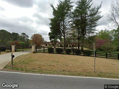
850 Cox Rd Roswell, GA 30075
Estimated Value: $1,103,000 - $1,832,430
4
Beds
5
Baths
4,582
Sq Ft
$330/Sq Ft
Est. Value
About This Home
This home is located at 850 Cox Rd, Roswell, GA 30075 and is currently estimated at $1,513,108, approximately $330 per square foot. 850 Cox Rd is a home located in Fulton County with nearby schools including Sweet Apple Elementary School, Elkins Pointe Middle School, and Roswell High School.
Ownership History
Date
Name
Owned For
Owner Type
Purchase Details
Closed on
Jan 6, 2010
Sold by
Osullivan Ann E
Bought by
Ramirez Horacio and Ramirez Veronica
Current Estimated Value
Purchase Details
Closed on
Nov 28, 1998
Sold by
Dangar Ray
Bought by
Osullivan Patrick M and Osullivan Ann
Home Financials for this Owner
Home Financials are based on the most recent Mortgage that was taken out on this home.
Original Mortgage
$205,000
Interest Rate
6.9%
Mortgage Type
New Conventional
Create a Home Valuation Report for This Property
The Home Valuation Report is an in-depth analysis detailing your home's value as well as a comparison with similar homes in the area
Home Values in the Area
Average Home Value in this Area
Purchase History
| Date | Buyer | Sale Price | Title Company |
|---|---|---|---|
| Ramirez Horacio | $525,000 | -- | |
| Osullivan Patrick M | $294,100 | -- |
Source: Public Records
Mortgage History
| Date | Status | Borrower | Loan Amount |
|---|---|---|---|
| Open | Ramirez Horacio | $625,000 | |
| Closed | Ramirez Horacio | $230,000 | |
| Closed | Ramirez Horacio | $775,000 | |
| Previous Owner | Osullivan Patrick | $220,000 | |
| Previous Owner | Osullivan Ann | $272,250 | |
| Previous Owner | Osullivan Ann | $70,000 | |
| Previous Owner | Osullivan Patrick O | $25,000 | |
| Previous Owner | Osullivan Patrick M | $205,000 |
Source: Public Records
Tax History Compared to Growth
Tax History
| Year | Tax Paid | Tax Assessment Tax Assessment Total Assessment is a certain percentage of the fair market value that is determined by local assessors to be the total taxable value of land and additions on the property. | Land | Improvement |
|---|---|---|---|---|
| 2023 | $14,137 | $500,840 | $206,600 | $294,240 |
| 2022 | $13,177 | $500,840 | $206,600 | $294,240 |
| 2021 | $10,487 | $486,280 | $200,600 | $285,680 |
| 2020 | $15,734 | $480,480 | $198,200 | $282,280 |
| 2019 | $2,339 | $472,000 | $194,720 | $277,280 |
| 2018 | $10,261 | $363,520 | $142,000 | $221,520 |
| 2017 | $9,181 | $314,680 | $91,840 | $222,840 |
| 2016 | $9,183 | $314,680 | $91,840 | $222,840 |
| 2015 | $13,903 | $400,000 | $91,840 | $308,160 |
| 2014 | $5,991 | $438,160 | $91,840 | $346,320 |
Source: Public Records
Map
Nearby Homes
- 12600 Silver Fox Ct
- 145 Cedarwood Ln
- 135 Cedarwood Ln
- 140 Cedarwood Ln
- 120 Cedarwood Ln
- 12680 Old Surrey Place
- 160 Cedarwood Ln
- 170 Cedarwood Ln
- 150 Cedarwood Ln
- 235 Winterberry Way
- 710 Cox Rd
- 2025 Fife Ridge Ct
- 5045 Huntwood Way
- 790 Oakhaven Dr
- 12520 Celestine Way
- 690 Ebenezer Rd
- 110 Vistacrest Way
- 225 Blueberry Ridge
- 13565 Wood Fern Way
- 12690 Ebenezer Pond Ct
- 850 Cox Rd
- 12620 Silver Fox Ct Unit 25
- 12630 Silver Fox Ct
- 12590 Silver Fox Ct Unit 25
- 12580 Silver Fox Ct
- 12570 Silver Fox Ct Unit 25
- 12610 Silver Fox Ct Unit 25
- 12640 Silver Fox Ct
- 12620 Old Surrey Place
- 800 Cox Rd
- 12625 Silver Fox Ct
- 12575 Silver Fox Ct Unit 25
- 12565 Silver Fox Ct
- 12635 Silver Fox Ct
- 12615 Silver Fox Ct
- 140 Brookfield Hollow
- 12660 Silver Fox Ct
- 12625 Old Surrey Place Unit 8
- 12605 Silver Fox Ct
- 12585 Silver Fox Ct