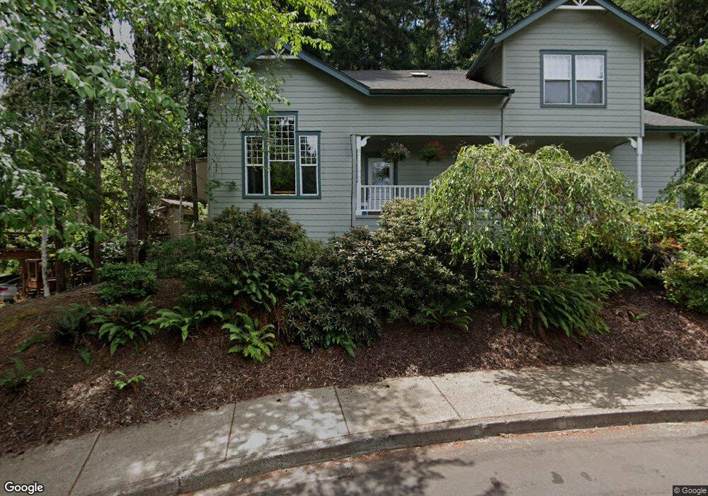
850 Foxglenn Ave Eugene, OR 97405
Southeast Eugene NeighborhoodEstimated Value: $611,640 - $706,000
3
Beds
3
Baths
2,163
Sq Ft
$305/Sq Ft
Est. Value
About This Home
This home is located at 850 Foxglenn Ave, Eugene, OR 97405 and is currently estimated at $660,160, approximately $305 per square foot. 850 Foxglenn Ave is a home located in Lane County with nearby schools including Edgewood Community Elementary School, Spencer Butte Middle School, and South Eugene High School.
Ownership History
Date
Name
Owned For
Owner Type
Purchase Details
Closed on
May 8, 2000
Sold by
Molesworth John R and Beaton Margaret R
Bought by
Johnson Wayne Dean and Johnson Rebecca Ann
Current Estimated Value
Home Financials for this Owner
Home Financials are based on the most recent Mortgage that was taken out on this home.
Original Mortgage
$231,800
Outstanding Balance
$78,164
Interest Rate
8.22%
Estimated Equity
$581,996
Create a Home Valuation Report for This Property
The Home Valuation Report is an in-depth analysis detailing your home's value as well as a comparison with similar homes in the area
Home Values in the Area
Average Home Value in this Area
Purchase History
| Date | Buyer | Sale Price | Title Company |
|---|---|---|---|
| Johnson Wayne Dean | $239,000 | Western Pioneer Title Co |
Source: Public Records
Mortgage History
| Date | Status | Borrower | Loan Amount |
|---|---|---|---|
| Open | Johnson Wayne Dean | $231,800 |
Source: Public Records
Tax History
| Year | Tax Paid | Tax Assessment Tax Assessment Total Assessment is a certain percentage of the fair market value that is determined by local assessors to be the total taxable value of land and additions on the property. | Land | Improvement |
|---|---|---|---|---|
| 2025 | $7,936 | $407,320 | -- | -- |
| 2024 | $7,837 | $395,457 | -- | -- |
| 2023 | $7,837 | $383,939 | $0 | $0 |
| 2022 | $7,342 | $372,757 | $0 | $0 |
| 2021 | $6,780 | $361,900 | $0 | $0 |
| 2020 | $6,578 | $351,360 | $0 | $0 |
| 2019 | $6,428 | $341,127 | $0 | $0 |
| 2018 | $6,004 | $321,546 | $0 | $0 |
| 2017 | $5,576 | $321,546 | $0 | $0 |
| 2016 | $5,378 | $312,181 | $0 | $0 |
| 2015 | $5,219 | $303,088 | $0 | $0 |
| 2014 | $5,152 | $294,260 | $0 | $0 |
Source: Public Records
Map
Nearby Homes
- 4320 Fox Hollow Rd
- 910 E 43rd Ave
- 4364 Fox Hollow Rd
- 4425 Hilyard St
- 0 E 39th Ave
- 4295 Ferry St
- 4429 Fox Hollow Rd Unit 3
- 4023 Donald St Unit K
- 3817 E Amazon Dr
- 434 E 39th Ave
- 1210 E 38th Ave
- 4680 W Hillside Dr
- 1180 E 37th Ave
- 275 E 39th Ave
- 3790 Onyx St
- 170 E 40th Ave
- 395 E 46th Ave
- 4845 Brookwood St
- 585 E 36th Ave
- 0 N Shasta Loop Unit 384285834
- 854 Foxglenn Ave
- 848 Foxglenn Ave
- 4115 Alder St
- 858 Foxglenn Ave
- 4125 Alder St
- 4087 Alder St
- 874 Foxglenn Ave
- 842 Foxglenn Ave
- 891 E 43rd Ave
- 866 Foxglenn Ave
- 893 E 43rd Ave
- 4135 Alder St
- 870 Foxglenn Ave
- 4081 Alder St
- 882 Foxglenn Ave
- 885 E 43rd Ave
- 4110 Alder St
- 895 E 43rd Ave
- 820 Foxglenn Ave
- 4120 Alder St
Your Personal Tour Guide
Ask me questions while you tour the home.