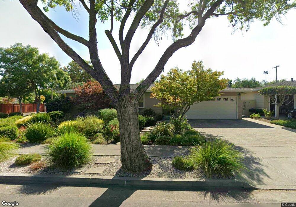
850 Lois Ave Sunnyvale, CA 94087
Estimated Value: $2,605,000 - $3,095,000
3
Beds
2
Baths
848
Sq Ft
$3,423/Sq Ft
Est. Value
About This Home
This home is located at 850 Lois Ave, Sunnyvale, CA 94087 and is currently estimated at $2,902,643, approximately $3,422 per square foot. 850 Lois Ave is a home located in Santa Clara County with nearby schools including Cherry Chase Elementary School, Sunnyvale Middle School, and Homestead High School.
Ownership History
Date
Name
Owned For
Owner Type
Purchase Details
Closed on
Dec 3, 2014
Sold by
Johnson Ross M and Johnson Sue Ellen
Bought by
The Ross & Sue Ellen Johnson Family Trus and Johnson Sue Ellen
Current Estimated Value
Purchase Details
Closed on
Aug 17, 1995
Sold by
Mousley Scott W and Mousley Teri L
Bought by
Johnson Ross M and Bohn Sue-Ellen
Home Financials for this Owner
Home Financials are based on the most recent Mortgage that was taken out on this home.
Original Mortgage
$284,000
Interest Rate
7.71%
Create a Home Valuation Report for This Property
The Home Valuation Report is an in-depth analysis detailing your home's value as well as a comparison with similar homes in the area
Home Values in the Area
Average Home Value in this Area
Purchase History
| Date | Buyer | Sale Price | Title Company |
|---|---|---|---|
| The Ross & Sue Ellen Johnson Family Trus | -- | None Available | |
| Johnson Ross M | $355,000 | North American Title |
Source: Public Records
Mortgage History
| Date | Status | Borrower | Loan Amount |
|---|---|---|---|
| Previous Owner | Johnson Ross M | $284,000 |
Source: Public Records
Tax History Compared to Growth
Tax History
| Year | Tax Paid | Tax Assessment Tax Assessment Total Assessment is a certain percentage of the fair market value that is determined by local assessors to be the total taxable value of land and additions on the property. | Land | Improvement |
|---|---|---|---|---|
| 2025 | $6,954 | $589,725 | $373,775 | $215,950 |
| 2024 | $6,954 | $578,163 | $366,447 | $211,716 |
| 2023 | $6,891 | $566,827 | $359,262 | $207,565 |
| 2022 | $6,779 | $555,714 | $352,218 | $203,496 |
| 2021 | $6,715 | $544,818 | $345,312 | $199,506 |
| 2020 | $6,632 | $539,233 | $341,772 | $197,461 |
| 2019 | $6,486 | $528,661 | $335,071 | $193,590 |
| 2018 | $6,373 | $518,296 | $328,501 | $189,795 |
| 2017 | $6,292 | $508,134 | $322,060 | $186,074 |
| 2016 | $6,048 | $498,172 | $315,746 | $182,426 |
| 2015 | $6,082 | $490,690 | $311,004 | $179,686 |
| 2014 | $5,883 | $481,079 | $304,912 | $176,167 |
Source: Public Records
Map
Nearby Homes
- 1075 Hudson Way
- 960 Heatherstone Ave
- 857 Peach Ave
- 1201 Heatherstone Way
- 1033 Crestview Dr Unit 308
- 1127 Viscaino Ave
- 745 Reseda Dr
- 1021 Golf Ct
- 839 Springfield Terrace
- 434 Purisima Ave
- 541 Holthouse Terrace
- 1244 Elderberry Dr
- 654 Princeton Dr
- 1098 Noriega Ave
- 373 Redondo Terrace
- 1243 E Fremont Terrace
- 725 Winstead Terrace
- 1140 Snowberry Ct
- 777 W Washington Ave
- 481 S Murphy Ave
- 854 Lois Ave
- 851 Mango Ave Unit 2
- 855 Mango Ave
- 858 Lois Ave
- 846 Lois Ave
- 1050 Heatherstone Way
- 859 Mango Ave
- 847 Mango Ave
- 862 Lois Ave
- 1051 Morningside Dr
- 842 Lois Ave
- 1051 Heatherstone Ave
- 1051 Heatherstone Way
- 863 Mango Ave
- 1054 Heatherstone Way
- 843 Mango Ave
- 1055 Morningside Dr
- 866 Lois Ave
- 838 Lois Ave
- 1034 Heatherstone Ave