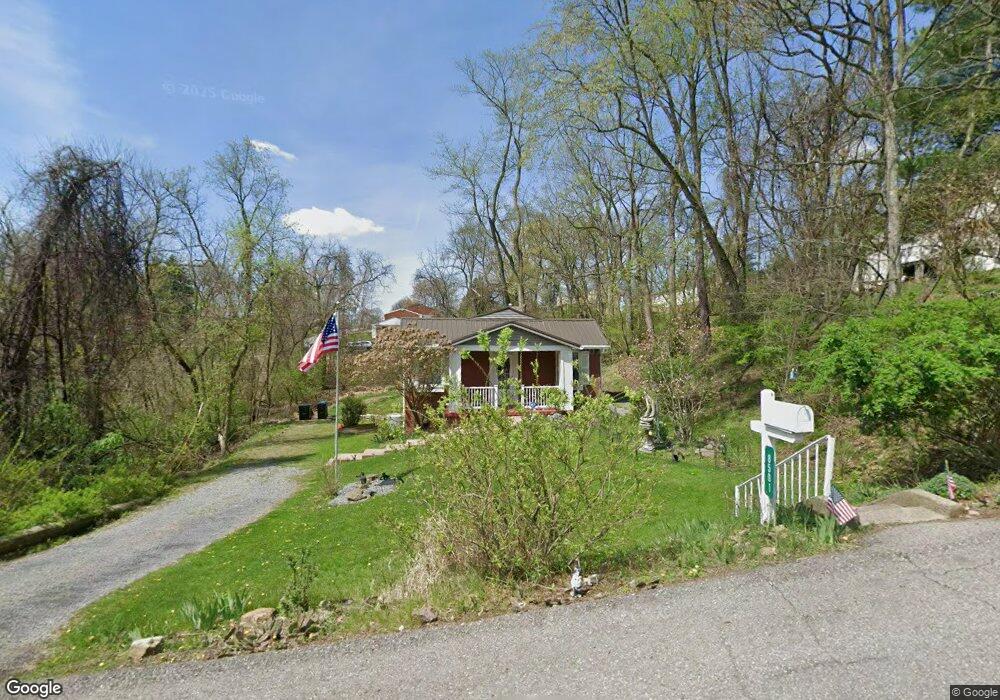
8501 Forest Ave Pittsburgh, PA 15237
McCandless Township NeighborhoodEstimated Value: $206,000 - $225,000
2
Beds
1
Bath
775
Sq Ft
$276/Sq Ft
Est. Value
About This Home
This home is located at 8501 Forest Ave, Pittsburgh, PA 15237 and is currently estimated at $213,993, approximately $276 per square foot. 8501 Forest Ave is a home located in Allegheny County with nearby schools including McKnight Elementary School, Carson Middle School, and North Allegheny High School.
Ownership History
Date
Name
Owned For
Owner Type
Purchase Details
Closed on
Jun 23, 2005
Sold by
Pelly Frank
Bought by
Lowe Diane
Current Estimated Value
Home Financials for this Owner
Home Financials are based on the most recent Mortgage that was taken out on this home.
Original Mortgage
$111,000
Outstanding Balance
$58,172
Interest Rate
5.82%
Mortgage Type
FHA
Estimated Equity
$155,821
Purchase Details
Closed on
Oct 4, 1999
Sold by
Estate Of Helen B Novak
Bought by
Novak Thomas C
Create a Home Valuation Report for This Property
The Home Valuation Report is an in-depth analysis detailing your home's value as well as a comparison with similar homes in the area
Home Values in the Area
Average Home Value in this Area
Purchase History
| Date | Buyer | Sale Price | Title Company |
|---|---|---|---|
| Lowe Diane | $112,000 | -- | |
| Novak Thomas C | -- | -- |
Source: Public Records
Mortgage History
| Date | Status | Borrower | Loan Amount |
|---|---|---|---|
| Open | Lowe Diane | $111,000 |
Source: Public Records
Tax History Compared to Growth
Tax History
| Year | Tax Paid | Tax Assessment Tax Assessment Total Assessment is a certain percentage of the fair market value that is determined by local assessors to be the total taxable value of land and additions on the property. | Land | Improvement |
|---|---|---|---|---|
| 2025 | $2,290 | $89,100 | $46,100 | $43,000 |
| 2024 | $2,290 | $89,100 | $46,100 | $43,000 |
| 2023 | $2,290 | $89,100 | $46,100 | $43,000 |
| 2022 | $2,237 | $89,100 | $46,100 | $43,000 |
| 2021 | $2,236 | $89,100 | $46,100 | $43,000 |
| 2020 | $2,237 | $89,100 | $46,100 | $43,000 |
| 2019 | $2,176 | $89,100 | $46,100 | $43,000 |
| 2018 | $421 | $89,100 | $46,100 | $43,000 |
| 2017 | $2,135 | $89,100 | $46,100 | $43,000 |
| 2016 | $421 | $89,100 | $46,100 | $43,000 |
| 2015 | $421 | $89,100 | $46,100 | $43,000 |
| 2014 | $2,088 | $89,100 | $46,100 | $43,000 |
Source: Public Records
Map
Nearby Homes
- 8521 Roosevelt Blvd
- 333 Rolshouse Rd
- 218 Lincoln Ave
- 518 Lincoln Ave
- 8229 E Van Buren Dr
- 7914 Hemlock St
- 159 Seminole Ave
- 368 Seminole Ave
- 170 Mayer Dr
- 0 Main Blvd
- 130 Grant Ave
- 605 Calais Dr Unit 301
- 605 Calais Dr Unit 104
- 405 Highland Pines Ct Unit D405
- 403 Sunderland Dr
- 106 Trolley Ct
- 73 Grace Dr
- 521 Olive St
- 8822 Sloop Rd
- 9270 Old Perry Hwy
- 8515 Forest Ave
- 8480 Forest Ave
- 315 Gloria St
- 9313 Forest Ave
- 8437 Forest Ave
- 352 Harold St
- 8506 Forest Ave
- 8452 Forest Ave
- 8512 Forest Ave
- 8430 Forest Ave
- 150 Gloria St
- 356 Harold St
- 326 Gloria St
- 355 Harold St
- 8419 Forest Ave
- 360 Harold St
- 337 Gloria St
- 352 Highview St
- 334 Gloria St
- 8424 Forest Ave