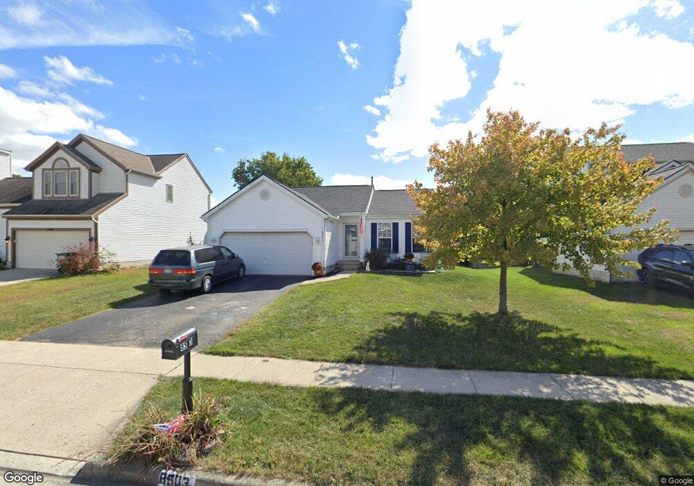
8503 Leader Dr Galloway, OH 43119
Estimated Value: $307,613 - $328,000
3
Beds
2
Baths
1,206
Sq Ft
$264/Sq Ft
Est. Value
About This Home
This home is located at 8503 Leader Dr, Galloway, OH 43119 and is currently estimated at $318,153, approximately $263 per square foot. 8503 Leader Dr is a home located in Franklin County with nearby schools including Brown Elementary School, Hilliard Station Sixth Grade Elementary School, and Hilliard Memorial Middle School.
Ownership History
Date
Name
Owned For
Owner Type
Purchase Details
Closed on
Sep 20, 1996
Sold by
M/I Schottenstein Homes
Bought by
Vassaux Christopher M and Vassaux Cheryl L
Current Estimated Value
Home Financials for this Owner
Home Financials are based on the most recent Mortgage that was taken out on this home.
Original Mortgage
$116,156
Outstanding Balance
$9,737
Interest Rate
7.93%
Mortgage Type
New Conventional
Estimated Equity
$308,416
Purchase Details
Closed on
Apr 26, 1996
Sold by
Davis & Son Inc
Bought by
M/I Schottenstein Homes Inc
Create a Home Valuation Report for This Property
The Home Valuation Report is an in-depth analysis detailing your home's value as well as a comparison with similar homes in the area
Home Values in the Area
Average Home Value in this Area
Purchase History
| Date | Buyer | Sale Price | Title Company |
|---|---|---|---|
| Vassaux Christopher M | $118,490 | -- | |
| M/I Schottenstein Homes Inc | $100,000 | -- |
Source: Public Records
Mortgage History
| Date | Status | Borrower | Loan Amount |
|---|---|---|---|
| Open | Vassaux Christopher M | $116,156 |
Source: Public Records
Tax History Compared to Growth
Tax History
| Year | Tax Paid | Tax Assessment Tax Assessment Total Assessment is a certain percentage of the fair market value that is determined by local assessors to be the total taxable value of land and additions on the property. | Land | Improvement |
|---|---|---|---|---|
| 2024 | $5,545 | $84,640 | $28,530 | $56,110 |
| 2023 | $4,764 | $84,640 | $28,530 | $56,110 |
| 2022 | $4,028 | $54,600 | $15,400 | $39,200 |
| 2021 | $4,025 | $54,600 | $15,400 | $39,200 |
| 2020 | $4,024 | $54,600 | $15,400 | $39,200 |
| 2019 | $4,008 | $46,310 | $12,850 | $33,460 |
| 2018 | $3,936 | $46,310 | $12,850 | $33,460 |
| 2017 | $3,987 | $46,310 | $12,850 | $33,460 |
| 2016 | $4,090 | $44,940 | $12,040 | $32,900 |
| 2015 | $3,874 | $44,940 | $12,040 | $32,900 |
| 2014 | $3,798 | $44,940 | $12,040 | $32,900 |
| 2013 | $2,056 | $47,285 | $12,670 | $34,615 |
Source: Public Records
Map
Nearby Homes
- 8421 Union Dr
- 8527 Carbine Place
- 8520 Cadence Dr
- 8528 Cadence Dr
- 8654 Cadet Dr N
- 8333 Squad Dr
- 8747 Crestwater Dr
- 0 Dellinger Rd Unit 9 2030113
- 1280 Four Star Dr W
- 8626 Fairbrook Ave
- 8482 Dover Crest Ct
- 287 Greenlake St
- 8595 Abbot Cove Ave
- 70 Riverside Dr
- 10763 Southwood Rd
- 9519 High Free Pike
- 360 State Route 142 NE
- 270 State Route 142 NE
- 2263 Amity Rd
- 74 S Chester St