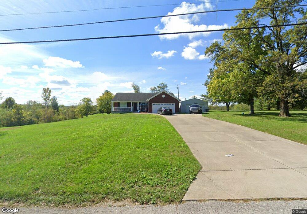
851 Hogreffe Rd Independence, KY 41051
Estimated Value: $355,000 - $380,928
3
Beds
1
Bath
1,560
Sq Ft
$239/Sq Ft
Est. Value
About This Home
This home is located at 851 Hogreffe Rd, Independence, KY 41051 and is currently estimated at $372,232, approximately $238 per square foot. 851 Hogreffe Rd is a home located in Kenton County with nearby schools including Beechgrove Elementary School, Twenhofel Middle School, and Simon Kenton High School.
Ownership History
Date
Name
Owned For
Owner Type
Purchase Details
Closed on
Mar 17, 2025
Sold by
Taylor Tammy J
Bought by
Dunford Mark Allan and Dunford Susan Whiteker
Current Estimated Value
Purchase Details
Closed on
Mar 8, 2021
Sold by
Whiteker Donald S and Taylor Tammy J
Bought by
Taylor Tammy J
Create a Home Valuation Report for This Property
The Home Valuation Report is an in-depth analysis detailing your home's value as well as a comparison with similar homes in the area
Home Values in the Area
Average Home Value in this Area
Purchase History
| Date | Buyer | Sale Price | Title Company |
|---|---|---|---|
| Dunford Mark Allan | $369,500 | Northwest Title | |
| Taylor Tammy J | -- | None Available | |
| Taylor Tammy J | -- | None Listed On Document |
Source: Public Records
Tax History Compared to Growth
Tax History
| Year | Tax Paid | Tax Assessment Tax Assessment Total Assessment is a certain percentage of the fair market value that is determined by local assessors to be the total taxable value of land and additions on the property. | Land | Improvement |
|---|---|---|---|---|
| 2024 | $2,879 | $235,000 | $25,000 | $210,000 |
| 2023 | $2,966 | $235,000 | $25,000 | $210,000 |
| 2022 | $3,023 | $235,000 | $25,000 | $210,000 |
| 2021 | $2,552 | $235,000 | $25,000 | $210,000 |
| 2020 | $2,166 | $200,000 | $20,000 | $180,000 |
| 2019 | $2,171 | $200,000 | $20,000 | $180,000 |
| 2018 | $2,205 | $200,000 | $20,000 | $180,000 |
| 2017 | $2,145 | $200,000 | $20,000 | $180,000 |
| 2015 | $2,091 | $200,000 | $20,000 | $180,000 |
| 2014 | $845 | $100,000 | $20,000 | $80,000 |
Source: Public Records
Map
Nearby Homes
- 10690 Melbury Ct Unit 305GL
- 10694 Melbury Ct Unit 306GL
- The Westchester Plan at The Greens of Glenhurst
- The Ella Marie Plan at The Greens of Glenhurst
- The Jefferson Plan at The Greens of Glenhurst
- The Leighann Plan at The Greens of Glenhurst
- The Waterson Plan at The Greens of Glenhurst
- The Lancaster Plan at The Greens of Glenhurst
- The Austin Plan at The Greens of Glenhurst
- The Morgan Plan at The Greens of Glenhurst
- The Marietta Plan at The Greens of Glenhurst
- The Camden Plan at The Greens of Glenhurst
- The Lincoln Plan at The Greens of Glenhurst
- The Bristol Plan at The Greens of Glenhurst
- The Livingston Plan at The Greens of Glenhurst
- The Madison Plan at The Greens of Glenhurst
- The Verona Plan at The Greens of Glenhurst
- The Courtney Plan at The Greens of Glenhurst
- The Avalon Plan at The Greens of Glenhurst
- The Rosewood Plan at The Greens of Glenhurst
- 833 Hogreffe Rd
- 10217 Chestnut Oak Dr
- 821 Hogreffe Rd
- 854 Hogreffe Rd
- 10213 Chestnut Oak Dr
- 848 Hogreffe Rd
- 873 Hogrefe Rd
- 10209 Chestnut Oak Dr
- 10210 Chestnut Oak Dr
- 801 Hogrefe Rd
- 10206 Chestnut Oak Dr
- 888 Hogreffe Rd
- 10205 Chestnut Oak Dr
- 10202 Chestnut Oak Dr
- 10217 Scarletoak Dr
- 899 Hogrefe Rd
- 899 Hogrefe Rd
- 10201 Chestnut Oak Dr
- 10217 Scarlet Oak Dr
- 800 Hogrefe Rd