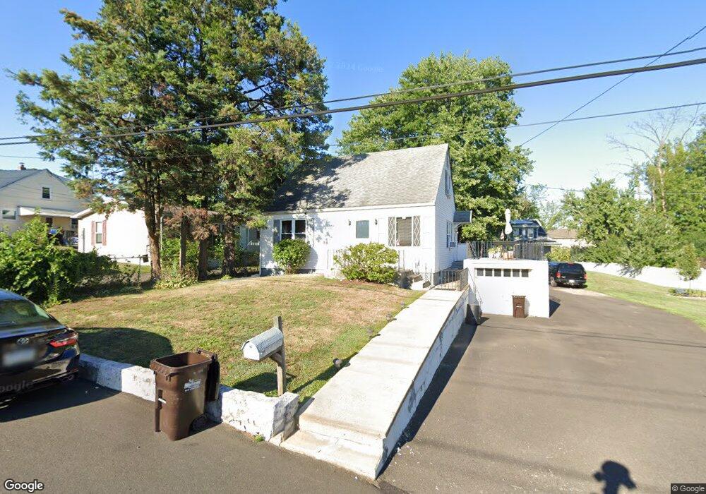
851 Simons Ave Bensalem, PA 19020
Estimated Value: $263,000 - $308,838
3
Beds
1
Bath
1,092
Sq Ft
$255/Sq Ft
Est. Value
About This Home
This home is located at 851 Simons Ave, Bensalem, PA 19020 and is currently estimated at $278,210, approximately $254 per square foot. 851 Simons Ave is a home located in Bucks County with nearby schools including Robert K. Shafer Middle School, School Lane Charter School, and St Charles Borromeo School.
Ownership History
Date
Name
Owned For
Owner Type
Purchase Details
Closed on
Apr 15, 2025
Sold by
Fisher Dorothy
Bought by
Pierson Brett A and Miller Karla
Current Estimated Value
Home Financials for this Owner
Home Financials are based on the most recent Mortgage that was taken out on this home.
Original Mortgage
$211,200
Outstanding Balance
$210,259
Interest Rate
6.63%
Mortgage Type
New Conventional
Estimated Equity
$67,951
Purchase Details
Closed on
Apr 3, 1989
Sold by
Usa Veterans Affairs
Bought by
Fisher Kenneth H and Fisher Dorothy E
Create a Home Valuation Report for This Property
The Home Valuation Report is an in-depth analysis detailing your home's value as well as a comparison with similar homes in the area
Home Values in the Area
Average Home Value in this Area
Purchase History
| Date | Buyer | Sale Price | Title Company |
|---|---|---|---|
| Pierson Brett A | $264,000 | Old Republic Title | |
| Fisher Kenneth H | $11,000 | -- |
Source: Public Records
Mortgage History
| Date | Status | Borrower | Loan Amount |
|---|---|---|---|
| Open | Pierson Brett A | $211,200 |
Source: Public Records
Tax History Compared to Growth
Tax History
| Year | Tax Paid | Tax Assessment Tax Assessment Total Assessment is a certain percentage of the fair market value that is determined by local assessors to be the total taxable value of land and additions on the property. | Land | Improvement |
|---|---|---|---|---|
| 2025 | $2,707 | $12,400 | $2,120 | $10,280 |
| 2024 | $2,707 | $12,400 | $2,120 | $10,280 |
| 2023 | $2,631 | $12,400 | $2,120 | $10,280 |
| 2022 | $2,615 | $12,400 | $2,120 | $10,280 |
| 2021 | $2,615 | $12,400 | $2,120 | $10,280 |
| 2020 | $2,589 | $12,400 | $2,120 | $10,280 |
| 2019 | $2,531 | $12,400 | $2,120 | $10,280 |
| 2018 | $2,472 | $12,400 | $2,120 | $10,280 |
| 2017 | $2,457 | $12,400 | $2,120 | $10,280 |
| 2016 | $2,457 | $12,400 | $2,120 | $10,280 |
| 2015 | -- | $12,400 | $2,120 | $10,280 |
| 2014 | -- | $12,400 | $2,120 | $10,280 |
Source: Public Records
Map
Nearby Homes
- 833 Simons Ave
- 2209 Dungan Ave
- 943 Cornwells Ave
- 1032 Sunset Ln
- 2387 Forrest Ave
- 2025 State Rd
- 1155 Regina Ave
- 2498 Ogden Ave
- 126B Royal Mews
- 113 Royal Mews
- 106A Prince George St Unit A
- 136b Alexandria St
- 106 Dock St
- 116B King St
- 120B Dock St
- 1742 Paradise Ln
- 114B King St
- 204A Dock St
- 104B King St
- 97 Waterside Mews
- 857 Simons Ave
- 843 Simons Ave
- 867 Simons Ave
- 883 Simons Ave
- 848 Simons Ave
- 875 Simons Ave
- 2228 Traylor Ave
- 844 Simons Ave
- 858 Simons Ave
- 838 Simons Ave
- 823 Simons Ave
- 836 Simons Ave
- 864 Simons Ave
- 830 Simons Ave
- 885 Simons Ave
- 870 Simons Ave
- 2130 Traylor Ave
- 828 Simons Ave Unit C
- 828 Simons Ave Unit A
- 828 Simons Ave