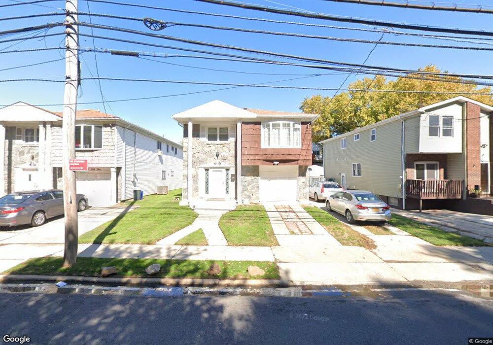
851 Travis Ave Staten Island, NY 10314
Bulls Head NeighborhoodEstimated Value: $831,031 - $1,108,000
--
Bed
--
Bath
2,289
Sq Ft
$431/Sq Ft
Est. Value
About This Home
This home is located at 851 Travis Ave, Staten Island, NY 10314 and is currently estimated at $985,508, approximately $430 per square foot. 851 Travis Ave is a home located in Richmond County with nearby schools including P.S. 060 Alice Austen School, Is 72 Rocco Laurie, and Port Richmond High School.
Ownership History
Date
Name
Owned For
Owner Type
Purchase Details
Closed on
Dec 7, 2016
Sold by
Donnell Martin P O and Estate Of Ann J O Donnell
Bought by
Yaseen Saad
Current Estimated Value
Home Financials for this Owner
Home Financials are based on the most recent Mortgage that was taken out on this home.
Original Mortgage
$380,000
Outstanding Balance
$306,368
Interest Rate
3.47%
Mortgage Type
New Conventional
Estimated Equity
$679,140
Purchase Details
Closed on
Apr 10, 2002
Sold by
Goldstein Natalie and Silverman Ann
Bought by
Silverman Ann and Alderman Ann
Create a Home Valuation Report for This Property
The Home Valuation Report is an in-depth analysis detailing your home's value as well as a comparison with similar homes in the area
Home Values in the Area
Average Home Value in this Area
Purchase History
| Date | Buyer | Sale Price | Title Company |
|---|---|---|---|
| Yaseen Saad | $450,000 | None Available | |
| Silverman Ann | -- | -- |
Source: Public Records
Mortgage History
| Date | Status | Borrower | Loan Amount |
|---|---|---|---|
| Open | Yaseen Saad | $380,000 |
Source: Public Records
Tax History Compared to Growth
Tax History
| Year | Tax Paid | Tax Assessment Tax Assessment Total Assessment is a certain percentage of the fair market value that is determined by local assessors to be the total taxable value of land and additions on the property. | Land | Improvement |
|---|---|---|---|---|
| 2025 | $7,011 | $62,640 | $5,387 | $57,253 |
| 2024 | $7,011 | $57,960 | $5,492 | $52,468 |
| 2023 | $7,089 | $34,906 | $5,370 | $29,536 |
| 2022 | $6,916 | $49,860 | $9,120 | $40,740 |
| 2021 | $6,878 | $45,480 | $9,120 | $36,360 |
| 2020 | $6,526 | $46,920 | $9,120 | $37,800 |
| 2019 | $6,085 | $45,840 | $9,120 | $36,720 |
| 2018 | $5,930 | $29,088 | $7,052 | $22,036 |
| 2017 | $5,885 | $28,869 | $7,878 | $20,991 |
| 2016 | $5,445 | $27,235 | $7,796 | $19,439 |
| 2015 | $4,652 | $25,694 | $6,770 | $18,924 |
| 2014 | $4,652 | $24,240 | $7,620 | $16,620 |
Source: Public Records
Map
Nearby Homes
- 877 Travis Ave Unit 889
- 234 Freedom Ave Unit 240
- 57 Sleepy Hollow Rd
- 907 Travis Ave
- 38 Bowling Green Place
- 16 Knapp St
- 117 Rockville Ave
- 57 Bowling Green Place
- 126 Mulberry Ave
- 135 Freedom Ave
- 80 Mulberry Ave
- 700 Travis Ave
- 1875 Richmond Ave
- 8 Rockville Ave
- 88 Radford St
- 1304 Rockland Ave
- 51 Shiloh St
- 1317 Rockland Ave
- 1294 Rockland Ave Unit 1D
- 49 Gadsen Place
- 849 Travis Ave
- 855 Travis Ave
- 847 Travis Ave
- 845 Travis Ave
- 861 Travis Ave
- 38 Sleepy Hollow Rd
- 32 Sleepy Hollow Rd
- 843 Travis Ave
- 28 Sleepy Hollow Rd
- 42 Sleepy Hollow Rd
- 24 Sleepy Hollow Rd
- 865 Travis Ave
- 20 Sleepy Hollow Rd
- 837 Travis Ave
- 46 Sleepy Hollow Rd Unit 1
- 46 Sleepy Hollow Rd Unit 2
- 46 Sleepy Hollow Rd
- 867 Travis Ave Unit 889
- 867 Travis Ave Unit Building
- 867-889 Travis Ave