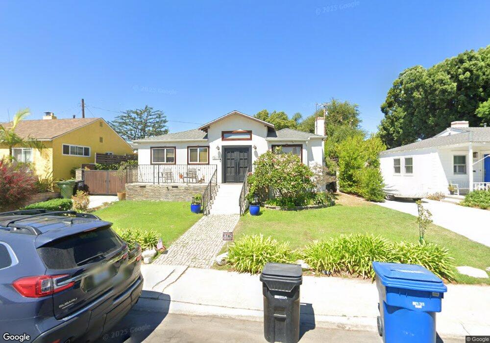
8511 Flight Ave Los Angeles, CA 90045
Westchester NeighborhoodEstimated Value: $1,379,000 - $1,606,000
3
Beds
2
Baths
1,708
Sq Ft
$859/Sq Ft
Est. Value
About This Home
This home is located at 8511 Flight Ave, Los Angeles, CA 90045 and is currently estimated at $1,467,333, approximately $859 per square foot. 8511 Flight Ave is a home located in Los Angeles County with nearby schools including Westport Heights Elementary, Wright Middle School STEAM Magnet, and Westchester Enriched Sciences Magnets.
Ownership History
Date
Name
Owned For
Owner Type
Purchase Details
Closed on
Dec 10, 2012
Sold by
Leslie Carol A
Bought by
Macdonald James and Macdonald Nelva
Current Estimated Value
Home Financials for this Owner
Home Financials are based on the most recent Mortgage that was taken out on this home.
Original Mortgage
$414,700
Interest Rate
3.33%
Mortgage Type
VA
Purchase Details
Closed on
Oct 16, 1997
Sold by
Heimann Olivea C
Bought by
Heimann Olivea C and 1997 Olivea C Heimann Trust
Create a Home Valuation Report for This Property
The Home Valuation Report is an in-depth analysis detailing your home's value as well as a comparison with similar homes in the area
Home Values in the Area
Average Home Value in this Area
Purchase History
| Date | Buyer | Sale Price | Title Company |
|---|---|---|---|
| Macdonald James | $405,000 | Title 365 | |
| Heimann Olivea C | -- | -- |
Source: Public Records
Mortgage History
| Date | Status | Borrower | Loan Amount |
|---|---|---|---|
| Previous Owner | Macdonald James | $414,700 |
Source: Public Records
Tax History
| Year | Tax Paid | Tax Assessment Tax Assessment Total Assessment is a certain percentage of the fair market value that is determined by local assessors to be the total taxable value of land and additions on the property. | Land | Improvement |
|---|---|---|---|---|
| 2025 | $7,484 | $603,630 | $375,578 | $228,052 |
| 2024 | $7,484 | $591,795 | $368,214 | $223,581 |
| 2023 | $7,346 | $580,193 | $360,995 | $219,198 |
| 2022 | $7,016 | $568,817 | $353,917 | $214,900 |
| 2021 | $6,171 | $496,491 | $346,978 | $149,513 |
| 2019 | $5,992 | $481,767 | $336,688 | $145,079 |
| 2018 | $5,911 | $472,322 | $330,087 | $142,235 |
| 2016 | $5,256 | $421,293 | $317,270 | $104,023 |
| 2015 | $5,182 | $414,966 | $312,505 | $102,461 |
| 2014 | $5,207 | $406,838 | $306,384 | $100,454 |
Source: Public Records
Map
Nearby Homes
- 8421 Kittyhawk Ave
- 6133 W 83rd Place
- 8420 Glider Ave
- 8454 Naylor Ave
- 8806 De Haviland Ave
- 8806 Croydon Ave
- 8843 De Haviland Ave
- 8309 Barnsley Ave
- 8324 Barnsley Ave
- 8906 Yorktown Ave
- 7907 Vicksburg Ave
- 8512 Belford Ave
- 8620 Belford Ave Unit 106
- 8436 Ramsgate Ave
- 8650 Belford Ave Unit 119A
- 8650 Belford Ave Unit A119
- 8650 Belford Ave Unit 116A
- 8650 Belford Ave
- 6350 W 80th Place
- 8716 Ramsgate Ave
- 8517 Flight Ave
- 8501 Flight Ave
- 8424 Bleriot Ave
- 8500 Bleriot Ave
- 8421 Airlane Ave
- 8417 Airlane Ave
- 8523 Flight Ave
- 8512 Flight Ave
- 8506 Flight Ave
- 8516 Flight Ave
- 8414 Bleriot Ave
- 8500 Flight Ave
- 8520 Flight Ave
- 8411 Airlane Ave
- 8410 Bleriot Ave
- 8526 Flight Ave
- 8407 Airlane Ave
- 8427 Bleriot Ave
- 8501 Bleriot Ave
- 8530 Flight Ave
Your Personal Tour Guide
Ask me questions while you tour the home.