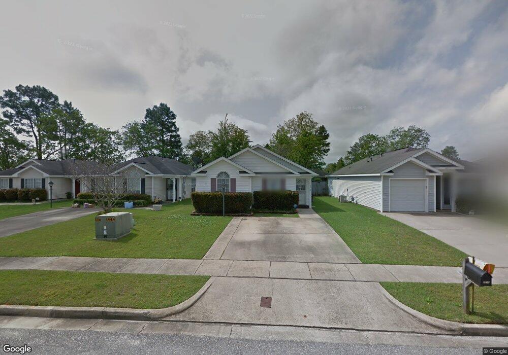
8513 Cherry Oak Ct Mobile, AL 36695
Yorkwood NeighborhoodEstimated Value: $177,529 - $192,000
3
Beds
2
Baths
1,247
Sq Ft
$150/Sq Ft
Est. Value
About This Home
This home is located at 8513 Cherry Oak Ct, Mobile, AL 36695 and is currently estimated at $187,132, approximately $150 per square foot. 8513 Cherry Oak Ct is a home located in Mobile County with nearby schools including O'rourke Elementary School, Bernice J Causey Middle School, and Baker High School.
Ownership History
Date
Name
Owned For
Owner Type
Purchase Details
Closed on
Jul 28, 2004
Sold by
Spann Morris A
Bought by
Spann Morris A and Spann Morris Wesley
Current Estimated Value
Purchase Details
Closed on
Apr 28, 2000
Sold by
The Mitchell Company Inc
Bought by
Spann Morris A and Spann Gloria P
Home Financials for this Owner
Home Financials are based on the most recent Mortgage that was taken out on this home.
Original Mortgage
$20,000
Interest Rate
8.23%
Create a Home Valuation Report for This Property
The Home Valuation Report is an in-depth analysis detailing your home's value as well as a comparison with similar homes in the area
Home Values in the Area
Average Home Value in this Area
Purchase History
| Date | Buyer | Sale Price | Title Company |
|---|---|---|---|
| Spann Morris A | -- | -- | |
| Spann Morris A | -- | -- |
Source: Public Records
Mortgage History
| Date | Status | Borrower | Loan Amount |
|---|---|---|---|
| Previous Owner | Spann Morris A | $20,000 |
Source: Public Records
Tax History
| Year | Tax Paid | Tax Assessment Tax Assessment Total Assessment is a certain percentage of the fair market value that is determined by local assessors to be the total taxable value of land and additions on the property. | Land | Improvement |
|---|---|---|---|---|
| 2025 | -- | $15,280 | $3,000 | $12,280 |
| 2024 | $564 | $14,400 | $2,800 | $11,600 |
| 2023 | $574 | $12,030 | $2,820 | $9,210 |
| 2022 | $439 | $11,430 | $2,560 | $8,870 |
| 2021 | $407 | $10,650 | $2,560 | $8,090 |
| 2020 | $411 | $10,740 | $2,560 | $8,180 |
| 2019 | $387 | $10,180 | $0 | $0 |
| 2018 | $385 | $10,140 | $0 | $0 |
| 2017 | $429 | $11,200 | $0 | $0 |
| 2016 | $434 | $11,320 | $0 | $0 |
| 2013 | $444 | $10,460 | $0 | $0 |
Source: Public Records
Map
Nearby Homes
- 1897 Burnham Ct
- 8400 Kendall Ct N
- 8525 Gayla Ct
- 2155 Brittany Dr
- 1720 Leroy Stevens Rd
- 8700 Irongate Way
- 2200 O'Rourke Dr
- 1735 Leroy Stevens Rd
- 1645 Dawes Rd
- 2271 Carrington Dr
- 8391 Jeff Hamilton Road Extension
- 8391 Jeff Hamilton Road Extension
- 2316 Leroy Stevens Rd
- 9002 Amelia Dr
- 8601 Grelot Rd
- 8011 Suzanne Way
- 1509 William Dunn Way
- 0 Air Terminal Dr Unit 7717451
- 8945 Spring Grove S
- 8601 Cottage Hill Rd
- 8517 Cherry Oak Ct
- 8507 Cherry Oak Ct
- 8523 Cherry Oak Ct
- 8503 Cherry Oak Ct
- 8527 Cherry Oak Ct
- 8516 Brandy Oak Ct
- 8512 Brandy Oak Ct
- 8497 Cherry Oak Ct
- 8506 Brandy Oak Ct
- 8526 Brandy Oak Ct
- 8502 Brandy Oak Ct
- 8532 Brandy Oak Ct
- 8512 Cherry Oak Ct
- 8518 Cherry Oak Ct
- 1935 Willow Oak Dr
- 8508 Cherry Oak Ct
- 8522 Cherry Oak Ct
- 8496 Brandy Oak Ct
- 8493 Cherry Oak Ct
- 8536 Brandy Oak Ct
Your Personal Tour Guide
Ask me questions while you tour the home.