Estimated Value: $170,000 - $237,000
3
Beds
2
Baths
1,419
Sq Ft
$136/Sq Ft
Est. Value
About This Home
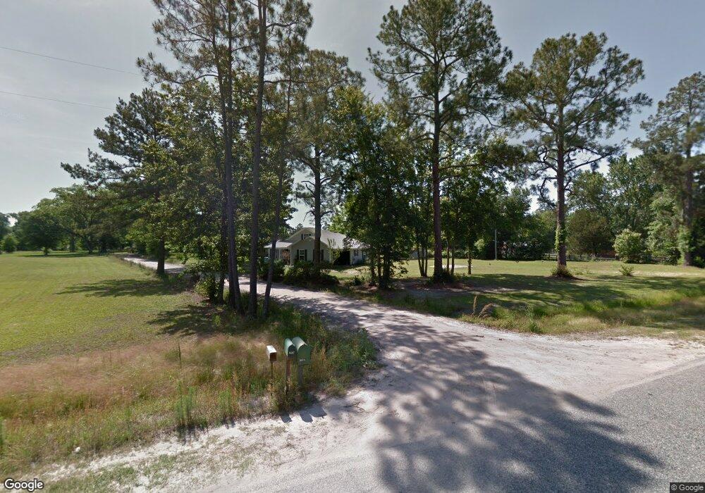
This home is located at 8515 Manningtown Rd, Jesup, GA 31546 and is currently estimated at $192,549, approximately $135 per square foot. 8515 Manningtown Rd is a home located in Wayne County with nearby schools including Jesup Elementary School, Arthur Williams Middle School, and Wayne County High School.
Ownership History
Date
Name
Owned For
Owner Type
Purchase Details
Closed on
Jul 9, 2018
Sold by
Puckett John O
Bought by
Puckett John O and Puckett Janell S
Current Estimated Value
Purchase Details
Closed on
Jun 20, 2017
Bought by
Puckett John O
Purchase Details
Closed on
Apr 4, 2017
Sold by
Manning Charles
Bought by
Bank Of America Na
Purchase Details
Closed on
Oct 29, 2010
Sold by
Manning Charles M
Bought by
Manning Charles M and Manning Earlene S
Home Financials for this Owner
Home Financials are based on the most recent Mortgage that was taken out on this home.
Original Mortgage
$195,150
Interest Rate
4.37%
Mortgage Type
Reverse Mortgage Home Equity Conversion Mortgage
Purchase Details
Closed on
Jul 1, 1983
Bought by
Manning Charles Monroe
Purchase Details
Closed on
Sep 1, 1971
Create a Home Valuation Report for This Property
The Home Valuation Report is an in-depth analysis detailing your home's value as well as a comparison with similar homes in the area
Home Values in the Area
Average Home Value in this Area
Purchase History
| Date | Buyer | Sale Price | Title Company |
|---|---|---|---|
| Puckett John O | -- | -- | |
| Puckett John O | $76,050 | -- | |
| Bank Of America Na | $55,000 | -- | |
| Manning Charles M | -- | -- | |
| Manning Charles Monroe | -- | -- | |
| -- | -- | -- |
Source: Public Records
Mortgage History
| Date | Status | Borrower | Loan Amount |
|---|---|---|---|
| Previous Owner | Manning Charles M | $195,150 |
Source: Public Records
Tax History Compared to Growth
Tax History
| Year | Tax Paid | Tax Assessment Tax Assessment Total Assessment is a certain percentage of the fair market value that is determined by local assessors to be the total taxable value of land and additions on the property. | Land | Improvement |
|---|---|---|---|---|
| 2024 | -- | $55,515 | $3,853 | $51,662 |
| 2023 | $350 | $49,071 | $3,853 | $45,218 |
| 2022 | $523 | $40,049 | $3,853 | $36,196 |
| 2021 | $477 | $34,335 | $3,853 | $30,482 |
| 2020 | $1,378 | $39,487 | $9,005 | $30,482 |
| 2019 | $1,418 | $39,487 | $9,005 | $30,482 |
| 2018 | $1,395 | $39,487 | $9,005 | $30,482 |
| 2017 | $446 | $39,487 | $9,005 | $30,482 |
| 2016 | $411 | $39,487 | $9,005 | $30,482 |
| 2014 | $410 | $39,487 | $9,005 | $30,482 |
| 2013 | -- | $39,487 | $9,005 | $30,482 |
Source: Public Records
Map
Nearby Homes
- 7256 Manningtown Rd
- 5100 Flowers Branch Rd
- 1554 Flowers Break Rd
- 0 Rogers Break Unit 1656131
- 301 Broadhurst Rd
- 0 Johns Rd
- 176 Covey Way Rd
- 0 Us Highway 301
- 0N E Rd
- 6911 Old Hortense Rd
- 6406 Mount Pleasant Rd
- 6432 Mount Pleasant Rd
- 694 Overstreet Rd
- 603 Cumberland Rd
- 255 Spell Landing Rd
- 49 Pine Forest Dr
- 26 Odessa Rd
- 2903 S Us Hwy 301
- 12 Par Dr
- 4545 S US Hwy 341