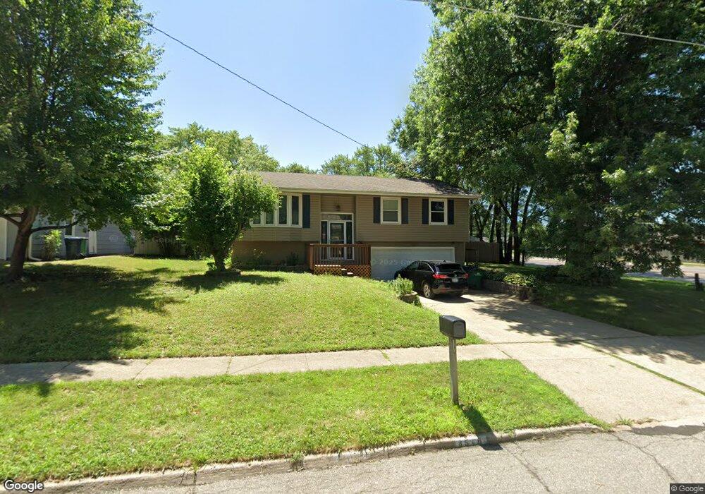
8516 Airline Ave Urbandale, IA 50322
Estimated Value: $263,745 - $281,000
3
Beds
2
Baths
1,169
Sq Ft
$232/Sq Ft
Est. Value
About This Home
This home is located at 8516 Airline Ave, Urbandale, IA 50322 and is currently estimated at $270,936, approximately $231 per square foot. 8516 Airline Ave is a home located in Polk County with nearby schools including Valerius Elementary School, Karen Acres Elementary School, and Urbandale Middle School.
Ownership History
Date
Name
Owned For
Owner Type
Purchase Details
Closed on
Jun 6, 2013
Sold by
Holms Laura Keegan and Holms Michael
Bought by
Tran Phong Thanh and Dang Vu Ngoc
Current Estimated Value
Home Financials for this Owner
Home Financials are based on the most recent Mortgage that was taken out on this home.
Original Mortgage
$131,355
Outstanding Balance
$92,660
Interest Rate
3.38%
Mortgage Type
New Conventional
Estimated Equity
$178,276
Purchase Details
Closed on
Jul 12, 2000
Sold by
Stokes David T and Stokes Barbara J
Bought by
Keegan Laura Ann
Home Financials for this Owner
Home Financials are based on the most recent Mortgage that was taken out on this home.
Original Mortgage
$70,000
Interest Rate
8.55%
Create a Home Valuation Report for This Property
The Home Valuation Report is an in-depth analysis detailing your home's value as well as a comparison with similar homes in the area
Home Values in the Area
Average Home Value in this Area
Purchase History
| Date | Buyer | Sale Price | Title Company |
|---|---|---|---|
| Tran Phong Thanh | $139,000 | None Available | |
| Keegan Laura Ann | $116,500 | -- |
Source: Public Records
Mortgage History
| Date | Status | Borrower | Loan Amount |
|---|---|---|---|
| Open | Tran Phong Thanh | $131,355 | |
| Previous Owner | Keegan Laura Ann | $70,000 |
Source: Public Records
Tax History Compared to Growth
Tax History
| Year | Tax Paid | Tax Assessment Tax Assessment Total Assessment is a certain percentage of the fair market value that is determined by local assessors to be the total taxable value of land and additions on the property. | Land | Improvement |
|---|---|---|---|---|
| 2025 | $3,772 | $236,700 | $71,900 | $164,800 |
| 2024 | $3,772 | $208,300 | $63,000 | $145,300 |
| 2023 | $3,848 | $208,300 | $63,000 | $145,300 |
| 2022 | $3,802 | $179,300 | $55,500 | $123,800 |
| 2021 | $3,636 | $179,300 | $55,500 | $123,800 |
| 2020 | $3,574 | $162,700 | $50,300 | $112,400 |
| 2019 | $3,332 | $162,700 | $50,300 | $112,400 |
| 2018 | $3,210 | $144,900 | $43,900 | $101,000 |
| 2017 | $3,076 | $144,900 | $43,900 | $101,000 |
| 2016 | $3,000 | $136,400 | $40,900 | $95,500 |
| 2015 | $3,000 | $136,400 | $40,900 | $95,500 |
| 2014 | $2,808 | $131,700 | $38,800 | $92,900 |
Source: Public Records
Map
Nearby Homes
- 8505 Airline Ave
- 8501 Airline Ave
- 3900 Rolling Green Dr
- 4117 83rd St
- 3924 80th St
- 8914 Valdez Dr
- 4221 90th St
- 3957 92nd Dr
- 3889 92nd Dr
- 7815 Douglas Ave Unit 304
- 7815 Douglas Ave Unit 107
- 8220 Twana Dr
- 8047 Dellwood Dr
- 4517 90th St
- 4505 90th St
- 4500 90th St
- 37 89th St
- 3916 Greenview Dr
- 8178 Dellwood Dr Unit 8178
- 7613 Prairie Ave
- 8512 Airline Ave
- 8521 Horton Ave
- 8517 Horton Ave
- 8508 Airline Ave
- 8517 Airline Ave
- 8513 Horton Ave
- 8513 Airline Ave
- 8509 Airline Ave
- 8504 Airline Ave
- 8509 Horton Ave
- 8601 Horton Cir
- 8516 Ridgemont Dr
- 8520 Horton Ave
- 8516 Horton Ave
- 8512 Ridgemont Dr
- 8500 Airline Ave
- 8512 Horton Ave
- 8508 Ridgemont Dr
- 8409 Horton Ave
- 8508 Horton Ave