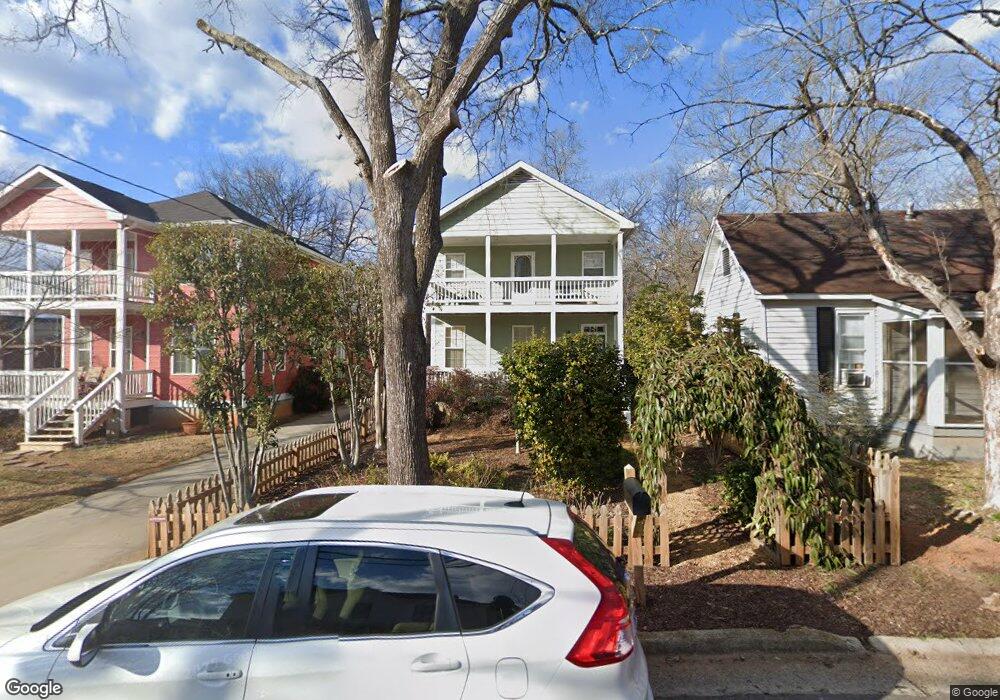
852 Reese St Athens, GA 30606
Cobbham NeighborhoodEstimated Value: $391,000 - $434,000
3
Beds
3
Baths
1,496
Sq Ft
$277/Sq Ft
Est. Value
About This Home
This home is located at 852 Reese St, Athens, GA 30606 and is currently estimated at $414,127, approximately $276 per square foot. 852 Reese St is a home located in Clarke County with nearby schools including Johnnie Lay Burks Elementary School, Clarke Middle School, and Clarke Central High School.
Ownership History
Date
Name
Owned For
Owner Type
Purchase Details
Closed on
May 27, 2005
Sold by
K Carpenter Builder Inc
Bought by
Clark Sarah K
Current Estimated Value
Purchase Details
Closed on
Jan 7, 2005
Sold by
Whitehead Reginald
Bought by
K Carpenter Builder Inc
Purchase Details
Closed on
Jan 5, 2005
Sold by
Thrasher Pinkie L Winfrey
Bought by
Whitehead Reginald
Purchase Details
Closed on
Feb 23, 2004
Sold by
Jackson Delores and Jackson Pinkie L
Bought by
Whitehead Reginald
Purchase Details
Closed on
Feb 26, 1996
Sold by
Winfrey Evelyn
Bought by
Jackson Delores and Winfrey Pinkie L
Create a Home Valuation Report for This Property
The Home Valuation Report is an in-depth analysis detailing your home's value as well as a comparison with similar homes in the area
Home Values in the Area
Average Home Value in this Area
Purchase History
| Date | Buyer | Sale Price | Title Company |
|---|---|---|---|
| Clark Sarah K | $149,900 | -- | |
| K Carpenter Builder Inc | $27,000 | -- | |
| Whitehead Reginald | -- | -- | |
| Whitehead Reginald | -- | -- | |
| Whitehead Reginald | -- | -- | |
| Jackson Delores | -- | -- |
Source: Public Records
Tax History Compared to Growth
Tax History
| Year | Tax Paid | Tax Assessment Tax Assessment Total Assessment is a certain percentage of the fair market value that is determined by local assessors to be the total taxable value of land and additions on the property. | Land | Improvement |
|---|---|---|---|---|
| 2025 | $2,638 | $181,839 | $28,000 | $153,839 |
| 2024 | $2,638 | $164,012 | $20,000 | $144,012 |
| 2023 | $774 | $142,110 | $20,000 | $122,110 |
| 2022 | $2,412 | $122,731 | $20,000 | $102,731 |
| 2021 | $2,171 | $95,802 | $20,000 | $75,802 |
| 2020 | $2,185 | $96,868 | $20,000 | $76,868 |
| 2019 | $2,133 | $91,585 | $20,000 | $71,585 |
| 2018 | $1,884 | $73,710 | $14,000 | $59,710 |
| 2017 | $0 | $71,371 | $12,000 | $59,371 |
| 2016 | $1,842 | $70,692 | $12,000 | $58,692 |
| 2015 | $1,672 | $59,254 | $12,000 | $47,254 |
| 2014 | $1,672 | $59,255 | $12,000 | $47,255 |
Source: Public Records
Map
Nearby Homes
- 1196 W Hancock Ave Unit 1
- 1198 W West Hancock Ave W
- 480 N Billups St
- 1226 W Broad St
- 468 N Milledge Ave Unit 203
- 500 Dearing St Unit 6
- 597 Dearing St
- 552 Cobb St
- 257 Hill St
- 1398 W Hancock Ave
- 570 Prince Ave
- 365 S Church St Unit 1A, 1B, 1C
- 283 King Ave
- 290 Hodgson Dr
- 494 Baxter St Unit 32
- 100 Prince Ave Unit A404
- 100 Prince Ave Unit A407
- 525 King Ave
- 100 Crestview Cir
- 559 Pulaski St