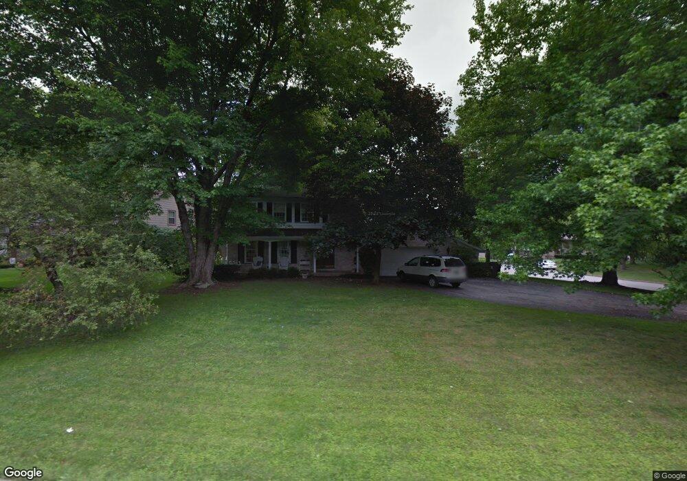
852 Westport Dr Youngstown, OH 44511
Estimated Value: $291,000 - $325,000
3
Beds
3
Baths
2,078
Sq Ft
$149/Sq Ft
Est. Value
About This Home
This home is located at 852 Westport Dr, Youngstown, OH 44511 and is currently estimated at $309,069, approximately $148 per square foot. 852 Westport Dr is a home located in Mahoning County with nearby schools including West Boulevard Elementary School, Boardman Center Middle School, and Boardman High School.
Ownership History
Date
Name
Owned For
Owner Type
Purchase Details
Closed on
May 28, 1998
Sold by
Hirschl Lawrence and Hirschl Marsha L
Bought by
Sotus Peter
Current Estimated Value
Home Financials for this Owner
Home Financials are based on the most recent Mortgage that was taken out on this home.
Original Mortgage
$123,025
Outstanding Balance
$25,084
Interest Rate
7.27%
Estimated Equity
$283,985
Purchase Details
Closed on
May 15, 1992
Bought by
Farbman Soloman and Farbman Ruth
Create a Home Valuation Report for This Property
The Home Valuation Report is an in-depth analysis detailing your home's value as well as a comparison with similar homes in the area
Home Values in the Area
Average Home Value in this Area
Purchase History
| Date | Buyer | Sale Price | Title Company |
|---|---|---|---|
| Sotus Peter | $129,500 | -- | |
| Farbman Soloman | $95,000 | -- |
Source: Public Records
Mortgage History
| Date | Status | Borrower | Loan Amount |
|---|---|---|---|
| Open | Sotus Peter | $123,025 |
Source: Public Records
Tax History Compared to Growth
Tax History
| Year | Tax Paid | Tax Assessment Tax Assessment Total Assessment is a certain percentage of the fair market value that is determined by local assessors to be the total taxable value of land and additions on the property. | Land | Improvement |
|---|---|---|---|---|
| 2024 | $4,317 | $85,590 | $9,350 | $76,240 |
| 2023 | $4,259 | $85,590 | $9,350 | $76,240 |
| 2022 | $3,452 | $52,970 | $8,490 | $44,480 |
| 2021 | $3,454 | $52,970 | $8,490 | $44,480 |
| 2020 | $3,472 | $52,970 | $8,490 | $44,480 |
| 2019 | $3,719 | $50,930 | $8,160 | $42,770 |
| 2018 | $3,226 | $50,930 | $8,160 | $42,770 |
| 2017 | $3,157 | $50,930 | $8,160 | $42,770 |
| 2016 | $3,092 | $48,380 | $8,160 | $40,220 |
| 2015 | $3,030 | $48,380 | $8,160 | $40,220 |
| 2014 | $3,039 | $48,380 | $8,160 | $40,220 |
| 2013 | $3,000 | $48,380 | $8,160 | $40,220 |
Source: Public Records
Map
Nearby Homes
- 990 Westport Dr
- 21.19 acres Truesdale and Lockwood Rd
- 29 Gillian Ln
- 537 W Glen Dr
- 5200 West Blvd Unit 505
- 5670 Tracy Dr
- 3927 Hopkins Rd
- 4478 Devonshire Dr Unit 1B
- 4042 Baymar Dr
- 272 Shields Rd
- 715 Crestview Dr
- 1342 Shields Rd
- 138 Robinhood Way
- 5020 Friendship Ave
- 772 Ewing Rd
- 5097 Tippwood Ct
- 4225 Stratford Rd
- 4096 Bob o Link Dr
- 813 Brookfield Ave
- 4506 Green Glen Dr
- 866 Westport Dr
- 842 Westport Dr
- 880 Westport Dr
- 850 Cove Place
- 849 Westport Dr
- 853 Westport Dr
- 845 Westport Dr
- 867 Westport Dr
- 881 Westport Dr
- 838 Westport Dr
- 848 Cove Place
- 844 Cove Place
- 896 Westport Dr
- 841 Westport Dr
- 846 Cove Place
- 835 Westport Dr
- 834 Westport Dr
- 910 Westport Dr
- 868 Shields Rd
- 917 Greyledge Place