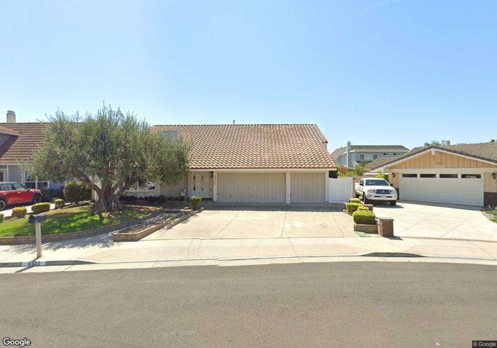
8522 Keel Dr Huntington Beach, CA 92646
Estimated Value: $1,560,000 - $1,906,000
5
Beds
4
Baths
3,070
Sq Ft
$561/Sq Ft
Est. Value
About This Home
This home is located at 8522 Keel Dr, Huntington Beach, CA 92646 and is currently estimated at $1,723,091, approximately $561 per square foot. 8522 Keel Dr is a home located in Orange County with nearby schools including William T. Newland Elementary, Talbert Middle School, and Huntington Beach High School.
Ownership History
Date
Name
Owned For
Owner Type
Purchase Details
Closed on
Jun 27, 2018
Sold by
Delucio Andrew De and Delucio Karen De
Bought by
Delucio Andrew and Lucio Karen D
Current Estimated Value
Purchase Details
Closed on
Jan 24, 2008
Sold by
Delucio Andrew
Bought by
Delucio Andrew and Delucio Karen D
Home Financials for this Owner
Home Financials are based on the most recent Mortgage that was taken out on this home.
Original Mortgage
$417,000
Interest Rate
6.17%
Mortgage Type
New Conventional
Create a Home Valuation Report for This Property
The Home Valuation Report is an in-depth analysis detailing your home's value as well as a comparison with similar homes in the area
Home Values in the Area
Average Home Value in this Area
Purchase History
| Date | Buyer | Sale Price | Title Company |
|---|---|---|---|
| Delucio Andrew | -- | None Available | |
| Delucio Andrew | -- | Service Link |
Source: Public Records
Mortgage History
| Date | Status | Borrower | Loan Amount |
|---|---|---|---|
| Closed | Delucio Andrew | $417,000 |
Source: Public Records
Tax History Compared to Growth
Tax History
| Year | Tax Paid | Tax Assessment Tax Assessment Total Assessment is a certain percentage of the fair market value that is determined by local assessors to be the total taxable value of land and additions on the property. | Land | Improvement |
|---|---|---|---|---|
| 2025 | $3,021 | $252,530 | $64,865 | $187,665 |
| 2024 | $3,021 | $247,579 | $63,593 | $183,986 |
| 2023 | $2,946 | $242,725 | $62,346 | $180,379 |
| 2022 | $2,898 | $237,966 | $61,123 | $176,843 |
| 2021 | $2,843 | $233,300 | $59,924 | $173,376 |
| 2020 | $2,824 | $230,908 | $59,309 | $171,599 |
| 2019 | $2,769 | $226,381 | $58,146 | $168,235 |
| 2018 | $2,794 | $221,943 | $57,006 | $164,937 |
| 2017 | $2,750 | $217,592 | $55,889 | $161,703 |
| 2016 | $2,639 | $213,326 | $54,793 | $158,533 |
| 2015 | $2,599 | $210,122 | $53,970 | $156,152 |
| 2014 | $1,805 | $136,927 | $52,913 | $84,014 |
Source: Public Records
Map
Nearby Homes
- 8242 Grant Dr
- 8582 Salt Lake Dr
- 8291 Polk Cir
- 19362 Weymouth Ln
- 18862 Carolyn Ln
- 8120 Islandview Cir Unit C
- 18785 Heavenwood Cir Unit C171
- 18601 Newland St Unit 59
- 18601 Newland St Unit 97
- 18601 Newland St Unit 12
- 18601 Newland St Unit 71
- 18601 Newland St Unit 38
- 18963 Acacia St
- 18566 Santa Andrea St
- 18712 Demion Ln
- 8803 Hummingbird Ave
- 18621 Santa Ramona St
- 18702 Demion Ln
- 19321 Beach Blvd
- 18555 Vallarta Dr