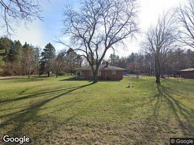
8525 Peer Rd South Lyon, MI 48178
Estimated Value: $299,000 - $391,000
3
Beds
2
Baths
1,487
Sq Ft
$225/Sq Ft
Est. Value
About This Home
This home is located at 8525 Peer Rd, South Lyon, MI 48178 and is currently estimated at $334,890, approximately $225 per square foot. 8525 Peer Rd is a home located in Livingston County with nearby schools including William A. Brummer Elementary School, Centennial Middle School, and South Lyon High School.
Ownership History
Date
Name
Owned For
Owner Type
Purchase Details
Closed on
Oct 31, 2011
Sold by
The Bank Of New York Mellon
Bought by
Matouka David G
Current Estimated Value
Home Financials for this Owner
Home Financials are based on the most recent Mortgage that was taken out on this home.
Original Mortgage
$90,001
Interest Rate
3.97%
Mortgage Type
FHA
Purchase Details
Closed on
Jun 2, 2010
Sold by
Freeman Susan and Leinart Susan
Bought by
Bank Of New York Mellon and Cwalt Inc
Purchase Details
Closed on
Jun 6, 2003
Sold by
Estate Of Elwood B Lachance
Bought by
Freeman David and Leinhart Susan
Create a Home Valuation Report for This Property
The Home Valuation Report is an in-depth analysis detailing your home's value as well as a comparison with similar homes in the area
Home Values in the Area
Average Home Value in this Area
Purchase History
| Date | Buyer | Sale Price | Title Company |
|---|---|---|---|
| Matouka David G | $80,000 | -- | |
| Bank Of New York Mellon | $117,000 | -- | |
| Freeman David | $185,000 | -- |
Source: Public Records
Mortgage History
| Date | Status | Borrower | Loan Amount |
|---|---|---|---|
| Open | Matouka David G | $76,800 | |
| Closed | Matouka David G | $79,400 | |
| Closed | Matouka David G | $90,001 |
Source: Public Records
Tax History Compared to Growth
Tax History
| Year | Tax Paid | Tax Assessment Tax Assessment Total Assessment is a certain percentage of the fair market value that is determined by local assessors to be the total taxable value of land and additions on the property. | Land | Improvement |
|---|---|---|---|---|
| 2024 | $2,121 | $146,700 | $0 | $0 |
| 2023 | $2,023 | $141,100 | $0 | $0 |
| 2022 | $2,571 | $114,700 | $0 | $0 |
| 2021 | $2,571 | $116,800 | $0 | $0 |
| 2020 | $2,559 | $111,300 | $0 | $0 |
| 2019 | $2,888 | $114,700 | $0 | $0 |
| 2018 | $2,849 | $115,200 | $0 | $0 |
| 2017 | $2,894 | $116,400 | $0 | $0 |
| 2016 | $2,936 | $108,800 | $0 | $0 |
| 2014 | $4,555 | $89,100 | $0 | $0 |
| 2012 | $4,555 | $87,200 | $0 | $0 |
Source: Public Records
Map
Nearby Homes
- 13563 12 Mile Rd
- 0 12 Mile Rd
- 13500 12 Mile Rd
- 12889 Burgandy Dr Unit 9
- 7768 N Dixboro Rd
- 000 Silver Lake Rd
- 62072 Savannah Dr
- 1132 Cantor Ln Unit 224
- 6040 Fieldstone Cir
- 1090 Shetland Dr Unit 340
- 9762 Dickerson Ct
- 1122 Colt Dr
- 1042 Polo Dr Unit 258
- 25861 Lexington Dr Unit 1
- 1134 Chestnut Ln Unit 134
- 61960 Arlington Cir Unit 1
- 62310 Arlington Cir Unit 6
- 62340 Arlington Cir Unit 5
- 62072 Yorktown Dr
- 12192 Doane Rd
- 8525 Peer Rd
- 8561 Peer Rd
- 000 Peer Rd
- 13058 12 Mile Rd
- 12991 12 Mile Rd
- 13055 12 Mile Rd
- 8585 Peer Rd
- 13060 12 Mile Rd
- 8609 Peer Rd
- 12948 12 Mile Rd
- 8633 Peer Rd
- 8655 Peer Rd
- 12945 12 Mile Rd
- 13120 12 Mile Rd
- 8650 Peer Rd
- 12815 12 Mile Rd
- 12789 12 Mile Rd
- 8550 Shamrock Ln
- 13300 12 Mile Rd
- 0 Twelve Mile Rd Unit 5511303