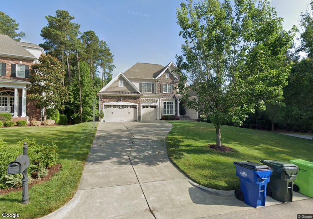
8525 Wynhurst Ct Unit 20 Raleigh, NC 27613
Northwest Raleigh NeighborhoodEstimated Value: $1,113,018 - $1,405,000
--
Bed
1
Bath
5,015
Sq Ft
$245/Sq Ft
Est. Value
About This Home
This home is located at 8525 Wynhurst Ct Unit 20, Raleigh, NC 27613 and is currently estimated at $1,230,005, approximately $245 per square foot. 8525 Wynhurst Ct Unit 20 is a home located in Wake County with nearby schools including Leesville Road Elementary School, Leesville Road Middle School, and Leesville Road High School.
Ownership History
Date
Name
Owned For
Owner Type
Purchase Details
Closed on
Dec 22, 2010
Sold by
Summit Development Llc
Bought by
Dunkley Craig L and Dunkley Kathryn D
Current Estimated Value
Home Financials for this Owner
Home Financials are based on the most recent Mortgage that was taken out on this home.
Original Mortgage
$360,000
Outstanding Balance
$234,132
Interest Rate
3.37%
Mortgage Type
New Conventional
Estimated Equity
$995,873
Purchase Details
Closed on
Jan 29, 2010
Sold by
Summit Development Llc
Bought by
Cruikshank Scott Cornell and Cruikshank Holly
Home Financials for this Owner
Home Financials are based on the most recent Mortgage that was taken out on this home.
Original Mortgage
$640,000
Interest Rate
4.94%
Mortgage Type
Construction
Create a Home Valuation Report for This Property
The Home Valuation Report is an in-depth analysis detailing your home's value as well as a comparison with similar homes in the area
Home Values in the Area
Average Home Value in this Area
Purchase History
| Date | Buyer | Sale Price | Title Company |
|---|---|---|---|
| Dunkley Craig L | $125,000 | Chicago Title Insurance Co | |
| Cruikshank Scott Cornell | $130,000 | None Available |
Source: Public Records
Mortgage History
| Date | Status | Borrower | Loan Amount |
|---|---|---|---|
| Open | Dunkley Craig L | $360,000 | |
| Previous Owner | Cruikshank Scott Cornell | $640,000 |
Source: Public Records
Tax History Compared to Growth
Tax History
| Year | Tax Paid | Tax Assessment Tax Assessment Total Assessment is a certain percentage of the fair market value that is determined by local assessors to be the total taxable value of land and additions on the property. | Land | Improvement |
|---|---|---|---|---|
| 2025 | $8,281 | $947,267 | $180,000 | $767,267 |
| 2024 | $8,247 | $947,267 | $180,000 | $767,267 |
| 2023 | $7,091 | $648,717 | $128,000 | $520,717 |
| 2022 | $6,588 | $648,717 | $128,000 | $520,717 |
| 2021 | $6,332 | $648,717 | $128,000 | $520,717 |
| 2020 | $6,217 | $648,717 | $128,000 | $520,717 |
| 2019 | $7,763 | $668,174 | $128,000 | $540,174 |
| 2018 | $7,320 | $668,174 | $128,000 | $540,174 |
| 2017 | $6,971 | $668,174 | $128,000 | $540,174 |
| 2016 | $6,827 | $668,174 | $128,000 | $540,174 |
| 2015 | $8,145 | $784,642 | $128,000 | $656,642 |
| 2014 | $7,724 | $784,642 | $128,000 | $656,642 |
Source: Public Records
Map
Nearby Homes
- 8601 Oneal Rd
- 8701 Oneal Rd
- 9305 Field Maple Ct
- 8802 Fidelis Ln
- 9309 Field Maple Ct
- 8101 Kingsland Dr
- 13204 Ashford Park Dr
- 7700 Pinecrest Rd
- 5145 Landguard Dr
- 3812 Covina Dr
- 8228 Clarks Branch Dr
- 12909 Baybriar Dr
- 8212 Clasara Cir
- 4309 Omni Place
- 8713 Little Deer Ln
- 4211 Norman Ridge Ln
- 9023 Colony Village Ln
- 8326 Ray Rd
- 9305 Langwood Dr
- 9800 Treymore Dr
- 8525 Wynhurst Ct
- 8521 Wynhurst Ct
- 8521 Wynhurst Ct Unit 19
- 8517 Wynhurst Ct
- 8517 Wynhurst Ct Unit 18
- 8633 Baybridge Wynd
- 8524 Wynhurst Ct
- 8524 Wynhurst Ct Unit 10
- 8636 Baybridge Wynd
- 8632 Baybridge Wynd
- 8632 Baybridge Wynd Unit 24
- 8637 Baybridge Wynd
- 8518 Wynhurst Ct
- 8518 Wynhurst Ct Unit 11
- 8613 Wood Lawn Dr
- 8513 Wynhurst Ct
- 8513 Wynhurst Ct Unit 17
- 8616 Wood Lawn Dr
- 8804 Katharina Ct
- 8512 Wynhurst Ct