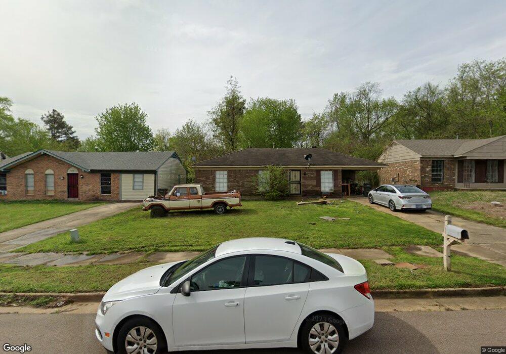
853 Pitney Ln Memphis, TN 38127
Estimated Value: $80,000 - $96,000
3
Beds
1
Bath
1,093
Sq Ft
$81/Sq Ft
Est. Value
About This Home
This home is located at 853 Pitney Ln, Memphis, TN 38127 and is currently estimated at $88,212, approximately $80 per square foot. 853 Pitney Ln is a home located in Shelby County with nearby schools including Northaven Elementary School, Woodstock Middle School, and Trezevant High School.
Ownership History
Date
Name
Owned For
Owner Type
Purchase Details
Closed on
Jul 8, 2008
Sold by
Lasalle Bank Na
Bought by
El Tayech Ghassan
Current Estimated Value
Purchase Details
Closed on
Mar 31, 2008
Sold by
Scott Roderick
Bought by
Lasalle Bank Na and Structured Asset Securities Corp Trust 2
Purchase Details
Closed on
Oct 5, 2004
Sold by
Murphy E Ronald and Murphy Harriet L
Bought by
Scott Roderick
Home Financials for this Owner
Home Financials are based on the most recent Mortgage that was taken out on this home.
Original Mortgage
$50,000
Interest Rate
7.12%
Mortgage Type
Purchase Money Mortgage
Create a Home Valuation Report for This Property
The Home Valuation Report is an in-depth analysis detailing your home's value as well as a comparison with similar homes in the area
Purchase History
| Date | Buyer | Sale Price | Title Company |
|---|---|---|---|
| El Tayech Ghassan | $11,000 | None Available | |
| Lasalle Bank Na | $35,200 | None Available | |
| Scott Roderick | $50,000 | -- |
Source: Public Records
Mortgage History
| Date | Status | Borrower | Loan Amount |
|---|---|---|---|
| Previous Owner | Scott Roderick | $50,000 |
Source: Public Records
Tax History
| Year | Tax Paid | Tax Assessment Tax Assessment Total Assessment is a certain percentage of the fair market value that is determined by local assessors to be the total taxable value of land and additions on the property. | Land | Improvement |
|---|---|---|---|---|
| 2025 | $404 | $20,100 | $2,000 | $18,100 |
| 2024 | $404 | $11,925 | $1,475 | $10,450 |
| 2023 | $404 | $11,925 | $1,475 | $10,450 |
| 2022 | $404 | $11,925 | $1,475 | $10,450 |
| 2021 | $411 | $11,925 | $1,475 | $10,450 |
| 2020 | $328 | $8,100 | $1,475 | $6,625 |
| 2019 | $328 | $8,100 | $1,475 | $6,625 |
| 2018 | $328 | $8,100 | $1,475 | $6,625 |
| 2017 | $333 | $8,100 | $1,475 | $6,625 |
| 2016 | $397 | $9,075 | $0 | $0 |
| 2014 | $397 | $9,075 | $0 | $0 |
Source: Public Records
Map
Nearby Homes
- 5207 Breckenwood Dr
- 5323 Plover Dr
- 5328 Clinchport Cir
- 5186 Broken Oak Dr
- 5338 Cedar Bluff Dr
- 5387 Cedar Bluff Dr
- 5315 Braden Dr
- 5319 Braden Dr
- 5235 Braden Dr
- 5378 Beaverton Dr
- 5423 Breckenwood Dr
- 5090 Belfast Dr
- 5083 Carterville Place
- 5088 Breckenwood Dr
- 5140 N Circle Rd
- 0 N Circle Rd N Unit 10214617
- 5075 Bowdoin Dr
- 5072 Blacksmith Dr
- 645 Mcwhirter Ave
- 635 Mcwhirter Ave
- 847 Pitney Ln
- 859 Pitney Ln
- 843 Pitney Ln
- 858 Brandywine Blvd
- 867 Pitney Ln
- 854 Brandywine Blvd
- 864 Brandywine Blvd
- 848 Brandywine Blvd
- 5290 Plover Dr
- 837 Pitney Ln
- 5291 Plover Dr
- 5269 Breckenwood Dr
- 866 Pitney Ln
- 844 Brandywine Blvd
- 5259 Breckenwood Dr
- 838 Pitney Ln
- 831 Pitney Ln
- 5287 Breckenwood Dr
- 5300 Plover Dr
- 832 Pitney Ln
Your Personal Tour Guide
Ask me questions while you tour the home.