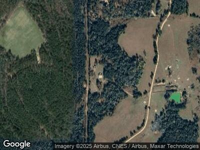
854 Clark Place Rd Tibbie, AL 36583
Estimated Value: $86,587 - $281,000
--
Bed
1
Bath
1,456
Sq Ft
$143/Sq Ft
Est. Value
About This Home
This home is located at 854 Clark Place Rd, Tibbie, AL 36583 and is currently estimated at $208,147, approximately $142 per square foot. 854 Clark Place Rd is a home located in Washington County.
Ownership History
Date
Name
Owned For
Owner Type
Purchase Details
Closed on
Feb 28, 2024
Sold by
Franklin Howard Larry
Bought by
Chestang Matthew Blake and Chestang Sarah
Current Estimated Value
Home Financials for this Owner
Home Financials are based on the most recent Mortgage that was taken out on this home.
Original Mortgage
$197,415
Outstanding Balance
$195,631
Interest Rate
6.63%
Mortgage Type
FHA
Estimated Equity
$10,127
Purchase Details
Closed on
Jan 19, 2016
Sold by
Howard Will and Howard Stephanie
Bought by
Howard Larry
Create a Home Valuation Report for This Property
The Home Valuation Report is an in-depth analysis detailing your home's value as well as a comparison with similar homes in the area
Home Values in the Area
Average Home Value in this Area
Purchase History
| Date | Buyer | Sale Price | Title Company |
|---|---|---|---|
| Chestang Matthew Blake | $218,000 | None Listed On Document | |
| Howard Larry | -- | -- |
Source: Public Records
Mortgage History
| Date | Status | Borrower | Loan Amount |
|---|---|---|---|
| Open | Chestang Matthew Blake | $197,415 |
Source: Public Records
Tax History Compared to Growth
Tax History
| Year | Tax Paid | Tax Assessment Tax Assessment Total Assessment is a certain percentage of the fair market value that is determined by local assessors to be the total taxable value of land and additions on the property. | Land | Improvement |
|---|---|---|---|---|
| 2024 | $179 | $11,940 | $1,460 | $10,480 |
| 2023 | $179 | $10,700 | $720 | $9,980 |
| 2022 | $152 | $9,400 | $720 | $8,680 |
| 2021 | $151 | $10,040 | $1,360 | $8,680 |
| 2020 | $151 | $10,040 | $1,360 | $8,680 |
| 2019 | $136 | $10,540 | $1,260 | $9,280 |
| 2018 | $129 | $4,400 | $0 | $0 |
| 2016 | $128 | $4,300 | $0 | $0 |
| 2014 | $128 | $4,000 | $680 | $3,320 |
| 2013 | $128 | $4,260 | $680 | $3,580 |
Source: Public Records
Map
Nearby Homes
- 2214 Hawthorne Rd
- 0 Lockwood Dr Unit 364470
- 0 Alabama 17
- 2145 County Road 28
- 14522 Saint Stephens Ave
- 203 Gordy St
- 19595 Jordan St
- 37 Blount Dr
- 0 Shine Johnston Rd
- 9288 Alabama 56
- 0 Highway 43
- 0 Bud Odom Rd Unit 7337493
- 0 Topton Rd Unit 7359866
- 578 John Johnston Rd
- 41 Buck Hill Rd
- 234 Nichols Rd
- 888 Mobile Cut Off Rd
- 0 Daugherty Ave
- 7336 Highway 43
- 383 Central Ave
- 854 Clark Place Rd
- 528 Clark Place Rd
- 1333 Clark Place Rd
- 367 Clark Place Rd
- 64 Lenard Dr
- 64 Lenard Dr
- 350 Clark Place Rd
- 2652 Howardtown Rd
- 2650 Howardtown Rd
- 708 Baxter Godwin Rd
- 4347 Howardtown Rd
- 4347 Howardtown Rd
- 122 Clark Place Rd
- 1150 Howardtown Rd
- 4128 Howardtown Rd
- 1476 Clark Place Rd
- 3090 Howardtown Rd
- 0 Hawthorne Rd Unit 7286823
- 0 Hawthorne Rd Unit 188775
- 0 County Road 20 Unit 623855
