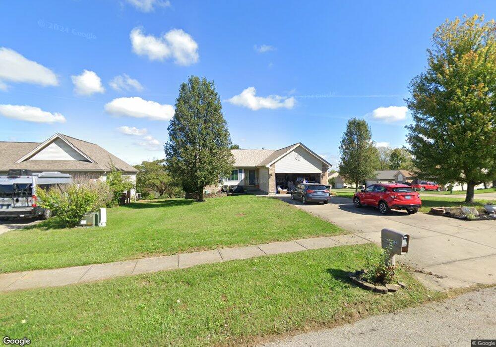
854 Hogreffe Rd Independence, KY 41051
Estimated Value: $287,000 - $318,000
3
Beds
2
Baths
1,420
Sq Ft
$213/Sq Ft
Est. Value
About This Home
This home is located at 854 Hogreffe Rd, Independence, KY 41051 and is currently estimated at $302,719, approximately $213 per square foot. 854 Hogreffe Rd is a home located in Kenton County with nearby schools including Beechgrove Elementary School, Twenhofel Middle School, and Simon Kenton High School.
Ownership History
Date
Name
Owned For
Owner Type
Purchase Details
Closed on
Oct 27, 2004
Sold by
Inverness Group Inc
Bought by
White Harold M and White Donna C
Current Estimated Value
Home Financials for this Owner
Home Financials are based on the most recent Mortgage that was taken out on this home.
Original Mortgage
$84,275
Outstanding Balance
$41,607
Interest Rate
5.62%
Mortgage Type
Purchase Money Mortgage
Estimated Equity
$261,112
Purchase Details
Closed on
Jul 15, 2004
Sold by
Hogreffe Road Llc
Bought by
Inverness Group Inc
Home Financials for this Owner
Home Financials are based on the most recent Mortgage that was taken out on this home.
Original Mortgage
$10,000,000
Interest Rate
6.24%
Mortgage Type
Credit Line Revolving
Create a Home Valuation Report for This Property
The Home Valuation Report is an in-depth analysis detailing your home's value as well as a comparison with similar homes in the area
Home Values in the Area
Average Home Value in this Area
Purchase History
| Date | Buyer | Sale Price | Title Company |
|---|---|---|---|
| White Harold M | $154,275 | Vintage Title Agency Inc | |
| Inverness Group Inc | $33,500 | Vintage Title Agency Inc |
Source: Public Records
Mortgage History
| Date | Status | Borrower | Loan Amount |
|---|---|---|---|
| Open | White Harold M | $84,275 | |
| Previous Owner | Inverness Group Inc | $10,000,000 | |
| Closed | Inverness Group Inc | $10,000,000 |
Source: Public Records
Tax History Compared to Growth
Tax History
| Year | Tax Paid | Tax Assessment Tax Assessment Total Assessment is a certain percentage of the fair market value that is determined by local assessors to be the total taxable value of land and additions on the property. | Land | Improvement |
|---|---|---|---|---|
| 2024 | $1,651 | $181,100 | $30,000 | $151,100 |
| 2023 | $1,700 | $181,100 | $30,000 | $151,100 |
| 2022 | $1,839 | $181,100 | $30,000 | $151,100 |
| 2021 | $1,866 | $181,100 | $30,000 | $151,100 |
| 2020 | $1,570 | $154,200 | $30,000 | $124,200 |
| 2019 | $1,574 | $154,200 | $30,000 | $124,200 |
| 2018 | $1,605 | $154,200 | $30,000 | $124,200 |
| 2017 | $1,561 | $154,200 | $30,000 | $124,200 |
| 2015 | $1,521 | $154,200 | $33,500 | $120,700 |
| 2014 | $1,511 | $154,200 | $33,500 | $120,700 |
Source: Public Records
Map
Nearby Homes
- 10690 Melbury Ct Unit 305GL
- 10694 Melbury Ct Unit 306GL
- The Westchester Plan at The Greens of Glenhurst
- The Ella Marie Plan at The Greens of Glenhurst
- The Jefferson Plan at The Greens of Glenhurst
- The Leighann Plan at The Greens of Glenhurst
- The Waterson Plan at The Greens of Glenhurst
- The Lancaster Plan at The Greens of Glenhurst
- The Austin Plan at The Greens of Glenhurst
- The Morgan Plan at The Greens of Glenhurst
- The Marietta Plan at The Greens of Glenhurst
- The Camden Plan at The Greens of Glenhurst
- The Lincoln Plan at The Greens of Glenhurst
- The Bristol Plan at The Greens of Glenhurst
- The Livingston Plan at The Greens of Glenhurst
- The Madison Plan at The Greens of Glenhurst
- The Verona Plan at The Greens of Glenhurst
- The Courtney Plan at The Greens of Glenhurst
- The Avalon Plan at The Greens of Glenhurst
- The Rosewood Plan at The Greens of Glenhurst
- 848 Hogreffe Rd
- 10210 Chestnut Oak Dr
- 10217 Chestnut Oak Dr
- 10206 Chestnut Oak Dr
- 10213 Chestnut Oak Dr
- 10209 Chestnut Oak Dr
- 10202 Chestnut Oak Dr
- 10205 Chestnut Oak Dr
- 833 Hogreffe Rd
- 851 Hogreffe Rd
- 10217 Scarletoak Dr
- 10198 Chestnut Oak Dr
- 10201 Chestnut Oak Dr
- 10217 Scarlet Oak Dr
- 10213 Scarletoak Dr
- 10194 Chestnut Oak Dr
- 10197 Chestnut Oak Dr
- 10205 Scarletoak Dr
- 800 Hogreffe Rd
- 800 Hogrefe Rd